Mammoth Area Fishing: January 2008 Archives
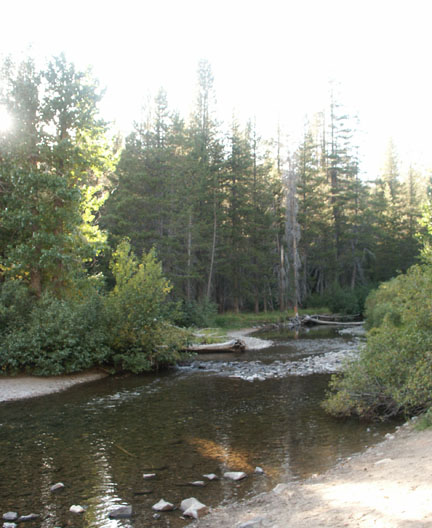
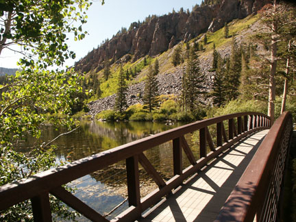
Name of river: Middle
Fork of the
Road condition: Paved
to gravel
Region:
Description: Although
it receives tremendous fishing pressure, the middle fork offers splendid
scenery, a variety of water and some of the most beautiful hiking areas in the
Species: Planted Rainbows and wild Browns and Brookies
Closest town or
supplies:
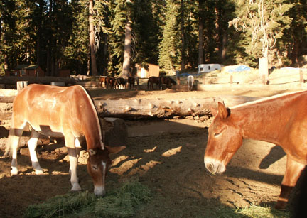
Contacts: Red’s Meadow Resort and Pack Station (800) 292-7758 Stop! Here is a must see web site with video streams of pack trips offered by Red’s Meadow –
Mammoth Lakes Visitor Bureau (888) 466-2666 /
(760)-924-5500; Rick’s
Nearest campground: Minaret Campground, Devils Postpile
Fishing season: General Best times: Early in the season and again in the fall after the pressure drops.
Tips:
Favorite lures or
bait: (See Category: Fishing Tips – Best Lures and Bait)
Favorite fly patterns: See Category: Fishing Tips – Best Fly Patterns and Techniques)
Stocking information: 19,000. The heaviest planting is at the Minaret Campground.
Nearby fishing:
Additional
information:
Directions: From
Highway 395, turn west on
Note: If you are visiting the Red’s Meadow area via the shuttle bus, here are the scheduled stops:
Agnew Meadows - trailheads for Shadow, Ediza, Thousand Island & Garnet lakes; Pacific Crest & John Muir trails; pack station; & camping;
Upper Soda Springs Campground – ½-mile walk to camping & river fishing;
Pumice Flat Campground turnoff - camping; group camping by reservation only; Ranger's cabin; pay phone; & amphitheater
Devils Postpile National Monument - camping; picnicking; Ranger Station; pay phone; information; books & maps; tours & programs; trailheads for Minaret & Beck lakes, Summit Meadow & John Muir Trail. 1/4-mile walk to the postpile rock formation
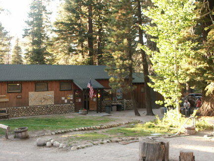
Reds Meadow Campground - camping; bath house; trailheads for Mammoth Pass & Pumice Flat
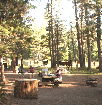
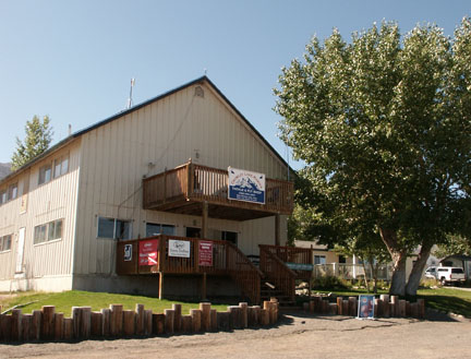
Reds Meadow Resort - pack station; store, cafe, cabins, pay phone.
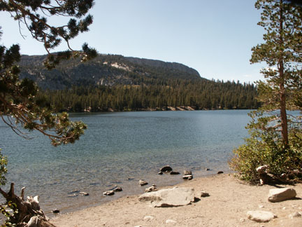
Name of creek: Minaret Creek
Road condition: Paved
to gravel Note: Read about the Mandatory Travel Restrictions noted on
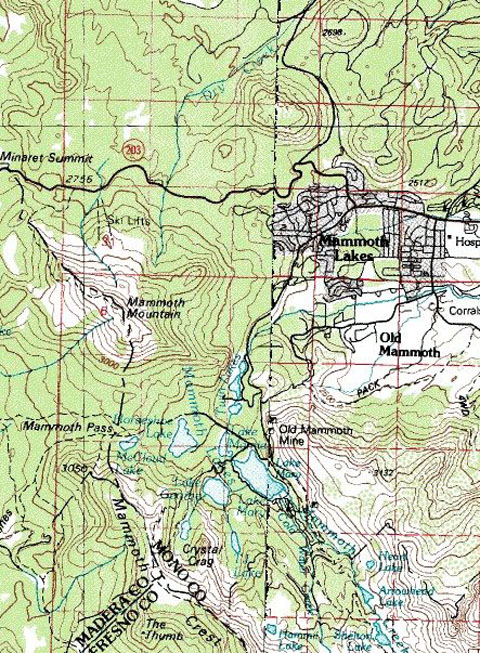
Region: Mammoth
Lakes Ranger District Area:
Devil’s Postpile / Red’s Meadow / Middle Fork,
Description: A very small creek
Species: Small Brookies along with a few Rainbows
Closest town or
supplies:
Contacts: Red’s Meadow Resort and Pack Station (800) 292-7758 Stop! Here is a must see web site with video streams of pack trips offered by Red’s Meadow –
Mammoth Lakes Visitor Bureau (888) 466-2666 /
(760)-924-5500; Rick’s
Nearest campground:
Fishing season: General
Tips:
Favorite lures or bait: Most Sierra creeks are too small to fish effectively with lures and spinners. Your best bet is to poke and dab using salmon eggs or worms. Small weighted jig patterns, especially grubs and very small tube worms work very well, and do not over look live terrestrials if they are allowed. If you are partial to lures bring along small Panther-Martins in a variety of colors. (See Category: Fishing Tips – Best Lures and Bait)
Favorite fly patterns: Using a poke and dab presentation, small Woolly Buggers, Girdle Bugs, Yuk Bugs and terrestrial patterns always work well on creeks. Dry fly patterns include Royal Wulffs, Parachute Adams, Humpies, Renegades, Stimulators, hoppers, ants, beetles and sometimes a Bead-head San Juan Worm. (See Category: Fishing Tips – Best Fly Patterns and Techniques. Also read the article on fishing creeks if you are new to the sport of angling.)
Stocking information:
Nearby fishing: Middle
Fork of the
Additional
information:
Directions: From
Highway 395, turn west on
Map courtesy of mytopo.com.
Road condition: Paved to gravel Note:
Read about the Mandatory Travel Restrictions noted on
Day hike fishing:
Region: Mammoth Lakes Ranger District
Area/description: Devil’s
Postpile / Red’s Meadow / Middle Fork,
Closest town:
Contacts: Red’s Meadow Resort and Pack Station (800) 292-7758 Stop! Here is a must see web site with video streams of pack trips offered by Red’s Meadow –
Mammoth Lakes Visitor Bureau (888) 466-2666 /
(760)-924-5500; Rick’s
Facilities: Red’s Meadow Resort and Pack Station
Facilities: Resort and pack station
Nearest campground:
Fishing season: General
Tips:
Favorite lures or
bait: (See Category: Fishing Tips – Best Lures and Bait)
Favorite fly patterns: (See Category: Fishing Tips – Best Fly Patterns and Techniques)
Stocking information: 10,000+
Additional
information:
Nearby fishing: Middle
Fork of the
Directions: From
Highway 395, turn west on
Map courtesy of mytopo.com.
Road condition: Paved to gravel Note: Mandatory
travel restrictions are enforced for the Middle Fork of the
The shuttle service to Reds Meadow/Devils Postpile began in 1979. The
shuttle was determined necessary to reduce the impact on the environment from
vehicle traffic. The narrow road into the Reds Meadow area serves as the only
access to the
Excessive vehicle use is the reason for a mandatory shuttle bus. However, some exceptions are recognized. Following is a list of most exceptions:
- Vehicles entering the valley before 7:00 am , or after 7:30 pm
- Vehicles carrying passengers with a disabled placard (once in the valley visitors must hike to most sites)
- Vehicles towing horse trailers or other livestock
- Campers camping in the Reds Meadow area
- Overnight Resort Guests
- Administrative vehicles
- Vehicles carrying car top boats, canoes, kayaks for use in valley
Exceptions are still charged the per person transportation fee.”
http://www.fs.fed.us/r5/inyo/recreation/redsmeadow.shtml
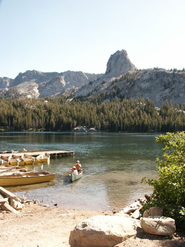
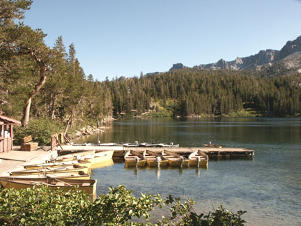
Name of Lake:
Region: Mammoth Lakes Ranger District 760-924-5500
Area/description: Devil’s
Postpile / Red’s Meadow / Middle Fork,
Closest town:
Contacts: Red’s Meadow Resort and Pack Station (800) 292-7758 Stop! Here is a must see web site with video streams of pack trips offered by Red’s Meadow –
Mammoth Lakes Visitor Bureau (888) 466-2666 /
(760)-924-5500; Rick’s
Facilities: Red’s Meadow Resort and Pack Station
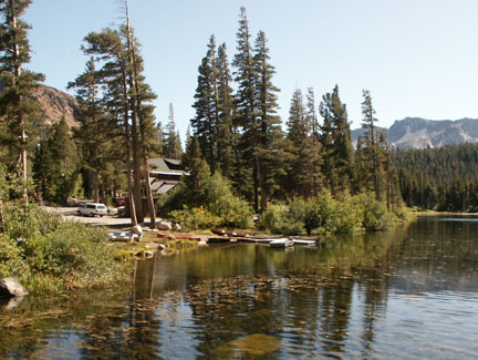
Nearest campground: Agnew Meadows Campground; Red’s Meadow Campground; Devils Postpile National Monument Campground
Fishing season: General
Tips:
Favorite lures or
bait: (See Category: Fishing Tips – Best Lures and Bait)
Favorite fly patterns: (See Category: Fishing Tips – Best Fly Patterns and Techniques)
Boating: No gas-powered motors
Stocking information: 12,000 +
Additional information: This is an excellent small lake for float tube fishing.
Nearby fishing: Middle
Fork of the
Directions: From
Highway 395, turn west on
Map courtesy of mytopo.com.
Road condition: Paved to
Day hike fishing: A
moderate grade on a short half-mile hike to
Region: Mammoth Lakes Ranger District 760-924-5500
Area/description:
Closest town or
supplies:
Contacts: Mammoth
Lakes Visitor Bureau (888) 466-2666 / (760)-924-5500; Rick’s
Nearest campground:
Fishing season: General
Tips:
Favorite lures or
bait: (See Category: Fishing Tips – Best Lures and Bait)
Favorite fly patterns: (See Category: Fishing Tips – Best Fly Patterns and Techniques)
Stocking information:
Additional
information:
Nearby fishing:
Directions: From
Highway 395 turn west at the junction with Highway 203 and drive through
Road condition: Paved
Day hike fishing:
Region: Mammoth Lakes Ranger District 760-924-5500
Area/description:
Closest town or
supplies:
Contacts: Wildyrie
Lodge (760) 934-2444; Mammoth Lakes Visitor Bureau (888) 466-2666 /
(760)-924-5500; Rick’s
Facilities: Wildyrie Lodge, bike and boat rentals
Nearest campground:
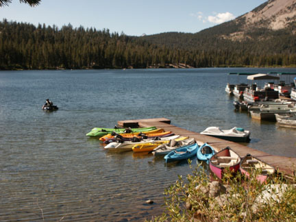
Boating: A fee launch ramp is provided, but no motors are permitted.
Fishing season: General Best times:
Tips: Be sure to go to the outlet viewing platform to see the falls and Twin Lakes 250 feet down the mountain side.
Favorite lures or
bait: (See Category: Fishing Tips – Best Lures and Bait)
Favorite fly patterns: (See Category: Fishing Tips – Best Fly Patterns and Techniques)
Stocking information: 13,000 +
Additional information: Long and narrow, the lake fishes well with a variety of methods.
Nearby fishing:
Directions: From
Highway 395 turn west at the junction with Highway 203 and drive through
Map courtesy of mytopo.com.
Road condition: Paved to trailhead parking
Day hike fishing: 1.3 miles with a moderate grade
Region: Mammoth Lakes Ranger District 760-924-5500
Area/description: Mammoth
day hike from
Closest town or
supplies:
Contacts: Mammoth
Lakes Visitor Bureau (888) 466-2666 / (760)-924-5500; Rick’s
Facilities: Lodge, marina, grocery store, bait and tackle, coin-laundry, coin-showers, RV campground
Nearest campground:
Fishing season: General Best times:
Tips:
Favorite lures or bait: Use small lures such as Kastmasters, Daredevils and Panther-Martins. Bring smaller lures, but have a variety of color combinations to entice both shallow and deep cruising trout. (See Category: Fishing Tips – Best Lures and Bait)
Favorite fly patterns: Fly & Bubble technique with small nymphs such as Hare’s Ear, Zug Bug, Bead-Head Prince Nymph, Pheasant Tail or a Tellico Shrimp; for larger trout be sure to have some good streamer patterns, particularly the Olive Matuka, Woolly Buggers and leech patterns. (See Category: Fishing Tips – Best Fly Patterns and Techniques)
Additional
information:
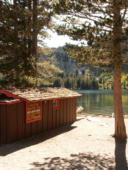
Nearby fishing: Lake
George,
Directions: From
Highway 395 turn west at the junction with Highway 203 and drive through
Map courtesy of mytopo.com.
Road condition: Paved
Day hike fishing: Duck
Pass Trail:
Region: Mammoth Lakes Ranger District 760-924-5500
Area/description:
Closest town or
supplies:
Contacts: Mammoth
Lakes Visitor Bureau (888) 466-2666 / (760)-924-5500; Rick’s
Facilities: Lodge, marina, grocery store, bait and tackle, coin-laundry, coin-showers, RV campground
Nearest campground:
Boating:
Fishing season:
General
Tips:
Favorite lures or bait: Use small lures such as Kastmasters, Daredevils and Panther-Martins. Bring smaller lures, but have a variety of color combinations to entice both shallow and deep cruising trout. Bank anglers typically use Power Bait, night crawlers or salmon eggs suspended above the bottom with marshmallows. (See Category: Fishing Tips – Best Lures and Bait)
Favorite fly patterns: The Fly & Bubble technique with small nymphs such as Hare’s Ear, Zug Bug, Bead-Head Prince Nymph, Pheasant Tail or a Tellico Shrimp; for larger trout be sure to have some good streamer patterns, particularly the Olive Matuka, Woolly Buggers and leech patterns. (See Category: Fishing Tips – Best Fly Patterns and Techniques)
Stocking information: 33,000 + carry-over survivors
Nearby fishing:
Directions: From
Highway 395 turn west at the junction with Highway 203 and drive through
Map courtesy of mytopo.com
Road condition: Paved
Day hike fishing:
Region: Mammoth Lakes Ranger District 760-924-5500
Area/description:
Closest town or
supplies:
Contacts: Mammoth
Lakes Visitor Bureau (888) 466-2666 / (760)-924-5500; Rick’s
Facilities: Boat launch, bait and tackle
Nearest campground:
Boating
Fishing season: General Best times:
Tips: Typically the lake is not ice free until June
Favorite lures or
bait: (See Category: Fishing Tips – Best Lures and Bait)
Favorite fly patterns: Trolling or using the Fly & Bubble technique with small nymphs such as Hare’s Ear, Zug Bug, Bead-Head Prince Nymph, Pheasant Tail or a Tellico Shrimp; for larger trout be sure to have some good streamer patterns, particularly the Olive Matuka, Woolly Buggers and leech patterns. (See Category: Fishing Tips – Best Fly Patterns and Techniques)
Stocking information: 24,000 + Alpers
Additional
information:
Nearby fishing:
Directions: From
Highway 395 turn west at the junction with Highway 203 and drive through
Road condition: Paved
Day hike fishing:
Region: Mammoth Lakes Ranger District 760-924-5500
Area/description:
Size: 30 acres Species: Rainbows, Browns and Brookies
Closest town or
supplies:
Contacts: Twin
Lakes Store (760) 934-6974; Mammoth Lakes Visitor Bureau (888) 466-2666 /
(760)-924-5500; Rick’s
Facilities: Lodge, marina, grocery store, bait and tackle, coin-laundry, coin-showers
Nearest campground:
Boating: Boat launch; no gas-powered motors
Fishing season: General Best times:
Tips:
Favorite lures or bait:
Use small lures such as Kastmasters, Daredevils and Panther-Martins. Bring smaller lures, but have a variety of
color combinations to entice both shallow and deep cruising trout. Bank anglers typically use Power Bait, night
crawlers or salmon eggs suspended above the bottom with marshmallows. (See
Category: Fishing Tips – Best Lures and Bait)
Favorite fly patterns: : The Fly & Bubble technique with small nymphs such as Hare’s Ear, Zug Bug, Bead-Head Prince Nymph, Pheasant Tail or a Tellico Shrimp; for larger trout be sure to have some good streamer patterns, particularly the Olive Matuka, Woolly Buggers and leech patterns. (See Category: Fishing Tips – Best Fly Patterns and Techniques)
Stocking information: 20,000 plus yearly carry-overs
Additional information: High pressure
Nearby fishing:
Directions: From
Highway 395 turn west at the junction with Highway 203 and drive through
I lowered my rod with a dejected sigh. “Yeah, but I want to catch a fish all by myself,” I replied.
“Well,” the oldest boy grinned, “I can help you do that. I’ll just get your worm out there in the water, but you’ll have to catch the fish.”
“OK!” I said, eager to begin a fishing lesson that my father had failed to initiate after many requests. I followed the older boy downstream to where a fence crossed the small channel. We crawled on our hands and knees the last few yards. Peeking through the grass on the bank above the water, we could see a couple of trout feeding right under the wire fence. The older boy flipped the worm out in the water and handed the rod to me. “Now, shake out some line. Just lift your rod a little and point it downstream. Shake it a little more.”
I couldn’t
believe my eyes. The red worm, neatly
skewered on an Eagle snelled hook, gradually worked down to the feeding
trout. One of the trout darted over to
the worm and greedily swallowed it. I
didn’t have to be told how to set the hook.
I was on my feet running backwards.
The little Rainbow never escaped the hook until I had him half-way on to
the playground. The other boys laughed
with glee, and so did I when I ran home to show my mom my first trout. Later, when I was in junior high, I spent a
week or more fishing
In 1959 the
mantra “Catch-and-Release” had not been coined.
I was in ninth grade, and I had just sold my bicycle, cleaned out my
Piggy bank and bought my first boat. It
was a Fold-A-Boat, a leaky old plywood and canvass ten foot pram that I
christened the “Twilight Wanderer.” Each
day I would row out on
Road condition: Dirt road to 4x4 spur road that is best suited to high-clearance 4x4 vehicles with short axle spacing.
Day hike fishing: A challenging and steep 4.5 mile hike
Region: Area/description:
Closest town or
supplies:
Contacts: Mammoth
Lakes Visitor Bureau (888) 466-2666 / (760)-924-5500; Rick’s
Nearest campground:
Fishing restrictions: Barbless flies and lures and a 14-inch minimum, two-fish limit
Fishing season: General Best times:
Tips:
Favorite lures or
bait: (See Category: Fishing Tips – Best Lures and Bait)
Favorite fly patterns: (See Category: Fishing Tips – Best Fly Patterns and Techniques)
Stocking information:
Additional
information:
Nearby fishing:
Directions: From
Highway 395 turn west at the junction with Highway 203. One of the first exit roads from Highway 203
will be the
Map courtesy of mytopo.com.
Name of creek: Mammoth Creek
Road condition: Paved
Region:
Description: A tiny, brushy creek with 10,000 stocked fish!
Species: Planted Rainbows
Closest town or
supplies:
Contacts: Mammoth
Lakes Visitor Bureau (888) 466-2666 / (760)-924-5500; Rick’s
Nearest campground:
Fishing season: General
Tips:
Favorite lures or bait: Most Sierra creeks are too small to fish effectively with lures and spinners. Your best bet is to poke and dab using salmon eggs or worms. Small weighted jig patterns, especially grubs and very small tube worms work very well, and do not over look live terrestrials if they are allowed. If you are partial to lures bring along small Panther-Martins in a variety of colors. (See Category: Fishing Tips – Best Lures and Bait)
Favorite fly patterns: Using a poke and dab presentation, small Woolly Buggers, Girdle Bugs, Yuk Bugs and terrestrial patterns always work well on creeks. Dry fly patterns include Royal Wulffs, Parachute Adams, Humpies, Renegades, Stimulators, hoppers, ants, beetles and sometimes a Bead-head San Juan Worm. (See Category: Fishing Tips – Best Fly Patterns and Techniques. Also read the article on fishing creeks if you are new to the sport of angling.)
Stocking information:
Nearby fishing:
Additional
information:
Directions: From
Highway 395 turn west at the junction with Highway 203. Drive 2.7 miles and turn left on
Road condition: Paved to dirt
Day hike fishing: The hike is a little over two miles on a well-maintained trail
Region: Mammoth
Lakes Ranger District (760) 924-5500
Closest town or
supplies:
Contacts: Mammoth
Lakes Visitor Bureau (888) 466-2666 / (760)-924-5500; Rick’s
Nearest campground: Sherwin Creek Campground
Fishing season: General
Tips: Wading is difficult due to the terrain and steep drop-offs.
Favorite lures or
bait: (See Category: Fishing Tips – Best Lures and Bait)
Favorite fly patterns: (See Category: Fishing Tips – Best Fly Patterns and Techniques)
Stocking information: Back country stocking program
Additional information / Sherwin Creek: Sherwin Creek is a small creek that is planted with 5,000 + Rainbows in and around the campground
Nearby fishing:
Directions: From
Highway 395 turn west at the junction with Highway 203. One of the first exit roads from Highway 203
will be the
Map courtesy of mytopo.com.
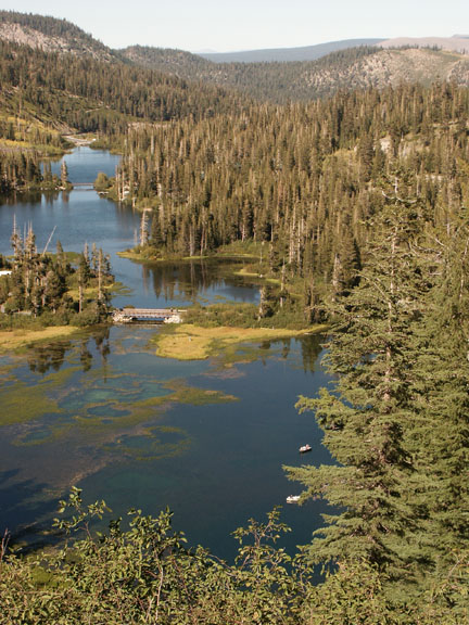
Name of creek: Hot Creek
Road condition: Paved to gravel
Region:
Description: A classic and world famous catch-and-release spring creek with only one mile of access for the public.
Species: Browns and Rainbows
Closest town or
supplies:
Contacts: Mammoth
Lakes Visitor Bureau (888) 466-2666 / (760)-924-5500; Rick’s
Nearest campground:
Fishing season: General
Tips: As typical on most spring creeks, use long leaders and 6 or 7X tippets. Favorite patterns are Caddis imitations and small Mayflies. Oops! Did I mention single, barbless hooks? As the season progresses so too does the aquatic plant growth. With prolific numbers of 12-inch fish and a fair number of Browns reaching 16-20 inches, it is no wonder anglers from all around the world come here to test their skills against educated trout who see more visitors than some theme parks. Nonetheless, skilled anglers are fairly successful, especially during the evening hatches.
Favorite fly
patterns: Caddis, Parachute
Stocking information:
Nearby fishing:
Additional information: The creek, due to its warm water temperatures, does not freeze during the winter and provides a plethora of insect life that supports a large population of wild trout. It is estimated that the creek supports upwards of 10,000 fish per mile! Hot Creek has two public access parking areas. Hot Creek Ranch offers private pay to fish access to Hot Creek.
Directions: From
Highway 395 drive past
Map courtesy of mytopo.com.
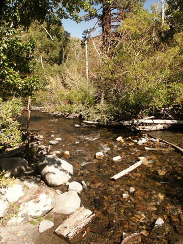
Name of creek: Convict Creek
Road condition: Paved
Region:
Description: A
small
Species: Stocked Rainbows along with some wild Browns
Closest town or
supplies: Tom’s Place,
Contacts:
Nearest campground:
Fishing season: General
Tips:
Favorite lures or bait: Most Sierra creeks are too small to fish effectively with lures and spinners. Your best bet is to poke and dab using salmon eggs or worms or Power Bait. Small weighted jig patterns, especially grubs and very small tube worms work very well, and do not over look live terrestrials if they are allowed. If you are partial to lures bring along small Panther-Martins in a variety of colors. (See Category: Fishing Tips – Best Lures and Bait)
Favorite fly patterns: Using a poke and dab presentation, small Woolly Buggers, Girdle Bugs, Yuk Bugs and terrestrial patterns always work well on creeks. Dry fly patterns include Royal Wulffs, Parachute Adams, Humpies, Renegades, Stimulators, hoppers, ants, beetles and sometimes a Bead-head San Juan Worm. (See Category: Fishing Tips – Best Fly Patterns and Techniques. Also read the article on fishing creeks if you are new to the sport of angling.)
Stocking information: 15,000 +
Nearby fishing:
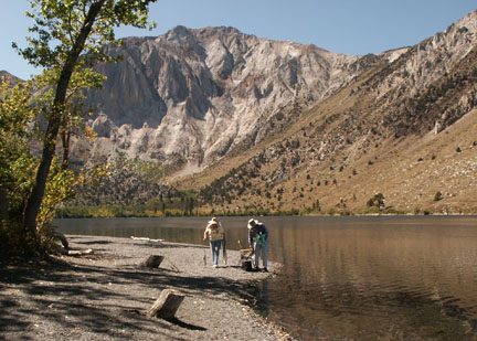
Additional information: The outlet is the most heavily stocked area.
Directions: From
Highway 395, drive 35 miles north of Bishop and turn left on
Map courtesy of mytopo.com.
Road condition: Paved
Day hike fishing:
Region: Mammoth Lakes Ranger District 760-924-5500
Area/description:
Closest town or
supplies:
Contacts:
Facilities: Lodge, marina, grocery store, bait and tackle, RV campground
Nearest campground:
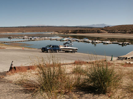
Boating: Boat launching fee
Fishing season:
General
Tips: If you have a boat, head for the inlet at the back of the lake
Favorite lures or bait:
(See Category: Fishing Tips – Best Lures and Bait)
Favorite fly patterns: (See Category: Fishing Tips – Best Fly Patterns and Techniques)
Stocking information:
43,000 + the resort stocks trophy Alper rainbows in addition to the
stocking from Mono County Fishing Enhancement, which are also trophy Alper
rainbows. Each spring and on the last
day of the season
Additional
information:
Nearby fishing: Convict Creek,
Directions: From
Highway 395, drive 35 miles north of Bishop and turn left on
Map courtesy of mytopo.com.
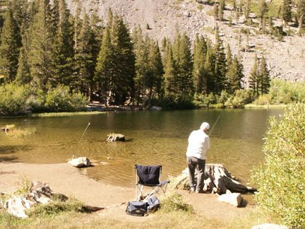
Name of creek: McGee Creek
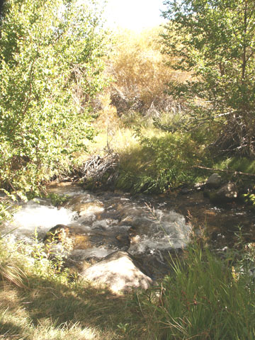
Road condition: Paved
Region: Near
Description: A small, shallow creek with few pools
Species: Stocked Rainbows
Closest town or supplies: Tom’s Place
Contacts:
Nearest campground: Gee Creek; McGee Creek RV Park
Fishing season: General
Tips: Bait fishing downstream with salmon eggs, worms and Power Bait is popular.
Favorite lures or bait: Most Sierra creeks are too small to fish effectively with lures and spinners. Your best bet is to poke and dab using salmon eggs or worms. Small weighted jig patterns, especially grubs and very small tube worms work very well, and do not over look live terrestrials if they are allowed. If you are partial to lures bring along small Panther-Martins in a variety of colors. (See Category: Fishing Tips – Best Lures and Bait)
Favorite fly patterns: Using a poke and dab presentation, small Woolly Buggers, Girdle Bugs, Yuk Bugs and terrestrial patterns always work well on creeks. Dry fly patterns include Royal Wulffs, Parachute Adams, Humpies, Renegades, Stimulators, hoppers, ants, beetles and sometimes a Bead-head San Juan Worm. (See Category: Fishing Tips – Best Fly Patterns and Techniques. Also read the article on fishing creeks if you are new to the sport of angling.)
Stocking information: 10,000
Nearby fishing:
Additional
information: This little creeks gets much less pressure than surrounding
creeks. It is a good respite from summer
heat or strong winds pummeling
Directions: From
Highway 395 in Bishop, drive 28 miles to
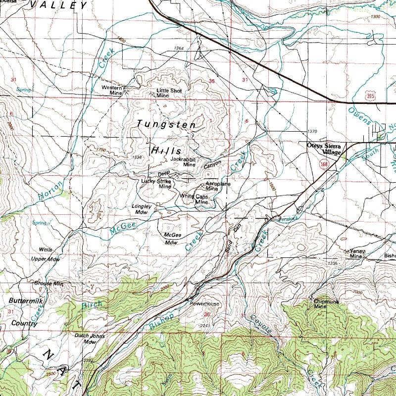
Map courtesy of mytopo.com.
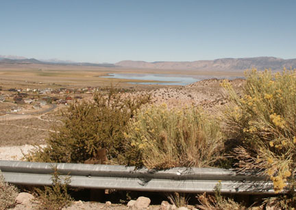
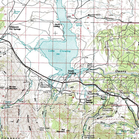
Road condition: Paved
Day hike fishing:
Region: Mammoth Lakes Ranger District 760-924-5500
Area/description:
Closest town or
supplies: Tom’s Place,
Contacts: Bureau
of Land Management-Bishop Field Office (760) 872-4881; Crowley Lake Fish Camp
(760) 935-4301; Mammoth Lakes Visitor Bureau (888) 466-2666 / (760)-924-5500;
Rick’s
Facilities: Lodge, marina, grocery store, bait and tackle, coin-laundry, coin-showers, RV campground; fish cleaning station
Nearest campground:
Boating: No restrictions
Fishing season:
General Best
times: Opening Day and during the fall, although fly fishing anglers do
well from float tubes all season. Note:
Read the regulations carefully as
Tips: Fly
fishers, in addition to Chironomid patterns and damselfly imitations, should
have a number of streamer patterns in their fly box to imitate the
Favorite lures or
bait: (See Category: Fishing Tips – Best Lures and Bait)
Favorite fly patterns: (See Category: Fishing Tips – Best Fly Patterns and Techniques)
Stocking information: 700,000 plus!
Additional
information: With shallow shorelines, abundant insect and plant life, many
tributaries and the
West side of lake: Bait fishing from shore: Whiskey Bay, Beaver Cove and Hilton Bay; trollers work the west shore from Hilton Bay to McGee Bay around the north end of the lake in the Green Banks bay working the old riverbed channel.
North end of lake: Green Banks – popular with float tubers and bait fishermen
East side: Layton Spring and Alligator Point are popular spots for all methods
Bait: Power Bait; night crawlers, salmon eggs
Jigs and large Rapalas and lures representing minnows; popular lures also include Thomas Buoyant, Kastmaster, Panther-Martins, Red Devils and swim baits
Fly anglers generally work the west shoreline from
Spring perch bite from late May through June in weedy, shallow areas during the spawn; use mini-jigs and small worms; no possession or daily limit.
Nearby fishing:
Directions: From
Highway 395 drive 31 miles north of Bishop to the
