A
Campground Name: Aspen Campground Area: Tioga Pass / Lee Vining Area
Administered by: Inyo National
Forest / Mono Basin Scenic Area Ranger Station and Visitor Center (760) 647-3044
Elevation: 7,490
Season Length: 4/26-10/20 - subject to weather conditions
Contact: Lee Vining Chamber of Commerce
(info@leevining.com; Visiting Mono Lake www.monolake.org/visiting/; Mono Lake
Visitor Center
(http://www.monolake.org/monomap/vc.htm
Number of sites: 56
Fee: $14.
RV sites: Yes RV’s up to: 40 feet No Hook-ups: Garbage: containers
Toilets: Portable Water: Yes Picnic tables and fire rings
Nearest town: Lee
Vining
Nearby facilities: Lee Vining
Nearby fishing: Lee Vining Creek, Ellery Lake, Tioga Lake, Saddleback
Lake
Reservations: No
Additional information:
Please note that the dates and prices below are subject to change
and reflect 2007 data. If listed, the
campground opening dates are approximate due to weather conditions
Directions: From
the junction of Highway 395 and Highway 120 on the outskirts of Lee Vining,
turn west on Highway 120 and proceed approximately 3.5 miles to Poole Power Plant Road. Turn left and then drive four miles the
campground.
B
Campground Name: Big Bend Campground Area: Tioga Pass / Lee Vining Area
Administered by: Inyo National
Forest / Mono Basin Scenic Area Ranger Station and Visitor Center (760) 647-3044
Elevation: 7,800
Season Length: 4/26-10/15 - subject to weather conditions
Contact: Lee Vining Chamber of Commerce
(info@leevining.com; Visiting Mono Lake www.monolake.org/visiting/; Mono Lake
Visitor Center
(http://www.monolake.org/monomap/vc.htm
Number of sites: 17
Fee: $17.
RV sites: Yes RV’s up to: 30 feet No Hook-ups: Garbage: containers
Toilets: Vault Water: Yes Picnic tables and fire rings
Nearest town: Lee
Vining
Nearby facilities: Lee Vining
Nearby fishing: Lee Vining Creek, Ellery Lake, Tioga Lake, Saddleback
Lake
Reservations: No
Additional information:
Please note that the dates and prices below are subject to change
and reflect 2007 data. If listed, the
campground opening dates are approximate due to weather conditions
Directions: From
the junction of Highway 395 and Highway 120 on the outskirts of Lee Vining,
turn west on Highway 120 and proceed approximately 3.5 miles to Poole Power Plant Road. Turn left and then follow the sign to the
campground.
_____________________________________________________________________________________________
Campground Name: Boulder
Campground Area: Tioga Pass / Lee Vining Area
Administered by: Inyo National
Forest / Mono Basin Scenic Area Ranger Station and Visitor Center (760) 647-3044
Elevation: 7,390
Season Length: 4/26-10/15 - subject to weather
conditions
Contact: Lee Vining Chamber of Commerce
(info@leevining.com; Visiting Mono Lake www.monolake.org/visiting/; Mono Lake
Visitor Center
(http://www.monolake.org/monomap/vc.htm
Number of sites: 100
Fee: $14.
RV sites: 10 RV’s up to: 30 feet No Hook-ups: Garbage: containers
Toilets: Portable Water: No Picnic tables and fire rings
Nearest town: Lee
Vining
Nearby facilities: Lee Vining
Nearby fishing: Lee Vining Creek, Ellery Lake, Tioga Lake, Saddleback
Lake
Reservations: No
Additional information:
Please note that the dates and prices below are subject to change
and reflect 2007 data. If listed, the
campground opening dates are approximate due to weather conditions
Directions: From
the junction of Highway 395 and Highway 120 on the outskirts of Lee Vining,
turn west on Highway 120 and proceed approximately 3.5 miles to Poole Power Plant Road. Turn left and then a quick right into the
campground.
C
Campground Name: Cattleguard Campground Area: Tioga Pass / Lee Vining Area
Administered by: Inyo National
Forest / Mono Basin Scenic Area Ranger Station and Visitor Center (760) 647-3044
Elevation: 7,325
Season Length: 4/26-10/20 - subject to weather conditions
Contact: Lee Vining Chamber of Commerce
(info@leevining.com; Visiting Mono Lake www.monolake.org/visiting/; Mono Lake
Visitor Center
(http://www.monolake.org/monomap/vc.htm
Number of sites: 16
Fee: $14.
RV sites: Yes RV’s up to: 30 feet No Hook-ups: Garbage: containers
Toilets: Portable Water: No Picnic tables and fire rings
Nearest town: Lee
Vining
Nearby facilities: Lee Vining
Nearby fishing: Lee Vining Creek, Ellery Lake, Tioga Lake, Saddleback
Lake
Reservations: No
Additional information:
Please note that the dates and prices below are subject to change
and reflect 2007 data. If listed, the
campground opening dates are approximate due to weather conditions
Directions: From
the junction of Highway 395 and Highway 120 on the outskirts of Lee Vining,
turn west on Highway 120 and proceed approximately 3 miles to the campground
entrance on the left.
E
Campground Name: Ellery
Lake Campground Area: Tioga Pass / Lee Vining Area
Administered by: Inyo National
Forest / Mono Basin Scenic Area Ranger Station and Visitor Center (760) 647-3044
Elevation: 9,500
Season Length: 6/1-10/15 - subject to weather
conditions
Contact: Lee Vining Chamber of Commerce
(info@leevining.com; Visiting Mono Lake www.monolake.org/visiting/; Mono Lake
Visitor Center
(http://www.monolake.org/monomap/vc.htm
Number of sites: 21
Fee: $17.
RV sites: 12 RV’s up to: 30 feet No Hook-ups: Garbage: containers
Toilets: Vault Water: Yes Picnic tables and fire rings
Nearest town: Lee
Vining
Nearby facilities: Grocery store nearby
Nearby fishing: Lee Vining Creek, Ellery Lake, Tioga Lake, Saddleback
Lake
Reservations: No
Additional information: Just outside the park boundary, Ellery Lake
is a popular campground when the park campsites are full. The lake is stocked, and small boats and
small motors are allowed, although they must be carried to the water and hand
launched.
Directions: From
the junction of Highway 395 and Highway 120 on the outskirts of Lee Vining,
turn west on Highway 120 and proceed approximately ten miles to the campground
entrance.
J
Campground Name: Junction Campground Area: Tioga Pass / Lee Vining Area
Administered by: Inyo National
Forest / Mono Basin Scenic Area Ranger Station and Visitor Center (760) 647-3044
Elevation: 9,600
Season Length: subject to weather conditions
Contact: Lee Vining Chamber of Commerce
(info@leevining.com; Visiting Mono Lake www.monolake.org/visiting/; Mono Lake
Visitor Center
(http://www.monolake.org/monomap/vc.htm
Number of sites: 13
Fee: $12.
RV sites: Yes RV’s up to: 30 feet No Hook-ups: Garbage: containers
Toilets: Vault Water: No Picnic tables and fire grills
Nearest town: Lee
Vining
Nearby facilities: Lee Vining
Nearby fishing: Lee Vining Creek, Ellery Lake, Tioga Lake, Saddleback
Lake
Reservations: No
Additional information:
Please note that the dates and prices below are subject to change
and reflect 2007 data. If listed, the
campground opening dates are approximate due to weather conditions
Directions: From
the junction of Highway 395 and Highway 120 on the outskirts of Lee Vining,
turn west on Highway 120 and proceed approximately 10 miles to Saddleback Road. Turn right on Saddleback Road for the entrance to the
campground.
L
Campground Name: Lower Lee Vining Campground Area: Tioga Pass / Lee Vining
Administered by: Inyo National
Forest / Mono Basin Scenic Area Ranger Station and Visitor Center (760) 647-3044
Elevation: 7,300
Season Length: 4/26-10/20 - subject to weather
conditions
Contacts: Lee Vining Chamber of Commerce
(info@leevining.com; Visiting Mono Lake www.monolake.org/visiting/; Mono Lake
Visitor Center
(http://www.monolake.org/monomap/vc.htm
Number of sites: 54
Fee: $14.
RV sites: Yes RV’s up to: 40 feet No Hook-ups: Garbage: containers
Toilets: Portable Water: No Picnic tables and fire rings
Nearest town: Lee
Vining
Nearby facilities: Lee Vining
Nearby fishing: Lee Vining Creek, Ellery Lake, Tioga Lake, Saddleback
Lake
Reservations: No
Additional information:
Please note that the dates and prices below are subject to change
and reflect 2007 data. If listed, the
campground opening dates are approximate due to weather conditions
Directions: From
the junction of Highway 395 and Highway 120 on the outskirts of Lee Vining,
turn west on Highway 120 and proceed approximately 2.5 miles for the campground
entrance on the right.
Campground Name: Moraine Campground Area: Tioga Pass / Lee Vining Area
Administered by: Inyo National
Forest / Mono Basin Scenic Area Ranger Station and Visitor Center (760) 647-3044
Elevation: 7,350
Season Length: 4/26-10/20 - subject to weather
conditions
Contacts: Lee Vining Chamber of Commerce
(info@leevining.com; Visiting Mono Lake www.monolake.org/visiting/; Mono Lake
Visitor Center
(http://www.monolake.org/monomap/vc.htm
Number of sites: 27
Fee: $14.
RV sites: Yes RV’s up to: 30 feet No Hook-ups: Garbage: containers
Toilets: Portable Water: No Picnic tables and fire rings
Nearest town: Lee
Vining
Nearby facilities: Lee Vining
Nearby fishing: Lee Vining Creek, Ellery Lake, Tioga Lake, Saddleback
Lake
Reservations: No
Additional information:
Please note that the dates and prices below are subject to change
and reflect 2007 data. If listed, the
campground opening dates are approximate due to weather conditions
Directions: From
the junction of Highway 395 and Highway 120 on the outskirts of Lee Vining,
turn west on Highway 120 and proceed approximately 3.5 miles to Poole Plant Road. Turn left and continue less than a quarter of
a mile to the campground entrance at the end of the road.
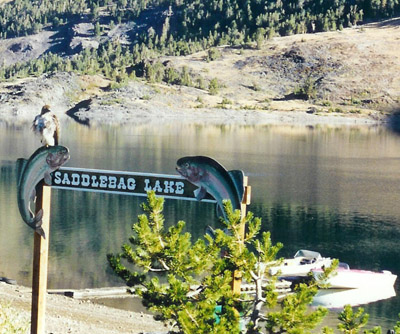
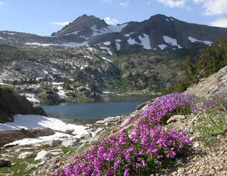
S
Campground Name:
Saddlebag Campground Area: Tioga
Pass
Administered by: Inyo National
Forest / Mono Basin Scenic Area Ranger Station and Visitor Center (760) 647-3044
Elevation: 10.087
Season Length: 6/1-10/15 - subject to weather
conditions
Contacts: Lee Vining Chamber of Commerce
(info@leevining.com; Visiting Mono Lake www.monolake.org/visiting/; Mono Lake
Visitor Center
(http://www.monolake.org/monomap/vc.htm
Number of sites: 20
Fee: $17.
RV sites: Yes RV’s up to: 40 feet but there is a scarcity of level sites No Hook-ups Garbage: containers
Toilets: Vault Water: Yes Picnic tables and fire grills
Nearest town: Lee
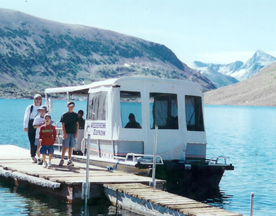
Vining
Nearby facilities: Small store and café, fishing tackle, boat rental and boat taxi to the Twenty Lakes
Basin. (
www.saddlebaglakeresort.com)
Nearby fishing: Saddlebag Creek, Ellery Lake, Gardisky
Lake, Tioga Lake
Reservations: No
Additional information:
The campground is about a
quarter of a mile from the lake with an excellent trail to the Twenty Lakes
Basin. The boat taxi, however, shaves off three
miles. Be prepared for cold weather at
this elevation. If you plan a hike, be
aware that it is not uncommon for hikers living at lower elevations to
experience aching lungs, headaches and nausea due to altitude sickness. Be sure to drink plenty of purified or
filtered water all day on the trail whether you are thirsty or not. Bring along sun screen, sun glasses, a hat
and an outer garment. Additionally, I
always recommend carrying in your day pack a first aid kit, a plastic rain coat
and a mosquito net just in case.
Please note that the dates and prices above are subject to
change and reflect 2007 data. If listed,
the campground opening dates are approximate due to weather conditions
Directions: From
the junction of Highway 120 and Highway 395 just outside Lee Vining, take
Highway 120 approximately eleven miles to the Saddlebag Lake Road on the right. Turn onto Saddlebag Road and drive 2.5 miles to the
campground.
T
Campground Name: Tioga
Lake Campground Area: Tioga Pass / Lee Vining Area
Administered by: Inyo National
Forest / Mono Basin Scenic Area Ranger Station and Visitor Center (760) 647-3044
Elevation: 9,700
Season Length: 6/1-10/15 - subject to weather
conditions
Contact: Lee Vining Chamber of Commerce
(info@leevining.com; Visiting Mono Lake www.monolake.org/visiting/; Mono Lake
Visitor Center
(http://www.monolake.org/monomap/vc.htm
Number of sites: 13
Fee: $17.
RV sites: Yes RV’s up to: 30 feet No Hook-ups: Garbage: containers
Toilets: Vault Water: Yes Picnic tables and fire grills
Nearest town: Lee
Vining
Nearby facilities: Lee Vining
Nearby fishing: Lee Vining Creek, Ellery Lake, Tioga Lake, Saddleback
Lake
Reservations: No
Additional information:
Please note that the dates and prices below are subject to change
and reflect 2007 data. If listed, the
campground opening dates are approximate due to weather conditions
Directions: From
the junction of Highway 395 and Highway 120 on the outskirts of Lee Vining,
turn west on Highway 120 and proceed approximately 11 miles just past Ellery Lake.
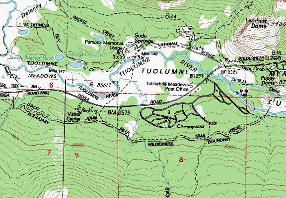
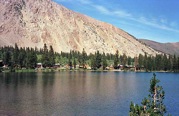
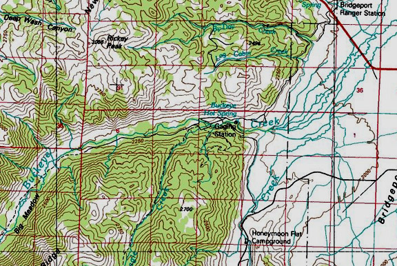
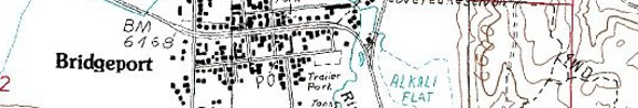
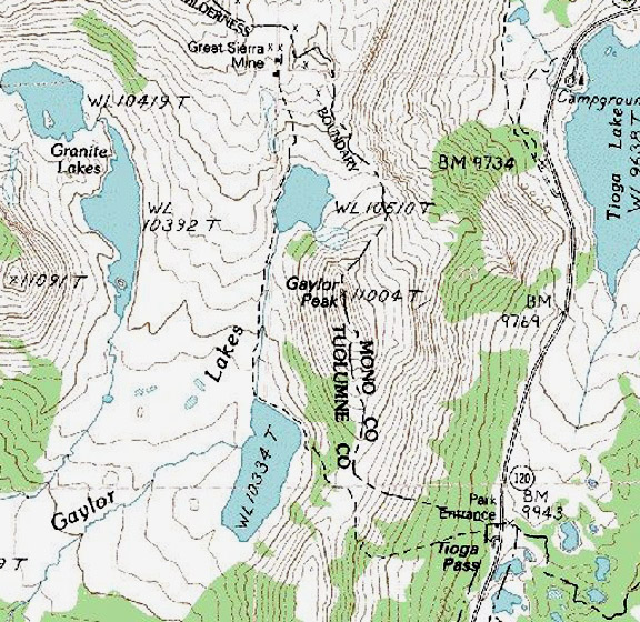
 Map courtesy of mytopo.com.
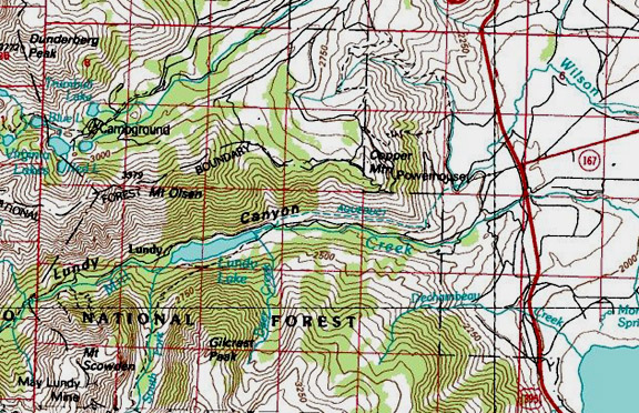
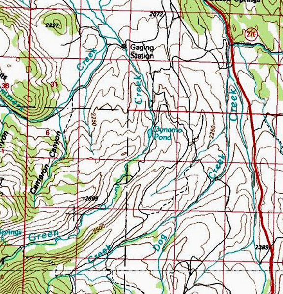
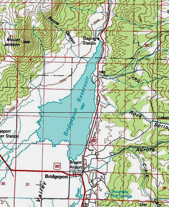
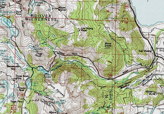
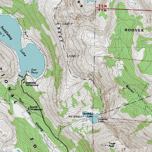
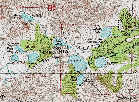
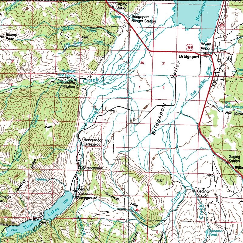
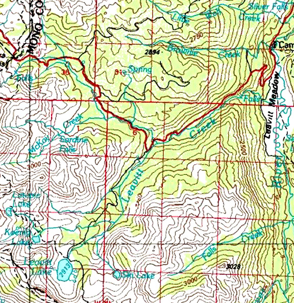
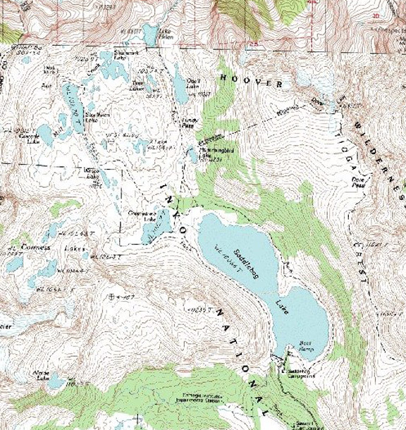
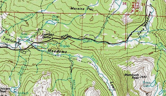 Map courtesy of
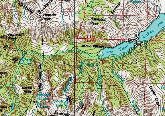
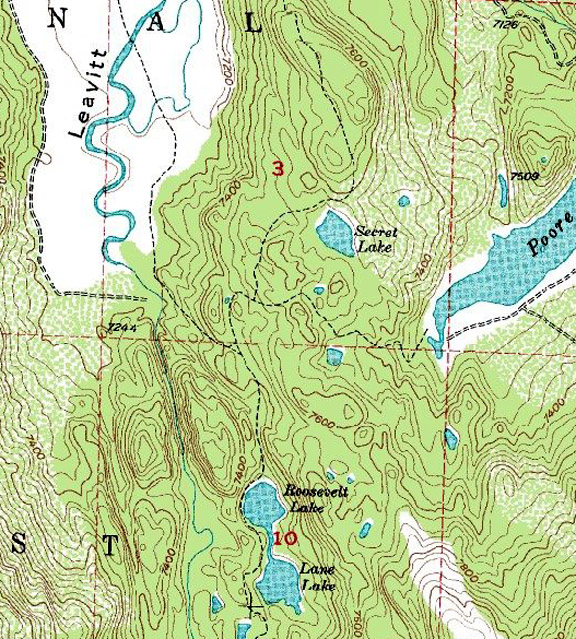
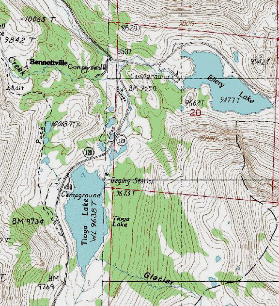