Test on the Basics of Stillwater Fly Fishing
As I have noted in my introduction to Mastering the Basics of Stillwater Fly Fishing,
I am not an expert or authority on stillwater fishing. In my five
decades of fly fishing and my years of guiding, I concentrated mostly
on moving waters, with the exception of high-elevation lakes. At age 62
I do not have the luxury of slowly acquiring stillwater skills over a
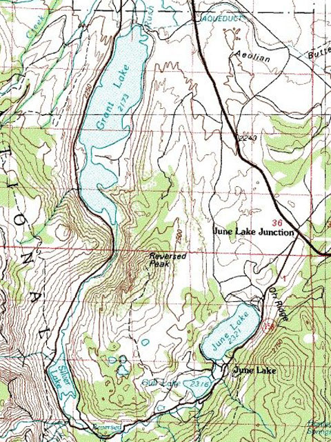
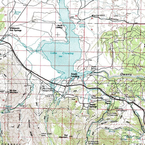
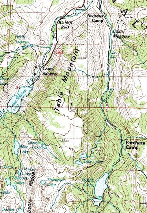
period of years. Now that I live across the street from Klamath Lake,
which harbors huge trout, I am hell-bent to learn the secrets of
stillwater fly fishing quickly. Over the past few years I have hooked
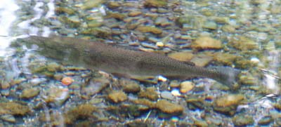
and landed a number of trout in the four to seven pound range, but I
also grudgingly admit that I have been skunked more times than I care
to address. The glossary and test, dear reader, are for me. As a
retired teacher, I know the value of reading, outlining information and
then writing a test in order to really learn the material. The ultimate
and final test is on the water.
I hope you too find some value in taking the test first, and then
reading my article. The test will prep you for the article. If you are
already an experienced stillwater fly fishing angler, the test may be
too elemental, as it truly targets the beginning angler who wants to
“master the basics.” As always, I would enjoy receiving any feedback or
suggestions for improvement. (The answers to the test are at the very
bottom.)
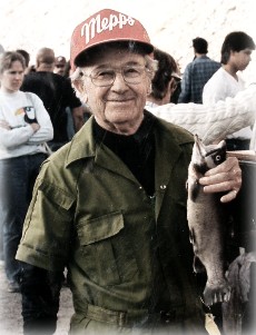
Dave Archer
1. Why do the experts recommend slow action rods for stillwater fishing?
2. What is the preference for rods in terms of length and line weight?
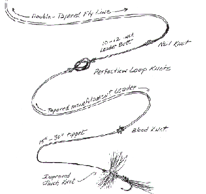
3. What is the most commonly recommended leader?
4. A Chironomid fly most closely resembles what other insect?
A. Caddis B. Grasshopper C. Mosquito D. Mayfly
5. With a few exceptions, the experts were fairly consistent in
their targeted “Go-To” patterns when searching for trout in a new lake.
In order of importance, which order most closely reflects the choice of
the experts?
A: Leech, Dragonfly/Damsel, Minnow, Chironomid, Scud, Terrestrial
B: Scud, Minnow, Dragonfly/Damsel, Terrestrial, Chironomid
C: Minnow, Scud, Chironomid, Dragonfly/Damsel, Terrestrial
D: Chironomid, Scud, Leech, Dragonfly/Damsel, Terrestrial
6. What is the most versatile fly line?
7. Another name for “midge” is ___________
8. A “scud” is ________
A. A lonely, small cloud drifting by itself
B. a clump of trico mayflies
C. a small crustacean resembling a shrimp
D. A & C
9. The experts agree that trout prey most actively on leeches in the
following range: A. 1-2 inches B. 2-3 inches C. 4-5 inches D. 6-8 inches
10. One advantage of fishing a dark Woolly Bugger is that it
imitates two sources of trout food which are ___________ and __________
11. T/F Unlike bass, trout will only feed on a crawdad when it is young and molting.
12. Use a mouse pattern after…
13. Generally, unless you have cabin fever, avoid these conditions:
A. A rapidly falling barometer
B. Wind
C. a period of a full moon
D. flat, calm conditions
E. water with an algae bloom present
F. C & E
G. A & C
14. In deciding on the distance and speed of retrieval, the experts
are in total agreement that the most important aspect of the retrieve
is the …
15. An approaching storm often (decreases the bite) (increases the bite).
16. T/F: Strike indicators are out of the realm of fly fishing and indicative of an inexperienced fly fisher.
17. When fishing with a San Juan Worm, an angler is imitating what larva?
A. Mayfly
B. Chironomid
C. Caddis
D. Leech
18. T/F: The Caddis is not as important to the stillwater angler as it is to the stream angler.
19. A Callibaetis insect is what “class” of insects?
A. Mayfly B. Caddis C. Chironomid D. Water Boatman
Match Retrieves with Patterns:
Note: The choices of retrieves are not precise. Select a retrieve
that is most appropriate. I found the experts have a wide range of
opinion on the matter of retrieve. Keep a record of what works for you,
but don’t be cavalier as this is the most critical aspect of stillwater
fly fishing. Bring along a cheat sheet and practice each retrieve when
you venture out on the water. Take notes!
A: One hand twist every five to ten seconds followed by a quick jerk and a pause
B: One inch slow and steady pulls followed by a pause
C: Three to six inch slow pulls followed by a pause
D: Two feet pulls speeding up with a flick of the wrist at the end w/ occasional pauses
E: Rapid short retrieves: Strip-strip-strip-pause
F: Long, fast pulls punctuated with an occasional pause and jerk
No retrieve
Which of the above retrieves would you use for the following patterns?
20. Leech on bottom
21. Leech swimming
22. Chironomid larva
23. Chironomid pupae
24. Dragonfly nymph
25. Damselfly nymph
26. Minnow
27. Scud
28. Terrestrial
29. Emergers or nymph on the surface
30. Cripple or dun on the surface
Matching Insects with Fly Patterns
A. Chironomid
B. Callibaetis Mayfly Dun
C. Callibaetis Mayfly Nymph
D. Caddis
E. Damselfly
F. Dragonfly
G. Leech
H. Scud
I. Terrestrial
J. Minnow
K. Crawdad
Match the following patterns with the insects above.
31. Bronzie, Chromie
32. Zonker
33. Adams, Midges, Black Gnat, Mosquito, Compara Dun
34. Pheasant Tail Nymph, Gold Ribbed Hare’s Ear
35. Sedge pattern (Hint: England and Canada)
36. Woolly Bugger, Carey Special, Beadhead Woolly
37. Sparkle Shrimp, Zug Bug
38. Seal Bugger
39. Ants, beetles and grasshoppers
40. Woolhead Sculpin, Red Sided Shiner
41. Hare’s Ear Wet
42. Carey Special (another use different than 36.
43. Reddish brown Woolly Bugger fished on the bottom
44. Denny’s All Purpose Emerger
45. Bloodworm
46. T/F: Callibaetis nymphs are active swimmers
47. T/F: Callibaetis duns and Hexagenia duns provide the best opportunity for dry fly fishing on lakes.
48. Why are Chironomid nymphs and Callibaetis nymphs bright during their ascent to the surface?
49. What is a major disadvantage of fishing stillwater with a floating line?
50. What one piece of equipment should you always have when wading or fishing a boat?
Answers:
1. The slower action rods absorb the shock of a large fish on the
take. Light tippets do not hold up on a stiffer rod when a large trout
fights in underwater vegetation.
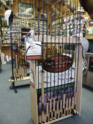
2. Many of the experts, both guides and authors that I have met, use 5
wt rods from 8.5 to 9.5 in length. As always, it is personal
preference. Certainly 5 – 8 weight rods will all do fine.
3. 4x-5x, 9 to 15 feet in length
4. C
5. D
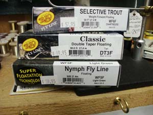
6. Floating
7. Chironomid
8. D
9. A
10. Minnow or forage fish and a leech
11. False
12. dark
13. A & C Denny Rickards and other experts note that trout like the
cover of an algae bloom until the oxygen is depleted and the
temperature of the water nears 70 degrees.
14. Pause
15. Increases the bite
16. Bull shit!
17. Chironomid blood worm
18. T The caddis larva moves slowly across the lake bottom not
attracting much attention. Its descent in the pupa stage to the surface
is slow, and it too often goes unnoticed. Once in the surface film, the
emerger stage is over quickly.
19. Mayfly
20. A or B
21. C or D
22. A or B
23. A or B
24. C or D
25. B or C
26. E or F
27. A or B
28. No retrieve, slight twitch
29. B or C
30. No retrieve
31. Chironomid nymph
32. Streamer
33. Chironomid emerger / dun
34. Callibaetis nymph or Chironomid nymph
35. Caddis
36. Leech
37. Scud
38. Leech or Dragonfly nymph
39. Terrestrial
40. Minnow
41. Chironomid nymph
42. Dragonfly nymph
43. Crawdad
44. Chironomid emerger
45. Chironomid larva
46. True
47. True
48. They use trapped air and gas to help them rise to the surface, which gives a shinny reflection to their bodies.
49. Wind drift moves the line which in turn moves your fly.
50. Inflatable chest suspenders or a Coast Guard approved floatation devise.
If you got an “A”, skip my article, although you may want to read one or more of the recommended books, especially Fly Patterns for Stillwater.
If you did poorly, read the accompanying article, and be sure to buy
one or more of the books that I recommend. If you are young and just
beginning to fly fish, I recommend Croft’s book, The Fish Bum’s Guide to Catching Larger Trout, an illustrated manual on stillwater tactics for the intermediate fly angler. Although I valued and enjoyed reading a number of books listed in my bibliography, my favorite remains Denny Rickards, Fly-Fishing Stillwaters for Trophy Trout.
Mastering the Basics of Stillwater Fly Fishing
Glossary
A
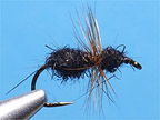
Alderflies: These insects are similar to Caddisflies, but they are black.
Anchored Position: Unless you are drifting with the wind or
trolling, an anchored stationary position provides the greatest
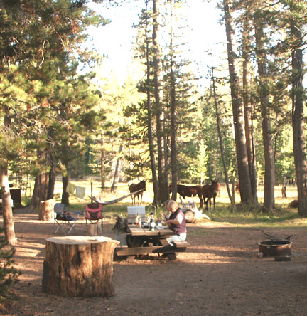
opportunity for precise casting and controlled retrieves. Cabala’s
offers a number of small anchors for belly boats and Kickboats. In a
larger boat, especially with two anglers, two anchors keep the boat
stationary in the wind so that the boat doesn’t swing back and forth.
In this manner both anglers may cast parallel and both casters have a
stationary zone to target.
B
Barometer: Fair and Stable means fair or stable fishing; Low or falling means “The Pits.”
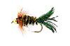
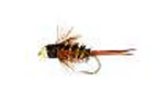
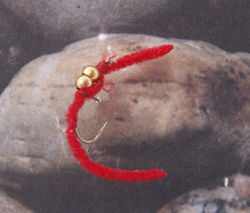
Bloodworm: Many species of Chironomids live deep in the lake. To
survive in this oxygen depleted zone, they need hemoglobin, which gives
the larva body a bright red color.
(Photograph)
Boil: A boil is a bulge of water on the surface indicating a fish is
feeding just under the surface on emerging insects. This is contrasted
to sippers who lazily sip insects in the surface film during low light.
This is contrasted by a splashy spay of water indicating a charging
trout eager to catch a surface resting insect prior to its maiden
flight.
C
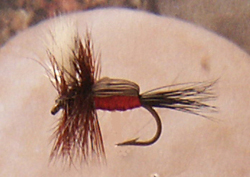
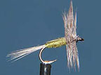
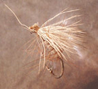
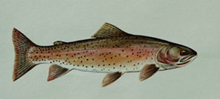
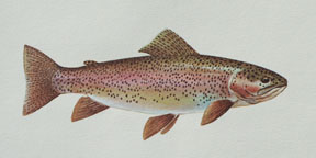
Callibaetis Mayfly: Although abundant in streams, mayflies do not
typically inhabit stillwaters. One of the exceptions, however, is the
Callibaetis, the speckled-wing mayfly. Preferring clear water, lakes
with Callibaetis mayflies are an important food source of trout as
nymphs, duns and spinners. Typically, two or three hatching periods
occur throughout the season with each successive hatch smaller in size
from the last. The hatch during spring comes off mid-morning, but as
the season progresses hatches occur in the early morning and low light
of evening. Mottled in browns and tans with speckled, translucent
wings, the Callibaetis mayfly can be found across the country,
including famous trout rivers offering slower water.
(Photograph)
Chemocline: This is the bottom of the lake, the profundal zone,
which holds little oxygen. Unless there is seepage springs offering
oxygenated water in the Chemocline, trout will not be found in this
zone.
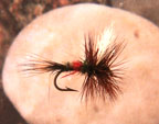
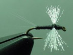
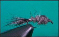
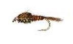
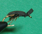
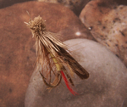
Chironomids – Midges: The most prolific insect in lakes around the
world, the chiromomidae are classified as “true” flies, with two sets
of wings and resembling their cousin the mosquito, but they do not
bite. Phillip Rowly in his book, Fly Patterns for Stillwaters, notes
that there are over 2500 species of Chironomids in North America, and
they make up approximately 40% of a trout’s diet almost year around.
This is a bug worth getting to know! (Refer to the article on
Stillwater fishing for more details and strategies.)
(photograph)
Cover: Read any good bass fishing book and you will learn everything
there is to know about stillwater fishing for trout. Keep in mind the
obvious. Trout need cover to protect themselves from overhead
predators. They need overhead obstructions or camouflaging to break up
their outline. They need cooler waters that provide sufficient oxygen,
and they need to be close to good sources of food. So in alphabetical
order, here are some “fishy” spots to target: algae blooms, bays,
branches, channels, cliffs, downed trees, drop-offs, feeder streams,
inlets and outlets, points, rocks, river channels, shoals (submerged
island), springs, vegetation.
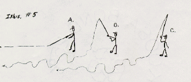
(Art illustration)
Counting Down: The dilemma of a stillwater fly angler in deeper water
is not knowing how far down the fly line and fly have settled. Keep in
mind that bass and trout do not look down. If they have acclimated to a
particular depth, which is comfortable, they are unlikely to dive down
to a food source. To search out these suspended fish which are
typically near the bottom, an angler must time his sinking cast prior
to retrieving it through a particular zone or depth. Once feeding trout
have moved out of the shallows for safety and sanctuary, they station
themselves at a suspended depth. Progressively allow each cast to sink
deeper by counting seconds prior to retrieval. Keep in mind that the
longer cast that you make will keep the fly in a particular depth or
zone before the retrieval gradually lifts the fly to the surface. The
countdown method is also beneficial when you are pulling your fly just
above underwater plants and vegetation. The countdown method is most
useful when fishing sinking lines, which have a particular sink rate.
(See fly line sink rates.)
Cripple: When a hatch occurs, quite a few pupa struggle and get tied
up in their nymphal shucks. These cripples make easy pickings for
trout, as Chironomid upon reaching the surface film often escape as
duns into the air in a matter of seconds.
D
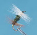
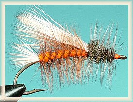
Damselflies: Delicate, slender and long bodied, the Damselfly is easily
recognized in “Smurff” blue. Fly anglers, however, are more interested
in the Damselfly when it is a nymph slowly swimming around and feasting
on other insects. Living in fairly shallow water, their migration to
stalks or pilings for their metamorphic escape into maturity provides
great opportunity for trout and angler alike.
(Photograph)
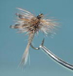
Dragonflies: Are you too young to have seen the movie Predator? If
you missed it, see it as soon as possible, and you will understand the
nature of a Dragonfly, the predator of the underwater, insect world.
They make their way into the stomachs of trout and bass only in the
nymph stage. One advantage for the angler is that the nymph stage often
spans two or three years, hence size does NOT matter in this
circumstance, as size is relative to age. Dragonfly nymphs are “Go-To”
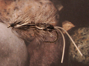
patterns, and the most common imitation is the Woolly Bugger.
(Photograph)
Drainage Lake: This is a natural lake characterized by an inlet and an outlet.
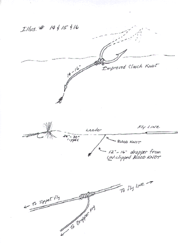
Dropper Fly: Using a second or third fly is referred to as a
dropper. Quiet often a smaller dropper nymph is tied directly to the
hook bend of the point fly. Some anglers reverse the size order and
place a larger fly as the dropper so that it looks like it is pursuing
a smaller fly just ahead of it.
(illustration)
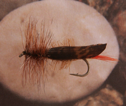
Dun: From larva to pupae to the dun stages, the dun is ready to mate and perpetuate the cycle of life.
(Photograph)
F
Fly Line Sink Rates:
Fly Patterns:
Searching Patterns: In the absence of rising fish,
or fish located cruising though the area, a searching pattern is the
“Go-To” choice. Determine the most prolific food sources for a
particular body of water. Of these, which food sources are most
abundant throughout the season? The experts recommend beginning with
the ubiquitous Chironomid midge, followed by scuds and dragonfly nymphs
and damsel nymphs. Finally, a leech pattern is a good “Go-To” searching
pattern anytime of the year. Be sure to cast in all directions around
your anchored boat.
(Photograph)
G
Gold Ribbed Hare’s Ear: This is a must have nymph pattern for high and
low elevation lakes. For high elevation lakes this patter and a Zug Bug
are sometimes all that you need.
H
Hatch: Being in the hatch on the hatch or near the hatch is like being
in the front row of an opera or behind home plate. It is close to the
action when large numbers of insects emerge and trout begin gorging
themselves. When the hatch dies, look for the same hatch at another
location of the lake, such as an area enveloped in mountain shade.
These areas are more gradual to warm during cool spring mornings.
Morris and Chan remind us that “good” hatches are not always so
noticeable and can be missed. Watch for surface feeding and birds
darting around catching their meal.
Heavy Water: When water reaches 39 degrees it becomes heavy and
settles towards the bottom whereas the surface water hovers at 32
degrees to form ice. Trout seek out these warmer water conditions
during the winter.
Hexagenia Mayfly: The Godzilla of mayflies, these giants of
stillwater are revered and prayed upon by trout and anglers in the
know. Short hatching periods near dark, keep initiated anglers
chuckling to themselves or making packs with their partners on vows of
secrecy. Recognized by brilliant yellow coloration, Hex duns are
imitated on hooks in size 8 to 4 on long shank hooks!
Hinge Effect: On fast sinking lines and sink tips, the uneven decent
of the line creates a hinge effect which adversely effects line
control. The uniform sinking intermediate lines do not have this
problem.
I
Ice-Out: Trout are hungry after ice-out, although due to the cold water
temperatures they are sluggish. Target inlets where trout will stage
for their spring spawning runs.
Interception: If a trout is feeding on the surface, make an effort
to anticipate the movement of the trout and place a dropped fly in its
path.
K
Kickboat: Replacing the dangerous Belly Boats of yesteryear, kickboats
utilize two pontoons with a rowing frame. They are safe, easy to
transport and still keep the angler low on the water. With swim fins
and oars, kickboats can cover a large area.
L
Life Vest: I distained wearing a life vest all my life until at age 60
I got myself in trouble in a near drowning incident of my own
stupidity. I now wear a suspenders type inflatable, and I forget I have
it on it is so unobtrusive.
Larva: This is the worm stage of an underwater insect as it grows
and matures. Many larva construct tubes or shells made of fiber or mud.
They feed on vegetation and keep a low profile. Dragging themselves
across the bottom their movements are slow and usually undetected.
During lake turnover (see turnover) or during windy periods where the
waves pull and fold water at the surface, shallow living larva are
dislodged from the bottom and make an easy meal for hungry trout.
Chironomid larva often live in deeper water. During spring they migrate
towards the shore, and trout and trout anglers are on the look out.
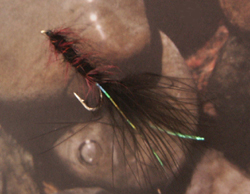
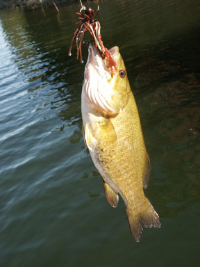
Leeches: I am not swayed by the fact that the great majority of
leeches are not of the blood-sucking variety. I remember as a young man
frantically flicking and swiping them off my muddy pants in sheer
panic. And yes, I recently watched the movie African Queen and I will
be no less panicked the next time they cling to my body, covered or
not. And yet I fondly recall catching a huge brown in the Hog Pond near
Anaconda, Montana in the early 80’s on a big, brown leech imitation.
Leech patterns are “Go-To” patterns in summer when hatches are on the
wane. Good imitations are Woolly Buggers, Beadhead Woolly, and the
Marabou Leech. Leech patterns are more ammunition for “Go-To” search
patterns, but keep your retrieve agonizingly slow!
Line Control: Always keep slack out of your finished cast and point
the rod tip down to the water. A straight line communicates a bite
whereas loose coils floating on the surface do not register a subtle
take. A lowered rod tip removes slack or sagging line. The same
principle is true with leaders. Use a piece of rubber or leather to
stretch the coils out of a leader prior to attaching a fly.
Littoral Zone: Shoreline
M
Match-the-Hatch: Observe and match the color of the abdomen.
N
Nymph: From egg to larva, the next stage is the nymph stage. (See Pupae.)
P
Pelagial Zone: Open water out in the middle of a lake
Profundal Zone: Down on the bottom of the Profundal Zone, beyond light
penetration, little or no oxygen is present to sustain fish.
Pupae: After the larva, or worm stage, the pupae mature in one or two
years. Sporting gills and slender bodies, they linger in this stage
long enough to become vulnerable to feeding trout. Bobbing and dipping
on the bottom, they gather trapped air and gas, which is their ticket
out of Mudville. Slowly they ascend to the surface where they shuck
their husks, dry their newly emerged wings and fly off to seek a mate
and once again insure the survival of their species. Some linger on the
surface too long and are leisurely sipped by cruising trout.
R
Retries:
Pauses: “All creatures great
and small” eventually poop out and pause to catch their breath. Trout
know this and dart in on the pauses of rising insects. More trout are
taken on the pause than the retrieve say the experts so keep pausing in
anticipation!
Hand-Twist Retrieve: The Hand-Twist retrieve is a forced slow
retrieve, a reminder that many of the patterns that imitate forage
creep along the bottom at a snail’s pace. Assuming that the angler is
right handed and controlling the line above the reel with the line
pinched at the top, the angler pinches the line between his thumb and
forefinger on his left hand a few inches below the right hand. Now,
simply roll the left hand across the line and cup the line in the palm
of your hand. Pinch the line above and keep rolling the line up in your
palm. Add frequent pauses in your retrieve.
Short Strip
Retrieve: The next short retrieve simply strips in line four to six
inches at a time punctuated by frequent pauses. A good ratio is
strip-strip-strip-pause in a fairly rapid manner.
Fast, Streamer Retrieve: Pulling line downwards and behind you in
two foot increments is best suited for streamer fishing. Croft
recommends tucking the rod under your armpit and stripping in line with
two hands like salt-water fly anglers.
No Retrieve: Gary LaFontaine, in his book, Fly Fishing the Mountain
Lakes, states that “a slow retrieve outfished a quick retrieve 4 to 1
and no retrieve outfished a slow retrieve four to one….I’m a specialist
at not moving a fly—nymph, dry, wet, or streamer—on lakes.” (p.15)
S
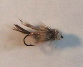
Scuds: Frequently referred to as freshwater shrimp, scuds are
crustaceans and an important food source for stillwater trout. Ranging
in colors from tan to green and from a quarter of an inch to almost an
inch, these creatures crawl or erratically swim in woody or weeded
areas year-around, particularly in more alkaline spring waters.
Seepage Lake: One defining aspect of a seepage lake is that it does
not have tributaries, feeder creeks or an outlet. Springs and seepage
from mountainsides or ground water maintain fertile waters conducive to
fish growth. Thermal heating with no escape to cooler waters will
periodically kill trout in a seepage lake.
Sight Fishing: Spotting a cruising fish and making a perfect cast is
the ultimate challenge of stillwater fly fishing. It is made somewhat
easier with polarized sun glasses and a low profile, which is why Belly
Boats and Kickboats are popular.
Silence and Stealth: What is true for the bass fisherman is true for
the stillwater fisherman. The rattling thrust and churning of props,
along with dropping objects onto the bottom of the boat, send shock
waves of sound far beyond a caster’s range. Voices, however, do not
penetrate the deep and are carried by the wind across the water
unbeknownst to the trout below. Once fish are alarmed and take fright,
you are wasting your time fishing in a vacated, dead zone. Move into a
targeted zone in silence and stealth. Tidy up your boat so that Thermos
bottles and coffee cups don’t jolt trout with shocking reverberations
like an annoying alarm clock
Spinner: From larva to pupae to the dun stages, the dun is ready to
mate and perpetuate the cycle. After mating the insects are spent and
fall to the water dying as spinners. Some species fly to cover,
however, and do not provide a “spinner fall” feast for hungry trout.
Strike Indicator: Similar to a bobber, the strike indicator is
usually placed so that the fly is suspended a foot or more from the
bottom. So many strike indicators line the shelves in fly shops that I
can’t keep track of them all. I have tried most. The Corkies work
great, but I am always short of tooth picks. The fold-over foam pads
really gum up a leader when you remove them. Remember, an unweighted
fly takes for ever to get to the bottom so add a tiny piece of weight.
(See Weighted Flies.) Fishing with strike indicators is a waiting game,
so be patient as this is a very effective method of fishing. Multiple
flies help determine what the fish are keying into.
Stripping Basket (Aprons): Casting 50 to 80 feet of line can be
challenging enough, but when you go to shot the line at the end of a
double-haul and it snags on your feet or on a boat cleat, it becomes
frustrating. Stripping baskets and aprons contain the line both on the
retrieve and the cast.
T
Thermocline: The thermocline is a narrow zone of water lower in oxygen
than the surface. It tends to hover just above the Chemocline as the
surface waters heat up during the summer months. Trout will often seek
refuge near the thermocline.
Trolling: Nothing new here! Fly anglers were trolling with flies
long before outboard motors. Armed with a streamer pattern or wet fly,
trolling is still an effective technique to reconnoiter unfamiliar
waters. Use full-sinking lines, and use oar power to allow the line to
sink to the bottom in ten to twenty feet of water. One difficulty,
however, is placing your rod in easy reach. Missed opportunities are
common. Row into the wind to slow the trolling speed down.
Turn-over: During the spring and again in the fall, the water at the
bottom of the lake moves upwards, which is caused from the wind’s waves
folding water over and over. This in turn tends to generate a current
which draws water from the bottom towards the surface. This mixing of
waters is beneficial in that it folds in oxygen and it pulls sediment
from the bottom up to the surface which aids insects. The Thermocline,
the division of surface water and warmer, heavier water on the bottom,
blends. Fish move to shallower water. During the fall the turn-over
reverses itself.
W
Water Boatman (Corixia): Although not highly recommended by the experts
as a “Go-To” pattern, Water Boatmen are actually flying beetles that
spend time in and out of the water. They are easily observed in shallow
water under the surface. During pauses it drifts upwards to the surface
a bit before it continues swimming.
Wind: Yes, the wind is the nemesis of the fly angler, but it also
provides rippled water cover for trout to slide into the shallows and
feed on drowned insects. If you can manage your boat in a strong wind,
the waves against the shoreline stir up mud and creatures for trout to
feed upon. Be careful what you pray for because CALM waters can really
slow the fishing down.
Wind Slicks: These isolated islands of mirror like water in rippled
waters, make for good feeding windows for trout hiding along the
rippled edges waiting for a visible morsel.
Weighted Flies: A weighted fly is wrapped with lead wire or a metal
bead or even a heavy, stout hook. Unweighted flies can be settled to
the bottom with a small split-shot, lead wire or a pinch of lead putty
on one of the blood knots on the leader.
Wind Drifting: I agree with Denny Rickards’ position that Wind Drifting is ineffective and a waste of time.
Bibliography
Most of the material in this article is from the following books. I
have placed them not in alphabetical order, but in my personal order of
preference. I have looked for consensus and shared common information.
Whenever I use information specific to one author, I have cited the
author’s name rather than using end notes.
1. Fly-Fishing Stillwaters for Trophy Trout by Denny Rickards (ISBN: 0-9656458-0-0) A Stillwater Productions Publication, PO Box 470, Fort Klamath, OR 97626
Rickards’ book is 181 glossy pages of beautiful photographs and
illustrations and a clear treatise on stillwater fly fishing for trophy
trout. He is both methodical and thorough. Sharing years of original
research, Rickards holds nothing back. He wants every reader who
applies his principles to achieve success. It is a beautiful and
absorbing book.
2. The Fish Bum’s Guide to Catching Larger Trout, an illustrated manual on stillwater tactics for the intermediate fly angler, written and illustrated by Mike Croft
(ISBN: 1-57188-142-5) Frank Amato Publications. In the spirit and
tradition of The Curtis Creek Fly Fishing Manifesto, I couldn’t resist
buying this book. After reading a half dozen books on stillwater fly
fishing, I knew I had to place this book as my second choice. It is
packed with information and quite possibly just as comprehensive as the
rest. For a young angler new to stillwater fly fishing, I would
recommend this book as a primer. It is excellent to review and peruse
because it is illustrated, and the verbiage has been whittled down.
3. Fly Patterns for Stillwaters, a Study of Trout, Entomology and Tying,
by Phillip Rowley (ISBN: 1-57188-195-6) Frank Amato Publications.
Rowley is an expert in the field of fly fishing, and he has written
many books and feature articles. I bought this book for the tying
directions, but what I found was that the book covers almost all the
important aspects of stillwater fly fishing from presentation and
retrieves to seasons, and the interesting life cycle of all the insects
he imitates.
4. Morris & Chan on Fly Fishing Trout Lakes, by Skip Morris and Brian Chan
(ISBN: 1-57188-181-6) Frank Amato Publications. Morris and Chan have
produced an exceptionally written, photographed and illustrated book
for the beginning or intermediate stillwater fly angler. It is
certainly a tie for my second choice. It ended up in the number four
spot only because I felt I had to place Rowley’s fly pattern book up
close to the top.
5. Strategies for Stillwater, by Dave Hughes (0-8117-1916-2)
Stackpole Books. I read every word in Hughes’ book and can recommend it
as a definitive book on stillwater fly fishing. I do not enjoy reading
instructional books on any subject when they are bereft of bold
headings, boxed information, lots of photographs and illustrations and
a format that aids in reviewing the information. Nonetheless,
Strategies for Stillwater is as comprehensive as Denny Rickards’ book,
and I learned a great deal from reading it.
6. ‘The Gilly’ A flyfisher’s Guide by Contributors
(ISBN:0-88925-638-1) Published by Alf Davy. An excellent resource,
especially for those anglers heading to British Columbia, it too is
organized and presented as mostly text.
7. Fly Fishing the Mountain Lakes by Gary LaFontaine (ISBN: 0-9626663-7-8)
Greycliff Publishing Company. This book is a great read both for
information on fishing high elevation lakes as well as a chronicle of
LaFontaine’s fishing adventures. I loved it, but I also became somewhat
depressed with how much equipment the experts rely on in fishing as an
expert!
For updates on fishing tips, visit Dave's companion site, Fishing Tips 101.


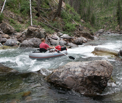
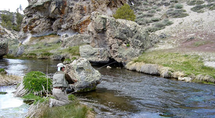
 Regardless if you fish a creek with a fly, a spinner or bait, the principles are basically the same, and the rewards are wonderfully experienced with a wild trout on the end of your line. This summer and fall I will be writing an entry on fishing creeks with lures and bait. Regardless of what tackle you use, small cricks and creeks require stealth and a low profile. Lure fishermen should cast downstream in shallow water conditions, but if there is good pocket water, follow the tips in this entry. Bait fishermen should go to smaller hooks, smaller tippet size and smaller bait portions.
 The
size of a trout is relative to the conditions of its environment. High
elevation canyon creeks do not produce large trout, but they do provide
a respite from the summer heat and an intimacy with the water and flora
of a mountain stream. Best of all, most creeks produce an abundance of
small, hungry trout. And when you catch a 10 to 12-incher, it is akin
to catching a 16-incher on a river. If you are new to fly fishing,
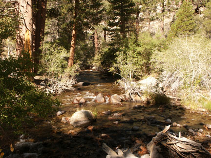
follow these short guidelines to Master the Basics of Creek Fishing.
The
size of a trout is relative to the conditions of its environment. High
elevation canyon creeks do not produce large trout, but they do provide
a respite from the summer heat and an intimacy with the water and flora
of a mountain stream. Best of all, most creeks produce an abundance of
small, hungry trout. And when you catch a 10 to 12-incher, it is akin
to catching a 16-incher on a river. If you are new to fly fishing,
follow these short guidelines to Master the Basics of Creek Fishing. Casting:
A short cast is all you need. How short? Try right in front of you with
no line on the water. The key to creek fishing is to keep your fly out
of tree top branches and brush. You do not need finesse casting skills
on a creek. Get your feet wet and position yourself in the middle of
the creek. Fish directly upstream on both sides. Make short casts and
control your line. After you make a short cast to a small riffle or
pocket, keep your fly line off the water! Keep your rod tip up and
allow the fly to drift naturally. Do not pull or move the fly once it
is on the water. In a tumbling creek, it is imperative to keep line off
the water. Once the line is on the water, you will have immediate line
drag, and your fly will be drowned. Instead of making a long cast over
tumbling water, move up closer to your target. Trout face upstream. If
you are directly behind them, you can catch them three feet away,
providing your shadow is not on the water or they do not see the flash
of your rod.
Casting:
A short cast is all you need. How short? Try right in front of you with
no line on the water. The key to creek fishing is to keep your fly out
of tree top branches and brush. You do not need finesse casting skills
on a creek. Get your feet wet and position yourself in the middle of
the creek. Fish directly upstream on both sides. Make short casts and
control your line. After you make a short cast to a small riffle or
pocket, keep your fly line off the water! Keep your rod tip up and
allow the fly to drift naturally. Do not pull or move the fly once it
is on the water. In a tumbling creek, it is imperative to keep line off
the water. Once the line is on the water, you will have immediate line
drag, and your fly will be drowned. Instead of making a long cast over
tumbling water, move up closer to your target. Trout face upstream. If
you are directly behind them, you can catch them three feet away,
providing your shadow is not on the water or they do not see the flash
of your rod. Line Control:
If you are right handed, slip the fly line under your pointing finger
of your right hand. Place your left hand under your right and pull down
any excess line, as the fly floats back to you. You should also be
raising your fly rod, as the fly drifts back to you.
Line Control:
If you are right handed, slip the fly line under your pointing finger
of your right hand. Place your left hand under your right and pull down
any excess line, as the fly floats back to you. You should also be
raising your fly rod, as the fly drifts back to you. Setting the Hook:
Creek trout slam an offering without hesitation. After all, winter is
long and cold in these canyons, and if they are going to grow up, they
have to eat everything that comes their way! These little buggers are
fast. You may miss a lot of strikes before you see their approach under
water. After the splash, it is usually too late to react. I suggest
wearing Polarized sun glasses, which cut through the surface glare.
Anticipate the strike when you see movement under the fly and lift the
rod tip up quickly as the trout breaks the surface. At the same time,
begin the habit of pulling the line in a downward motion with your left
hand. (Remember, the line has already been transferred under the index
finger of your right hand.) Don't feel embarrassed if you throw a
little cutthroat over your shoulder. We have all done this.
Setting the Hook:
Creek trout slam an offering without hesitation. After all, winter is
long and cold in these canyons, and if they are going to grow up, they
have to eat everything that comes their way! These little buggers are
fast. You may miss a lot of strikes before you see their approach under
water. After the splash, it is usually too late to react. I suggest
wearing Polarized sun glasses, which cut through the surface glare.
Anticipate the strike when you see movement under the fly and lift the
rod tip up quickly as the trout breaks the surface. At the same time,
begin the habit of pulling the line in a downward motion with your left
hand. (Remember, the line has already been transferred under the index
finger of your right hand.) Don't feel embarrassed if you throw a
little cutthroat over your shoulder. We have all done this. Reading the Water:
The benefit of learning to fly fish on a creek is that the angler gets
a crash course on trout hiding places. The advantage is that a creek is
a much smaller classroom. Trout need protection from predators, and
they need a resting spot where they can spot food drifting their way.
Reading the Water:
The benefit of learning to fly fish on a creek is that the angler gets
a crash course on trout hiding places. The advantage is that a creek is
a much smaller classroom. Trout need protection from predators, and
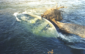
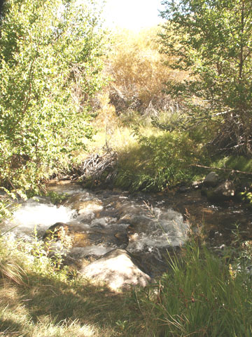
they need a resting spot where they can spot food drifting their way. Waterfalls and Pools:
Carefully cast your fly to a pool, as it will hold larger fish. Keep
your fly out of the turbulent water and foam. Start presenting your fly
on the tail-out of the pool, so that you are not disturbing trout
further up in the pool. Next cast your fly along the edges of the pool
on both sides before you cast to the middle. Look for dark pockets in
the pool to cast your fly.
Waterfalls and Pools:
Carefully cast your fly to a pool, as it will hold larger fish. Keep
your fly out of the turbulent water and foam. Start presenting your fly
on the tail-out of the pool, so that you are not disturbing trout
further up in the pool. Next cast your fly along the edges of the pool
on both sides before you cast to the middle. Look for dark pockets in
the pool to cast your fly. Pockets:
Look for small pockets of water behind boulders in fast water. Drop
your fly dead-center in the pocket or along the fast seams. The trick
to fishing pocket water is to keep the fly moving very slowly.
Pockets:
Look for small pockets of water behind boulders in fast water. Drop
your fly dead-center in the pocket or along the fast seams. The trick
to fishing pocket water is to keep the fly moving very slowly.