April 2008 Archives

Fly Fishing Tips and Techniques

| No Comments | No TrackBacks

Mastering the Basics of Fly Fishing: Pretest

flyshop.jpg.jpg

Mastering the Basics of Fly Fishing was originally an outline that I followed when I taught classes on fly fishing. Working for an outfitter and fly shop owner in Hamilton, Montana, I taught a number of parent/child introductory classes. Later when I set up my Montana Fly Fishing site in the early 90's, I expanded this article for adults who wanted to learn on their own, as well as parents wanting to teach their children the skills of fly fishing. It continues to be one of the most visited sections on my Montana site. The instructional program is broken down into the sub-categories below.  The entire article is stored on my companion web site, www.fishingtips101.com.

Step 1: Pre and Post Test
Step 2: Terminal equipment and Paraphernalia
Step 3: Necessary Knots and Leaders
Step 4: Casting
Step 5: Basic Fly Patterns and Presentation
Step 6: Mastering the Basics of Creek Fishing
Step 7: Mastering the Basics of Stillwater Fly Fishing

boy.gif

Introduction and Pre / Post Test

Fishing with Lures

| No Comments | No TrackBacks

Spoons, Spinners and Jigs

What's in this article?
Flatfish.jpg
* A review of the top trout producing lures
* Fishing Tips from Sierra Tackle Shop Managers
* Tips and Techniques for Using Lures in Streams
* Using a Fly Rod Un-conventionally (Like the Old Timers)
* A Killer Technique (NO BULL!)

Rapala.jpg

Through the years I have not kept up with the continuous introduction of new spoons and spinners. I follow the minimalist approach to fly fishing and lure fishing. It has saved me lots of money, allowed me to organize my tackle boxes more intuitively and, most importantly, it has kept me from befuddlement trying to remember when, where and how to effectively fish all the lures that I have crammed into a tackle box. I wasn't surprised to see that my old standbys from the fifties and sixties still reigned supreme in John Merwin's Field and Stream article, "50 Greatest Lures of All Time," published April 2006. When I checked to see if my All-Time Favorite Lure for Mammoth Lakes circa 1959 was even mentioned, I was delighted to find the red and white Daredevle Spinnie ranked in the number two position, just below the Curley Tail Grub. My next favorite lures, Mepps Aglia, Panther Martin, Kastmaster and Little Cleo, were all ranked high. Along with a Super Duper lure, these were the lures that I used exclusively in my youth when I wasn't using a fly rod to dab a red worm in a small crick. Note:  Visit my companion web site, Fishing tips 101.

Rooster Tail.jpg

Field and Stream published a follow-up article a year later with "50 Best Lures." For the trout recommendations, they listed (in order of preference) a baker's dozen: 1. Wiggle King Flatfish; 2. Rooster Tail; 3. Panther Martin; 4. Mepps Aglia; 5. Norman Deep Tiny "N" crankbait; 6. CountDown Rapala; 7. Yo-Zuri Snap Bean crankbait; 8. Al's Goldfish; 9. Needlefish spoon; 10. Phoebe spoon; 11. Float and Fly trailer; 12. Marabou Micro-Jig; 13. Mister Twister Jig. Everyone has their confidence lures and their secret, unorthodox perversions of angling tradition that they often don't even share with a brother or best friend. I will share my, honest-to-Goodness, fish catching abomination later in the article.

mepps_aglia_marabou.jpg

Recently I surveyed two tackle shop managers in the eastern Sierras for their recommendations. Both shops have long standing reputations for offering good tackle selection, friendly service and outstanding tips and information. Jeremy Ross of Ernie's Tackle and Ski Shop in June Lake and Jim Reid of Ken's Sporting Goods in Bridgeport echoed some of the recommendations of Field and Stream, as well as suggesting tried-and-proven trout catching techniques for the Sierras. In the survey that I submitted to them, I asked them to rank spoons and lures with four rankings. Number 1 was a top choice. I asked them not to differentiate between which lure was the top lure in their number one choices. Keep in mind that I also included bait in this survey. Both men listed CountDown Rapala and Thomas Buoyants as a number one choice. Both managers recommended inflated nightcrawlers and PowerBait as a number 1 pick. Salmon eggs came in 2 and 3, as did Kastmaster lures, Little Cleo lures, Daredevle lures and float-and-fly combinations. Both Jeremy and Jim ranked the Mepps Aglia and the Rooster Tail as a number four choice.

phoebe.gif

For bait Jeremy Ross recommended PowerBait or Gulp or Rainbow. He also recommended original Rapala lures in silver and rated them as a #2 choice. Other lures that he recommends to his customers are Trout Teasers, Tasmanian Devils and Panther Martins, which I forgot to include on the survey. He noted that June Lake has excellent shore access, and he noted that fly fishers in float tubes and kick-boats do well early in the morning and the evening with Woolly Buggers and Matuka streamers. Jim Reid of Bridgeport recommends trolling from Rainbow Point to the dam with flashers and crawlers, Rapala, or Thomas Buoyants both early and late in the season on Bridgeport Reservoir. He also recommended Worden's Flatfish as a #3 choice. When fishing from the shore or a stationary boat, he recommends CountDown Rapala, Buoyants, and Kastmasters near the dam. He said that the best side of the reservoir for shore anglers was northeast from the dam to about a ¼ mile south.

Tips and Techniques

An old adage among lure fisherman is that lures are designed and packaged to attract buyers. Don't believe it for a minute. Most lure companies spend a great deal of money on scientific research. If you fished and fished a lure and never caught a fish and than lost it on a snag, are you going to rush out and replace it? The movement of the spoon or spinner has to be realistic; it has to reflect light, and the color of the lure needs to match a particular color of water, such as brown, green or blue. One simple rule to remember is that if you are fishing at dusk or very low light, fish will see a dark silhouette against a lighter skyline better than if you use a light colored lure. If you are fishing in bright light go white. If you are fishing in the dark go black. Mepps recommends using "silver on bright days; polished brass (gold) blades produce best when it is overcast. Try copper in streams after a heavy rain, or in dark, stained water." Into this equation must be factored the depth and the color of the water and how much current exits. The following lures are recommendations for stream fishing patterns and lake patterns, but first let me review some general information.
As I have outlined in my article on fly fishing creeks and again in using baits on creeks, let me reiterate a key factor on catching trout in moving water. Get in the water and wade upstream!

Reasons to Get Your Feet Wet and Fish Upstream

1. Fish face upstream. If you are behind them, you can catch them directly in front of you.
2. If you can see to the bottom of the creek, they can see you! Approaching a creek or stream from the bank often spooks fish.
3. It is much easier to cast to a pocket, pool or small riffle from the center of a stream and maintain a slow retrieve. Best of all you are in an ideal position to cast effectively towards either bank.
4. Wade fishing in a stream also allows you to cast directly upstream which creates minimal arm, rod and line movement that might otherwise spook a fish. Trout have great peripheral vision. Often they lie in broken water out of sight, but if they don't see the angler blended into the bank cover, they often see a flash of line or arm or rod movement, which warns them that a predator is near. Even while you are wading in the current, it is paramount to keep your shadow off the water in front of you. I often crouch in the water behind a boulder to make a short cast to a pool above me.
5. In many instances, where there is heavy brush or trees, it is difficult to reach choice water from the bank. If you are wading upstream, you have an easier shot at often over-looked water that bank anglers pass up because they can not penetrate the tangled bank barrier.
6. Finally, once you are in the water, keep moving! Bank anglers typically spend too much time sitting on a comfortable rock or log. Fishing is a game of percentages. How many perfect casts to good holding water can you achieve in an outing? If you have made two or three casts to a pool without eliciting a strike, move on to the next spot.
7. I am always amazed at how I can walk up a stream under the cover of moving water without spooking fish, but when I walk along a meadow bank I spook fish way ahead of me just from the vibration of my footsteps, which is another reason to be out in the current. An exception to casting and wading upstream is if you locate a shallow pool that is difficult to approach upstream. Remember that trout face upstream in current so they are often spooked by a lure working from the downstream position right past them. However, in slower water the trout will cruise in all directions so the approach is not critical. Another exception to wading upstream and casting upstream is when you are on a river or large stream. In this situation you can make an effective downstream cast by quartering the stream.
Cast downstream in a quartering angle. In other words, stand facing the opposite bank. Draw an imaginary line from your feet to the opposing bank. You now have half the stream above you and half the stream below you. As you face the bank, the stream flow is coming from your left down stream past your right side. Now, divide the stream below you in half. This quarter demarcation is your target angle for the opposing bank. Cast as close to the bank as possible. If a trout is on the far bank, he will see the lure coming at him broadside and "swimming" out and away from the bank, as the current sweeps the lure out towards the faster water. Sometimes if you plant it right in front of the trout, your cast will trigger a reaction take. Often times they will follow the streamer as it drifts downstream and begins to sweep out into the deeper water. They will hit the lure just as it swings out from the bank and slows down.
8. If you walk up to a pool, target the tail-out first. Trout will often drift back to the tail-out and hide under broken water or behind small rocks waiting for food to be pushed up from the bottom of the pool into a zone of compressed water. Approach the tail-out quietly and with a low profile. Make your cast land softly. The next target is the center of the pool. Allow your lure to flutter down to the bottom of the pool, and don't be surprised if you get a take on the decent. Just as bass anglers use a spinnerbait sometimes in a jigging motion off the bottom, good spinner anglers will jig up the spinner from the bottom once or twice before retrieving the lure back towards them. The next pool target is to place the lure or spinner above the riffle or small waterfall that feeds the pool. Trout will often lie in wait for bugs and insects to drop from the plunging waters into the pool.
9. ALWAYS target bank cover, rocks, submerged logs, foam lines and broken water where you can not see the bottom. (Guess who is hiding down there waiting for dinner?)
10. If you snag your lure on an underwater object, reach down and retrieve it. After all, you are already wading. Snagging a lure is another reason to use a single hook when fishing a creek or a stream. Often you can retrieve the lure by simply pushing the eyelet of the rod tip right down on the lure and shaking it.

Recommendations for Lure Fishing in Streams or Rivers

For best results when fishing a stream, both for hook-ups and less snagging, use a single hook on a spoon or spinner, and bend down the barb for easy release. The Thomas Buoyant lures work well in small streams, unlike the heavier Kastmasters that sink too rapidly. Use a Thomas Buoyant in a red/gold combination or a blue/silver combination in a 1/6 oz. or a ¼ oz. You want a slower retrieve with an occasional twitch. I would also recommend the Mepps Aglia #2 or a Mepps Black Fury #2. Field and Stream recommend Al's Goldfish for heavy, fast water or a Phoebe spoon for slower retrieves on a shallow stream. Generally stick with 1/16 ounce lure for small creeks and 1/8 and ¼ ounce for larger streams and lakes.

Recommendations for Lure Fishing on Lakes


If you plan on fishing a lake from the shore, you have a primary decision to make. The heavier pound test lines do not cast a lure as far as a smaller, lighter line. A four-pound test line is generally all that you need for fishing most alpine lakes and creeks. Changing your reel spool to a two-pound test line will significantly increase your casting distance, but it also comes with the potential for "the big one that got away story." Be sure to buy high quality lighter lines. Be sure that your rod is rated for 2 to 6 lb. lines. Never use a snap swivel on your lures unless you are trolling. The snap swivel frequently alters the designed motion of the lure. If you are in a boat or the lake is sufficiently small enough to hike around it, always target the major inlet first thing in the morning. Other target areas are other creek inlets, points, drop-off ledges, weed beds and banks with good over-hanging cover. Use larger lures, especially more heavily weighted lures like the Kastmaster, and concentrate on your retrieval pattern. Generally, a steady retrieve punctuated by a pause and a twitch is the most effective retrieve to start. Vary your retrieves and your count down, but really give a pattern a chance before you switch. If you see fish working the surface, switch to a bubble-and-fly technique

Recommendations for Fishing Jigs on Small Streams and Rivers
Or How I Became an Un-Conventional Fly Fisher
Or Back to the Future of Fly Fishing.

I am like Rip Van Winkle. I have been asleep for far too many years regarding new fishing techniques and the resurrection of old methods. After retiring as a teacher in Montana, I headed to the Modesto area of California to finish out my last few years as an educator. I went with the clear goal of buying recreational toys and boats before I actually retired. When I realized that my trout fishing opportunities required extensive driving, I took up bass fishing. Living in Ripon, I was just a few blocks from the Stanislaus River. I soon discovered what great fun it was catching smallmouth bass while floating in a kick-boat. I used my fly rod and small Gitzits or tube worms. When I got back to Montana for a visit, I excitedly told a local fly shop owner my great discovery. He went to the book shelf and pulled down two books that he recommended that I buy. OK, so I didn't re-discover or invent anything! My success with lead-head jigs, curly tail grubs and tube worms on both trout and bass and delivered with a fly rod has been an outstanding journey. Hey, sometimes the casts are not very pretty when I am slinging heavy tube baits on the end of my fly rod, but the results have been greatly rewarding.

Don't hesitate in using curly tail grubs, white mini-jigs, marabou jigs or tiny Rooster Tail lures on creeks and streams regardless if they are delivered with a fly rod or a spinning rod. Small marabou jigs in white and red are my first choice. All of the above can be purchased. I have come to the close of this article, and it is time to reveal my honest-to-goodness trout catching abomination. A few years back I landed a 7-pound rainbow in Klamath Lake using a fly rod and a 1-inch crankbait. My soft-plastic confidence bait for bass is a tube bait. (I prefer the original Gitzits.) I was heading back to Montana, and I began wondering how they would work on a Brown trout that had never seen a crawdad. It was early summer and I was fishing a canyon fork of one of western Montana's famous rivers. The salmon fly hatch was over, but a few golden stoneflies were still whirling up the canyon. Because the water was too deep and fast to wade, I crawled down the embankment to a tail-out of a large pool. I cast upstream without success. My stimulator drifted below me as I surveyed how I was going to approach the main pool. Just as I was about to lift my fly, I saw a dark shadow rise and then silently retreat when he saw my presence. It was a really big fish. I had been made so I retreated to the shore and had lunch and began wondering what I should present this fish sub-surface.

Munching on my sandwich, I remember that I had packed a number of tube worms in my vest. I had been optimistic when I packed them. They were two to three inches long! Nonetheless, I changed to a stout leader and put on a speckled, brown tube worm and marveled at the long tentacles that so effectively work on bass. Would it work here I thought? I crouched back to the water's edge and made a perfect drift through the dark crevice three times without success. Just downstream was another dark crevice about four to five feet deep. I lobbed out the lead-head jig hook with the Gitzit and saw a flash of silver boil up from the dark. If he had headed downstream through the fast riffle, I would never have landed him. Instead this big Bull trout buck pushed up into the pool. When I landed him, he measured 25 inches.

I fished the Gitzit in varying sizes and colors ranging from tan to brown to green. On Rock Creek I landed many Brown trout ranging in size from 12 to 17 inches; on the Bitterroot River I landed only a few rainbows, but on Idaho's Lochsa River, I had outstanding fishing catching many 16 to 18-inch cutthroats. The only difficulty that I encountered was that the smaller fish in the seven to ten inch range would bite the tail, and I could not catch them. Sure I could have added a stinger hook, but I was having too much fun catching larger fish. I swore I wouldn't reveal this secret, but according to my Google analytics, readers seldom read more than a page and a half of any article on my web site. If you have got this far, give a Gitzit a try. This summer I plan on packing Berkley PowerBait dough in the tube and try some different colors on the rainbows in the Bitterroot River.

For more fishing tips and techniques, visit my companion site, fishingtips101.com.


Bait Fishing

| No Comments | No TrackBacks

Mastering the Basics of Bait Fishing

What's in this article?

*Stream Strategy and Productive Spots to Fish
*How Much Gear Should You Lug Up that Canyon Creek?
*Rigging for Worms, Salmon Eggs and Power Bait in Both Streams and Lakes
*Fishing with Live, Natural Bait
*Fishing with Live Grasshoppers the HemingWAY (Read Hemingway's "Big Two- Hearted River," or read my synopsis.)

creek.JPG

It is with some hesitation that I review the basics steps for bait fishing. I have been a catch-and-release adherent since the 1970's. But I must remind myself that much of Sierra trout fishing is "put-and-take" harvest fishing. So much pressure is put on the resources that generous weekly stockings in creeks or small streams are frequently harvested in three or four days. Perhaps you have brought your family from southern California on a camping trip to the eastern Sierras. How can I hold judgment on your desire to share a trout dinner with your family, as my generation did back in the 50's and 60's? Please kill only what you will eat fresh, and never take them home in a cooler to reside in a freezer until they get freezer burn or lose their flavor. When you are ready to fish for fun, go to a lake and fish with a fly and bubble. You will have more action, and best of all you can easily release the fish unharmed. Keep in mind that if you catch a trout on bait and they swallow it, there is a high probability that they will not survive. Once they bleed around the gills, they eventually bleed to death. Fishing with lures and flies with pinched barbs allows the lure to be easily removed from their mouth or jaw. Forgive me for this lecture. Old principles die hard after fishing for wild fish for over forty years. If you are new to fishing, just enjoy the sport along with a camp dinner of trout and fried potatoes. However, when you move to a stream with wild trout, plan a camp dinner of hot dogs held over a campfire with a freshly cut willow stick, and don't forget the marshmallows!

fishrelease.JPG

Stream Strategy and Productive Spots to Fish

I would suggest that you read my article on fly fishing on creeks. I am not trying to convert you to fly fishing so much as to provide a review of the holding water that trout seek out for both feeding and sanctuary. Keep in mind that a fly rod is an excellent rod for bait fishing on creeks and small streams. Unless the creek is a "crick" and so small that you only have to sneak or crawl through the willows and brush to "poke and dab" at a likely spot, get right in the water and walk upstream like fly anglers do. I can not recall seeing a bait angler in the middle of a stream using the same approach as a fly fisher. Why would a bait angler limit his opportunities? Regardless of what bait you are using, get out in the middle of the stream so that you will catch more fish, catch bigger fish, cover more water and make more progress!

CK-Lineoffwatre.jpg

Reasons to Get Your Feet Wet and Fish Upstream

1. Fish face upstream. If you are behind them, you can catch them directly in front of you.
2. If you can see to the bottom of the creek, they can see you! Approaching a creek or stream from the bank often spooks fish.
3. It is much easier to cast to a pocket, pool or small riffle from the center of a stream and maintain a natural drift with your bait. Best of all you are in an ideal position to cast effectively towards either bank.
4. Wade fishing in a stream also allows you to cast directly upstream which creates minimal arm, rod and line movement that might otherwise spook a fish. (Trout have great peripheral vision. Often they lie in broken water out of site, but if they don't see the angler blended into the bank cover, they often see a flash of line or arm or rod movement, which warns them that a predator is near. Even while you are wading in the current, it is paramount to keep your shadow off the water in front of you. I often crouch in the water behind a boulder to make a short cast to a pool above me.)

hide-low.JPG

5. In many instances where there is heavy brush or trees it is difficult to reach choice water from the bank. If you are wading upstream, you have an easier shot at often over-looked water that bank anglers pass up because they can not penetrate the tangled bank barrier.
6. Finally, once you are in the water, keep moving! Bank anglers typically spend too much time sitting on a comfortable rock or log. Fishing is a game of percentages. How many perfect casts to good holding water can you achieve in an outing? If you have made two or three casts to a pool without eliciting a strike, move on to the next spot.
7. I am always amazed at how I can walk up a stream under the cover of moving water without spooking fish, but when I walk along a meadow bank I spook fish way ahead of me just from the vibration of my footsteps, which is another reason to be out in the current.

Productive Spots to Fish

Most fishing books spend chapters discussing and diagramming trout lies and holding water. Let's look at it from a fish's perspective. They want cover to hide from predators. That could mean hiding below broken water, hiding directly below a foam line, holding behind or to the side of a boulder or just lazily resting in shallow water with a canopy of overhanging branches above them. Next, a trout wants to be in a spot where it can find a food source. This could be off to the side of a boulder where the force of water plunging past the boulder funnels insects past the boulder and down a bubbly seam of water. Big Moe will be just behind the boulder waiting just beneath the bubbling foam. But a smaller fish or two might be directly underneath the seam or foam line. A prime lie is a spot which provides both good protection and a steady source of food. The point here is that the trout will be facing upstream waiting for food to come to them. Casting above a trout and allowing your presentation to drift naturally to the waiting trout is the key to success. A final reminder is that if the fish are down on the bottom of the stream bed protected from the fast water, where should your bait be?

The next factor that a trout must consider when picking a home or prime lie is to find a spot that it doesn't have to expend more energy than its calorie intake! I remember diving for abalone along the coast of northern California when I was in my twenties. We would drop an anchor from our inner tube and swim down fifteen to twenty feet through the kelp. The currents and rip tides were so fierce that I could see and feel myself propelled sideways so fast that I wasn't gaining much depth. My partners told me to grab a piece of kelp and pull myself down to the bottom! Meanwhile, over the top of me waves were crashing towards the beach. What a surprise awaited me when I reached the last five or six feet of water. It was relatively slow water compared to just a few feet above, and when I found a ledge or a large rock, it was like being in a swimming pool. Rainbows like fast, shallow riffles. They sink to the bottom and rest in a trough or behind a rock and await their dinner. Brown trout and cutthroats prefer slower water that offers cover and deeper water to escape to in an emergency situation.

Everyone knows to fish a pool, but don't over-look the head of the pool. Often a pool will have a small riffle or ledge that the water plunges down into the pool. Trout will lie in wait for food at the base of the ledge or drop-off. At the tail-out of the pool, water surges upwards from the deeper pool to meet a riffle or run. Trout will often drift back into this shallow water to pick off insects that are pulled down into the pool and then re-emerge in the shallow tail-out where the water is compressed and the food sources likewise. For a couple of years I guided Sam Lawrence, the founder of Budget Rental Cars. We primarily fished the Bitterroot River in Montana. A hatch was on mid-day, and a few simpers could be seen at the tail-out of a pool just below some over-hanging willows. Sam picked off a nice fished as we drifted by the tail-out. We pulled up downstream where Sam landed a nice rainbow, and then we hiked back to the tail-out. Usually, trout will move into the tail-outs under cover of darkness or cloudy weather or a rain storm. Sam walked up behind the tail-out and landed four big trout in less than a half hour. He picked off the first fish closest to the end of the tail-out and worked it downstream in the riffle water. Than he hiked up to the same spot and made a short, deft cast just a little further out towards the pool. He caught the next fish, and then he went on to catch two more really big trout. Sometimes you get lucky, and sometime trout break their own rules for survival!

The greatest reason for fishing a small stream as a beginner is that you gain much knowledge about where the fish are holding. Small streams and many creeks have the same holding water as larger rivers - riffles, pools and runs. My mother taught me the greatest fishing lesson that I have ever learned at age five. We lived in Bishop, California. Near our house was an irrigation ditch that during the summer held many smaller trout. We would see them on our daily walks. They would dart ahead of us in the waving grass and disappear. I begged her to take me fishing until one day she agreed. She cut a willow branch, tied one of my father's fly fishing leaders to the end of the willow branch. Her rigging was simple enough. She tied on a small safety pin to which she molded a piece of Velveeta cheese. She picked a nice shady spot along the ditch, tossed out the offering, and than we sat down for a picnic lunch. Eating my baloney sandwich, I looked down in the water at the Velveeta cheese resting close by. I was five years old, and I knew I was participating in a farce. We had already scared the fish away. I knew they would not come back and bite an offering directly beneath my gaze, and I knew we needed a real hook, and that we would have to be sneaky in our approach. It was a revelation. My mother was not the perfect woman. She was flawed. Worse, I didn't know if she was patronizing me or she was just plain ignorant. I only recently shared this experience with my 90-year old mother. She just laughed and said, "I didn't know anything about fishing, and I probably figured you didn't either."


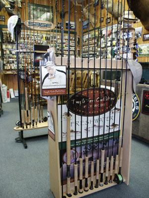
How Much Gear Should You Take Along?

A cheap or expensive fishing vest is essential. Toss in a small, hinged fly box with compartments for split-shot, hooks and swivels. Add a pair of needle-nose pliers and nippers to cut line, as well as a pocket knife. Add a spool of tippet material. Drop in some mosquito repellant into one pocket, along with a mosquito head net. Toss in a bottle of water and an apple into the back pocket. Finally, pick a pocket to store your bait. When I was a youngster, you could buy a curved, tin worm can with air holes in the top. It had rings to thread your belt through. To be on the safe side, I would bring a small box of lures and a few wet flies. A hemostat attached to a retractable pull string is really essential for removing a hook and releasing a fish unharmed. Now, you are ready.

nipper-hemo.jpg

Rigging for Worms and Salmon Eggs on Moving Water (Hook, Line and Sinker!)

The two most popular baits for stream or creek fishing are red worms and salmon eggs. It doesn't get any easier than this. Use a short-shank number 8 or 10 hook. Embed the hook completely inside the worm. If you are fishing a slow stretch of water, you may not need a split-shot for the worm to drift naturally on the bottom. If need be, attach a small split-shot about 10 to 12-inches above the hook. If your weight is impeding a natural drift along the bottom, change out the split-shot with a smaller one. Cast upstream and allow the bait to drift through a prime lie. Keep a taunt line, as any slack in the line and you will not be able to detect subtle bites. Your bait is drifting back to you as you slowly lift the rod tip and reel in excess line. Suddenly your bait stops tumbling along the bottom, but you did not detect a tick at the end of your line nor a sharp pull on your rod tip. Maybe you are stuck. After all you have already replaced your hook and sinker when it became lodged in a crevice. Your instinct is to quickly snatch the bait off the bottom. But just as likely a trout has gingerly sucked in your bait in the corner of its mouth and it has moved back to its former position or lie. Lift the rod slowly upwards to determine if there is resistance and a fish on the line. Otherwise, if you react too quickly thinking that you have got stuck on the bottom, you might just rip the bait out of the fish's mouth without embedding the hook. If it is not a fish and your bait breaks free, you may simply lower the rod and allow the bait to continue drifting. Learn to be patient when fishing fast, tumbling water, as snagging the bottom is quite common.
A cricket rigging begins with 1 or 2 BB weights followed by a #14 Snap Swivel. Attached to the Snap Swivel is a two-pound test, 18-22-inch leader terminating with a #10 worm hook.

Rigging a Wet Fly on a Spinning Outfit for Larger Streams

You don't have to be a fly fisher to use a wet fly or streamer pattern on a river. Simply add a medium size casting bubble to your line and fill it full with water. (They have a retractable stop plug.) After the bubble add a #14 Snap Swivel. (Now the bubble can not slide forward.) Add 5 to 6-feet of two to three pound test leader. At the terminal end add a streamer. Cast downstream in a quartering angle. In other words, stand facing the opposite bank. Draw an imaginary line from your feet to the opposing bank. You now have half the stream above you and half the stream below you. As you face the bank the stream flow is coming from your left down stream on your right side. Now, divide the stream below you in half. This quarter demarcation is your target angle for the opposing bank. Cast as close to the bank as possible. If a trout is on the far bank, he will see the streamer coming at him broadside and "swimming" out and away from the bank, as the current sweeps the fly and bubble out towards the faster water. Sometimes if you plant it right in front of the trout your cast will trigger a reaction take. Often times they will follow the streamer downstream and hit the fly just as it swings out from the bank and slows down.

Rigging for Worms, Salmon Eggs and Power Baits in Still Water--Unlike a stream where you want your bait drifting on or near the bottom, in a lake you will need to keep your bait visible above the weeds or mossy bottom. You need to float or suspend your bait one to two feet above the bottom with a marshmallow, or if you are fishing with a nightcrawler, you may want to inflate the nightcrawler with air from a device that most tackle shops carry.

Rigging a Worm: Add a ¼ oz. Egg Sinker to your line. Directly in front of the Egg Sinker add a #14 Snap Swivel with an improved clinch knot. Attach a two-pound test, 18-22-inch leader . At the end of the leader add a #10-14 worm hook. Just add worm! If the lake is weedy, use an inflated nightcrawler to float your bait above the weeds.

Rigging Salmon Eggs: Add a ¼ oz. Egg Sinker to your line with an improved clinch knot. Directly in front of the Egg Sinker add a #14 Snap Swivel. Attach a two-pound test, 18-22-inch leader. At the end of the leader add a #10-14 worm hook or a treble hook. Before you attach the egg(s) run a miniature marshmallow through the hook up to the eye of the hook. The marshmallow will float the egg up off the bottom. If you use PowerBait dough or trout bait, it floats. Be sure to test the amount that you apply to the hook to be sure that it floats and negates the weight of the hook and the line.

Rigging a PowerBait Creature: Add a ¼ oz. Egg Sinker to your line. Directly in front of the Egg Sinker add a #14 Snap Swivel. Attach a two-pound, 18-22-inch leader. At the end of the leader add a #14 dry fly hook and attach a scented PowerBait creature, such as a minnow, grub or lizard.

Note: I would like to thank Carolyn Webb of Virginia Lakes Resort for the above formulas. It has been too many years since I last used bait. Carolyn teaches children the merits of catch-and-release using the fly-and-bubble technique.


Fishing with Live, Natural Bait
After almost thirty years, I met up with my favorite childhood cousin, Steve Odell. Steve grew up in Lee Vining where his father was a deputy sheriff. He took to fishing Lee Vining Creek at a very early age. He is a bait fisherman from the old school, which is to simply gather up natural fish food such as crickets, grasshoppers and ----ant eggs! I had taken a different path in my angling life preferring to fly fish. When Steve told me about an Old Indian woman named Nellie who was the best angler in town, I was ready to listen. Nellie had the reputation for knowing how to catch fish even when they weren't on the bite. Nellie gathered up her fishing gear and with Steve in tow went hunting up ant hills to raid the ant eggs. After she taught him to ignore the ant bites and stop crying, off they went to one of the Virginia Lakes. Steve said that the fishing was fantastic and that lesson changed his perspective on how to fish. He said some tourists gathered around when they began catching some big fish. When they asked what Nellie and Steve were using, Steve said they were using ant eggs. Some of the tourists just shook their head in disbelief thinking they were having their leg pulled. Recently I was reminded of Steve's lesson from Nellie when I read an article on bait fishing in the free 2007 Eastern Sierra Fishing Guide. If you pass through Bishop country, be sure to pick one up as it is an excellent fishing resource.
The author of the article, "Getting Back to Nature", suggests gathering up the ant eggs early in the morning when the ants are cold and lethargic. He recommends threading three or four ant eggs on a fine wire #14 hook. He also suggests adding a bit of Styrofoam first to keep the eggs off the bottom as they are easily damaged. If you are fishing with children, make an adventure out of gathering up crickets, grubs, beetles and ant eggs, and fish with the real thing! It will probably be a lesson that both you and your children will never forget.

Fishing with Grasshoppers the HemingWAY
(I'll post this information next September when I can get some good photographs.)

For more tips and techniques on fishing, visit Dave's companion site fishingtips101.com.

BLM Campgrounds / Eagle Lake

| No Comments | No TrackBacks

(BLM) www.blm.gov/ca/st/en/fo.eaglelakecamping.html

North Eagle Lake Campground

Area: Located at the north end of the lake, away from the lake on a wooded slope

N-Eagle-BLMcamp.jpg


Administered by: Bureau of Land Management – Eagle Lake Field Office, 2950 Riverside Drive, Susanville, CA 96130.  Phone: (530) 257-0456

Setting: The campground is exposed to harsh sun and high winds, but it is a favorite area for anglers during the fall.

Elevation: 5,100

Season Length: Subject to weather conditions, mid May to early November

Number of sites: 20

Fee: $8 per night for single occupancy or $11 for multiple occupancy

RV sites:  Yes   RV’s up to: 35-feet    No Hook-ups:   Garbage: containers

Toilets: Vault    Water: Yes      Picnic tables and fire grills                     

Nearest town: Spaulding (west side of lake)

Nearby facilities:

Nearby boat launch: A private boat launch is located on Stone Road about 1.5 miles away.

Reservations:  No

Additional information:  Pets must be kept on a leash.  Please note that the dates and prices below are subject to change and reflect 2007 data.  If listed, the campground opening dates are approximate due to weather conditions. 

Directions: From Highway 395 continue on Highway 36 to Susanville.  Turn north  on Highway 139 for 30 miles.  Turn west (left) on County Road A-1 and travel one-half mile and turn right at the campground entrance.

_________________

Rocky Point East Campground / Eagle Lake

Area: The east shore of Rocky Point on the west side of the lake

Administered by: Bureau of Land Management – Eagle Lake Field Office, 2950 Riverside Drive, Susanville, CA 96130.  Phone: (530) 257-0456

Setting: This is an undeveloped campground, and it is best suited for self-contained camping.

Elevation: 5,100

Season Length: Subject to weather conditions.  Generally from Memorial Day to November.

Number of sites: NA

Fee: None

RV sites:  Yes   RV’s up to:     No Hook-ups:   Garbage: containers 

Toilets: Vault    Water: No     No Picnic tables or fire grills                   

Nearest town: Spaulding (west side of lake)

Nearby facilities:

Nearby boat launch:  The area is packed earth, gravel or sand.  It is possible to launch small boats along the shoreline in the campground area.

Reservations:  No

Additional information:  Pets must be kept on a leash.  Please note that the dates and prices below are subject to change and reflect 2007 data.  If listed, the campground opening dates are approximate due to weather conditions. 

Directions: From Highway 395 continue on Highway 36 to Susanville.  Turn north on Highway 139 for 30 miles.  Turn west (left) on County Road A-1 and travel approximately 5 miles.  Turn left (south) on Lakeside Drive in the Bucks Bay subdivision.  Continue south to the Rocky Point access road and watch for signs to Rocky Point.  Follow the dirt road south along the shoreline until you reach the campground area.

_________________

Rocky Point West Campground / Eagle Lake

Area: Rocky Point West Campground is on the west shore of Rocky Point, which is on the west side of the lake near Spaulding.

Administered by: Bureau of Land Management – Eagle Lake Field Office, 2950 Riverside Drive, Susanville, CA 96130.  Phone: (530) 257-0456

Setting: Another small undeveloped campground

Elevation: 5,100

Season Length: Subject to weather conditions, generally from Memorial Day to November. 

Number of sites:

Fee: Nonw

RV sites:  Yes   RV’s up to:     Hook-ups:   Garbage: containers  Pack-it-out!

Toilets: Vault    Water: Yes      Picnic tables and fire grills / pits            

Nearest town: Spaulding (west side of lake)

Nearby facilities:

Nearby fishing:

Reservations:  No

Additional information:  Pets must be kept on a leash.  Please note that the dates and prices below are subject to change and reflect 2007 data.  If listed, the campground opening dates are approximate due to weather conditions.  For reservable campsites, go on line at  www.recreation.gov or phone toll free at 877-444-6777.

Directions: From Highway 395 continue on Highway 36 to Susanville.  Turn north on Highway 139 for 30 miles.  Turn west (left) on County Road A-1 and drive six miles.  Turn south (left) at the bottom of a mile long grade.  The town of Spaulding should be visible across the bay as you come down the grade.

 _____________

Dispersed BLM camping around Eagle Lake:  “Although dispersed camping is allowed on all land administered by the Bureau of Land Management…I around the lake, the stretch of shoreline between Hwy. 139 and the lake a couple of miles south of the County Road A-1 and Highway 139 intersection is the most popular.  Although during the high use seasons portable toilets are provided in this area, self-contained camping is required to avoid the disposal of gray water within the closed basin of Eagle Lake.  With the exception of portable toilets, no services are provided in this dispersed camping area….When camping, ‘Leave No Trace’ so the area is as clean or cleaner than when you found it….”  BLM – Eagle Lake web site


Bureau of Land Management – Eagle Lake Field Office, 2950 Riverside Drive, Susanville, CA 96130.  Phone: (530) 257-0456


Merrill Campground / Eagle Lake

| No Comments | No TrackBacks

Merrill Campground / Eagle Lake

Area: Located at the south end of Eagle Lake

Eagle-southwest.jpg


Lassen National Forest, 2550 Riverside Drive, Susanville, CA 96130, (530) 257-2151

Administered by: Eagle Lake Ranger District, (530) 258-4188

Setting:

Elevation: 5,100

Season Length: Subject to weather conditions, May-October

Number of sites: 173 individual sites and two small-group sites (waterfront sites for tent camping)

Fee: $18-$56  $19 for water front sites 57-73 with no hook-ups; $29 for sites 27-56 and 123-156 with partial hook-ups; $33 for sites 1-26 and 91-122 with full hook-ups; $56 for small groups at site 17 and 118 with full hook-ups.

RV sites:  Yes   RV’s up to: 50-feet    Full and Partial Hook-ups:   Garbage: containers 

Toilets: Vault    Water: Yes      Picnic tables and fire grills                     

Nearest town: Spaulding (west side of lake)

Nearby boat launch: Eagle Lake Marina, resort and campground

Reservations:  Yes (fee)

Additional information:  A dump station is nearby.  Pets must be kept on a leash.  Please note that the dates and prices below are subject to change and reflect 2007 data.  If listed, the campground opening dates are approximate due to weather conditions.  For reservable campsites, go on line at  www.recreation.gov or phone toll free at 877-444-6777.

Directions: From Highway 395 continue on Highway 36 to Susanville.  Continue on Highway 36 west to A1/Eagle Lake Road.  Turn north on Eagle Lake Road and drive 17.5 miles to the campground.


Eagle Campground / Eagle Lake

| No Comments | No TrackBacks

Eagle Campground / Eagle Lake

Area: Located at the south end of Eagle Lake above Aspen Grove Walk-in Campground.

Eagle-southwest.jpg


Lassen National Forest, 2550 Riverside Drive, Susanville, CA 96130, (530) 257-2151

Administered by: Eagle Lake Ranger District, (530) 258-4188

Setting:

Elevation: 5,100

Season Length: Subject to weather conditions, May-September

Number of sites: 50 individual sites and two sites for small groups.

Fee: $18; $30 for small group

RV sites:  Yes   RV’s up to: 25-feet    Hook-ups:   Garbage: containers

Toilets: Flush    Water: Yes      Picnic tables and fire grills                     

Nearest town: Spaulding (west side of lake)

Nearby facilities: A dump station is 1.5 miles away.

Nearby boat launch: Eagle Lake Marina

Reservations: Yes (fee)

Additional information:  Some of the facilities are wheel-chair accessible.  Pets must be kept on a leash.  Please note that the dates and prices below are subject to change and reflect 2007 data.  If listed, the campground opening dates are approximate due to weather conditions.  For reservable campsites, go on line at  www.recreation.gov or phone toll free at 877-444-6777.

Directions: From Highway 395 continue on Highway 36 to Susanville.  Continue on Highway 36 west to A1/Eagle Lake Road.  Turn north on Eagle Lake Road and drive 15.5 miles to the junction with County Road 231.  Drive on 231 a half-mile to the campground on the left.


Christie Campground / Eagle Lake

| No Comments | No TrackBacks

Christie Campground / Eagle Lake

Area: Located at the south end of Eagle Lake

Eagle-south.jpg


Lassen National Forest, 2550 Riverside Drive, Susanville, CA 96130, (530) 257-2151

Administered by: Eagle Lake Ranger District, (530) 258-4188

Setting:

Elevation: 5,100

Season Length: Subject to weather conditions, May-September

Number of sites: 69; some pull-through sites for larger rigs

Fee: $18 single; $30 small group; $5 for additional vehicle

RV sites:  Yes   RV’s up to: 50-feet    No Hook-ups:   Garbage: containers

Toilets: Flush    Water: Yes      Picnic tables and fire grills                     

Nearest town: Spaulding (west side of lake)

Nearby facilities: A dump station is 2.5 miles away at Merrill Campground.  A store is nearby.

Nearby boat launch: Eagle Lake Marina has a boat launch, as well as boat rentals, boat slips, a full-service marina and five campgrounds.

Reservations:  Yes (fee)

Additional information:  Some handicapped facilities are provided.  A five-mile paved wheel-chair trail leads to Aspen Grove Walk-in Campground.  Pets must be kept on a leash.  Please note that the dates and prices below are subject to change and reflect 2008 data.  If listed, the campground opening dates are approximate due to weather conditions.  For reservable campsites, go on line at  www.recreation.gov or phone toll free at 877-444-6777.

Directions: From Highway 395 continue on Highway 36 to Susanville.  Continue on Highway 36 west to A1/Eagle Lake Road.  Turn north on Eagle Lake Road and drive 17.5 miles to the campground entrance on the right.


Aspen Grove Walk-In Campground / Eagle Lake

| No Comments | No TrackBacks

Aspen Grove Walk-in Campground / Eagle Lake

Area: South end of Eagle Lake

Eagle-south.jpg


Lassen National Forest, 2550 Riverside Drive, Susanville, CA 96130, (530) 257-2151

Administered by: Eagle Lake Ranger District, (530) 258-4188

Setting:

Elevation: 5100

Season Length: Subject to weather conditions, May-September

Number of sites: 26

Fee: $18

RV sites:  No.   Tents Only     Garbage: containers

Toilets: Flush    Water: Yes      Picnic tables and fire grills                     

Nearest town: Spaulding (west side of lake)

Nearby facilities: A dump station is 3.5 miles away.

Nearby boat launch: The campground is close to a boat launch.

Reservations: No

Additional information:  No wheel-chair facilities are available.  However, a five-mile paved wheel-chair trail leads to Christie Campground.  Pets must be kept on a leash.  Please note that the dates and prices below are subject to change and reflect 2008 data.  If listed, the campground opening dates are approximate due to weather conditions

Directions: From Highway 395 continue on Highway 36 to Susanville.  Continue on Highway 36 west to A1/Eagle Lake Road.  Turn north on Eagle Lake Road and drive 15.5 miles to the junction with County Road 231.  Drive on 231 two miles to the campground parking area.


Eagle Lake / Susanville

| No Comments | No TrackBacks

Side Trip: A1 or Highway 139 to Eagle Lake

 
Eagle Lake

Eagle-StonesLanding.jpg


Elevation: 5,100

Road condition:   Paved   

Day hikes to fishing:


Eagle-Osprey-Mid.jpg


Region:           Area/description: Located in a semi-arid basin surrounded by volcanic mountains on the eastern flank of the Cascade Range

Eagle-SpauldingTract.jpg

Lake size: As the second largest natural lake in California, Eagle Lake is almost 13-miles long and exceeds 27,000 acres at full pool.  Boaters have about 100 miles of shoreline to explore and fish for those famous Eagle Lake lunkers that can reach upwards of eight pounds and average 2 to 3 pounds.   Depth: Maximum 92-feet.  The BLM web site describes the lake as irregular in shape, divided into three sections and connected by channels.  “The northern section averages six feet in depth; the middle section has an average of ten feet; and the southern section reaches a maximum of 92 feet.”      Species: Eagle Lake Trout are the only strain of trout adaptable to the high alkalinity in the lake.  The only other fish inhabitants in the lake are tui chub and minnows.  With high concentrations of aquatic insect life, especially leeches and freshwater shrimp (scuds), trout experience phenomenal growth.  Planted trout can exceed two pounds by the end of their second year.

Eagle-southwest.jpg

Tips: As noted above, the shallow waters in the northern section of the lake becomes heated by June and the trout migrate to the deeper and cooler waters in the southern part of the lake, especially around underwater springs.  Eagle Lake is huge and challenging for first time visitors, especially during the early part of summer.  It can also become quite crowded.  If you want to locate traditional popular spots, just look for the flotilla over the springs over by Eagle’s Nest and Wildcat.  When fall arrives, the trout begin to migrate back to the shallow waters of the north end of the lake to bulk up for the winter.

            Bait fishing: Bait fishing from a boat or from the shore typically utilizes a nightcrawler under a slip bobber or an inflated nightcrawler with a sliding sinker.  Popular shore spots are the rock jetty at the Eagle Lake Marina and the shoreline along Highway 139 at the northern end of the lake.

Eagle-south.jpg

            Fly fishing: Work in and around the tulles with stillwater imitations for leeches and freshwater shrimp in the northern sections as well as the west shoreline south of Spaulding.  Popular patterns include Woolly Buggers and Denny Rickards’ Stillwater Nymph.

            Trolling: During the spring troll slowly with a nightcrawler along the shoreline.  Small lures behind flashers are popular.  Favorite lures include Needlefish, Triple Teasers, and a variety of Rapalas. As the water becomes heated by the summer sun, trollers work their lures down in deeper zones using lead core lines with long leaders or downriggers.         

Closest town or supplies: Spaulding

Contacts: Lassen National Forest (530) 257-2151; BLM (530) 257-0456; Eagle Lake Marina (530) 825-3454; Spaulding Marina and Resort (530) 825-2118; Eagle Lake RV Park (530) 825-3133; Eagle Lake General Store in Spaulding (530) 825-2191

Facilities: Lodge, marina, grocery store, bait and tackle, RV campground

Nearest campgrounds: National Forest Campgrounds: North Eagle Lake, Christie, Merrill, Aspen Grove Walk-In, Eagle.  BLM Campgrounds: Rocky Point-East, Rocky Point-West and primitive, dispersed camping sites.

Boat launches: Eagle Lake Marina (full service) on the southern end of the lake (530) 825-454; Spaulding Track mid-way up the lake on the west shore and Stones Landing at the northern end of the lake.

Mariner’s Resort (public launch facility) (530) 825-3333

Fishing season: Opens on the Saturday of Memorial Day weekend and closes December 31.      

Favorite lures or bait:

Favorite fly patterns: Denny Rickards, in his book Fly Fishing the West’s Best Trophy Lakes, recommends targeting the shoreline in late fall fishing with his Stillwater Nymph in size 10 when the scuds migrate to the shallows.

Stocking information:

Additional information:

Directions: From Highway 395 continue on Highway 36 to Susanville.  Continue on Highway 36 west to A1/Eagle Lake Road.  Turn north on Eagle Lake Road and drive 18 miles to the lake.


Susanville, California / Highway 395

| No Comments | No TrackBacks
Susanville.jpg

Susanville, California

Highway 395, 86 miles northwest of Reno, Nevada

Photo Gallery

Services and Accommodations: Apple Inn Motel (530) 257-4726; Best Western Trailside Inn (530) 257-4173; Budget Host Frontier Inn (530) 257-4141; Diamond View Motel (530) 257-4585; High Country Inn (530) 257-3450; Knights Inn Motel (530) 257-6577; Motel 9 (530) 251-5702; Roseberry House B&B (530) 257-5675; River Inn Motel (530) 257-6051; Super 8 Motel (530) 257-2782; Susanville Inn (530) 257-4522; Mountain View RV Park (530) 251-4757

Public Internet Use Facilities:

Museums and Point of Interest: (See information below.)

Events and Festivities: (spring) Best of Broadway, Junior Fishing Derby, Children’s Fair, (summer) Junior Rodeo, Main Street Cruise, Lassen County Fair, Susanville Air Fair, (fall) Biz Johnson Marathon, Eagle Lake Triathlon, Susanville Powwow, (winter) Eagle Lake Snowshoe Walks, Magical Country Christmas.  Recurring Events: symphony, adult gaming, art shows, farmer’s market, rodeo events, motorcross and auto racing.

Summer Recreation: Biking, Birding, Camping, Fishing, Golfing, Hiking, Hunting, Horseback Riding, Photography,

Sporting Goods Stores: The Men’s Den (530) 252-4747

Fly Shops:

Nearby Fishing: Eagle Lake

Nearby Camping: Eagle Lake

Lassen County Chamber of Commerce: (530) 257-4323, www. lassencountychamber.org

Community Parks:

Tours and Side-Trips:

Weather  wrh.noaa.gov

Recreational Contacts: Eagle Lake Recreation Area and Marina (530) 825-3454;  Scenic flights from Susanville Aviation (530) 257-2030

Government Contacts: Lassen National Forest, 2550 Riverside Drive, Susanville, CA 96130, (530) 257-2151; Bureau of Land Management, 2950 Riverside Drive, Susanville, (530) 257-0456

RV Contacts:

Expanding Above Information  / Alphabetical Order

Biz Johnson Trail: (bicycling, hiking, equestrian, camping, fishing) “This trail runs from Susanville to Westwood along an old railroad line that ran next to the Susan River.  The 26-mile trail offers majestic views of the river canyon and the east slope of the Sierra.  It is an ideal, multi-use trail.” –Lassen County Visitor’s Guide

Diamond Mountain Casino, 900 Skyline Drive, Susanville, CA 96130 (530) 252-1100

Diamond Mountain Golf Club (530) 252-1100

Honeylake Motorcross Park (55 miles north of Reno and 28 miles south of Susanville on Highway 395

Lassen County Fair, third week in July (530) 251-8900

Lassen Historical Museum, 115 Weatherlow Street, Susanville (530) 257-3292.  May to November, Monday through Friday, 10 am to 4pm.

Susanville Historic Railroad Depot Museum, 601 Richmond Road, Susanville (530) 257-3252.  Open 9am-5pm, all week from May – Oct.


Long Point Campground / Antelope Lake

| No Comments | No TrackBacks

Long Point Campground / Antelope Lake

Area: The campground is located at the southern end of the lake on a peninsula.

Antelope Lake.jpg


Plumas National Forest

Administered by: Mount Hough Ranger District (530) 283-0555

Setting: Conifer lined lake

Elevation: 5,000

Season Length: Subject to weather conditions, May through early September 

Number of sites: 38 (four group sites, each accommodating up to 25 people)

Fee: $18-20; $5 for each additional vehicle

RV sites:  Yes   RV’s up to: 30   Hook-ups:   Garbage: containers  Pack-it-out!

Toilets: Vault    Water: Yes      Picnic tables and fire grills / pits            

Nearest town: Susanville

Nearby facilities: Sanitary Dump Station, boat launch and grocery store

Nearby fishing: Indian Creek

Reservations:  Yes (fee)

Additional information:  Pets must be kept on a leash.  Please note that the dates and prices below are subject to change and reflect 2007 data.  If listed, the campground opening dates are approximate due to weather conditions.  For reservable campsites, go on line at  www.recreation.gov or phone toll free at 877-444-6777.

Directions: From Highway 395 at the junction with Highway 70, drive ___ miles north past Honey Lake towards Janesville.  Look for County Road 208 one mile south of Janesville.  Look for a sign to Antelope Lake, and turn left on County Road 208.  Drive 15 miles to a Y in the road.  Turn right one mile to the campground entrance.

Lone Rock Campground / Antelope Lake

| No Comments | No TrackBacks

Lone Rock Campground / Antelope Lake         

Area: Northern end of the lake

Antelope Lake.jpg


Plumas National Forest

Administered by: Mount Hough Ranger District (530) 283-0555

Setting: Conifer lined lake

Elevation: 5,000

Season Length: Subject to weather conditions, May through early September

Number of sites: 87

Fee: $20; $5 for each additional vehicle

RV sites:  Yes   RV’s up to: 40-feet   No Hook-ups:   Garbage: containers

Toilets: Vault    Water: Yes      Picnic tables and fire grills                     

Nearest town: Susanville

Nearby facilities: Sanitary Dump Station, boat ramp and grocery store

Nearby fishing: Indian Creek

Reservations:  Yes (fee)

Additional information:  Pets must be kept on a leash.  Please note that the dates and prices below are subject to change and reflect 2007 data.  If listed, the campground opening dates are approximate due to weather conditions.  For reservable campsites, go on line at  www.recreation.gov or phone toll free at 877-444-6777.

Directions: From Highway 395 at the junction with Highway 70, drive ___ miles north past Honey Lake towards Janesville.  Look for County Road 208 one mile south of Janesville.  Look for a sign to Antelope Lake, and turn left on County Road 208.  Drive 15 miles to a Y in the road.  Turn left at the Y and drive 4 miles to the northwest end of the lake.


Boulder Creek Campground / Antelope Lake

| No Comments | No TrackBacks

Boulder Creek Campground / Antelope Lake

Area: northern end of the lake

Antelope Lake.jpg


Plumas National Forest

Administered by: Mount Hough Ranger District (530) 283-0555

Setting: Conifer lined shore

Elevation: 5,000

Season Length: Subject to weather conditions,  May through early September

Number of sites: 70

Fee: $20; $5 for each additional vehicle

RV sites:  Yes   RV’s up to: 40-feet  No Hook-ups:   Garbage: containers

Toilets: Vault    Water: Yes      Picnic tables and fire grills                     

Nearest town: Susanville

Nearby facilities: Sanitary Dump Station; boat launch, grocery store

Nearby fishing: Indian Creek

Reservations:  Yes (fee)

Additional information:  Pets must be kept on a leash.  Please note that the dates and prices below are subject to change and reflect 2007 data.  If listed, the campground opening dates are approximate due to weather conditions.  For reservable campsites, go on line at  www.recreation.gov or phone toll free at 877-444-6777.

Directions: From Highway 395 at the junction with Highway 70, drive ___ miles north past Honey Lake towards Janesville.  Look for County Road 208 one mile south of Janesville.  Look for a sign to Antelope Lake, and turn left on County Road 208.  Drive 15 miles to a Y in the road.  Turn left at the Y and drive 4 miles to the northwest end of the lake.


Antelope Lake / South of Susanville

| No Comments | No TrackBacks

Antelope Lake

Elevation: 5,000

Antelope Lake.jpg

Road condition:   Paved   

Region: South of Susanville, west of Highway 395 and north of Davis Lake, Antelope Lake is out of the way and most certainly worth the extra driving time         

Area/description: A beautiful alpine setting in a less traveled area, Antelope Lake offers a more intimate fishing experience for those anglers with small prams or canoes.

Lake size: 930 acres with 15 miles of shoreline   Depth:     

Species: Planted rainbows and brook trout, browns,  largemouth bass and small mouth bass, along with catfish and panfish.  The lake offers good fishing for trout in the early summer and fall, and during the hotter months of summer bass fishing can be good.

Closest town or supplies: Quincy, Crescent Mills, Taylorville or Susanville

Contacts: Mt. Hough Ranger District (530) 283-0555;

Facilities: Taylorville: Young’s Market (530) 284-7024

Nearest campgrounds: Boulder Creek Campground, Lone Rock Campground, Long Point Campground

Boating: A boat launch is located on the north shore at Lost Creek Cove. 

Fishing season: General season     Best times: Early and late season for trout and bass during the hot summer months.

Tips: The best shore fishing is from the dam along the southern shore and the north shore in the Lost Creek area.  Trollers do well trolling small lures or nightcrawlers with flashers.

Favorite lures or bait:

Favorite fly patterns:

Stocking information: 20,000+ annually with 50,000 Eagle Lake fingerlings

Additional information:

Nearby fishing: Indian Creek below the dam provides good fishing for small trout.  A two-lane road follows the creek south into Genessee Valley on the way to Taylorville, southwest of Antelope Valley Dam.

Directions: From Highway 395 at the junction with Highway 70, drive ___ miles north past Honey Lake towards Janesville.  Look for County Road 208 one mile south of Janesville.  Look for a sign to Antelope Lake, and turn left on County Road 208.  Drive 15 miles to a Y in the road.  Turn left at the Y and drive 4 miles to the northwest end of the lake.


Meadow View Campground / South of Susanville

| No Comments | No TrackBacks

Meadow View Campground / Highway 395

Meadow View Camp.jpg


Area: East of Highway 395 near Doyle on Little Last Chance Creek

Plumas National Forest

Administered by: Beckwourth Ranger District

Setting:

Elevation: 6,100

Season Length: Subject to weather conditions, May-October

Number of sites: 6 primitive camp sites

Fee: None

RV sites:  Yes   RV’s up to: 30-feet   No Hook-ups:   Garbage: Pack-it-out!

Toilets: Vault    Water: No      Picnic tables and fire grills                      

Nearest town: Susanville

Nearby facilities: Susanville

Nearby fishing: Frenchman Lake

Reservations:  No

Additional information:  Pets must be kept on a leash.  Please note that the dates and prices below are subject to change and reflect 2007 data.  If listed, the campground opening dates are approximate due to weather conditions.  For reservable campsites, go on line at  www.recreation.gov or phone toll free at 877-444-6777.

Directions: From Highway 395 at the junction with Highway 70, drive ___ miles north to Doyle.  From Doyle turn west on Doyle Grade Road (County Road 331) and drive seven miles on a dirt road to the campground.

Doyle-Meadow.jpg


Return to Highway 395 North to Susanville
 

Conklin Park Campground / East of Highway 395 – 24 miles south of Susanville

Conklin.jpg

Area: Willow Creek / Dixie Mountain State Game Refuge

 Plumas National Forest

Administered by: Beckwourth Ranger District (530) 836-2575

Setting:

Elevation: 5,900

Season Length: Subject to weather conditions, May-September

Number of sites: 9

Fee: None

RV sites:  Yes   RV’s up to: 25  No Hook-ups:   Garbage: Pack-it-out!

Toilets: Vault    Water: No      Picnic tables and fire grills                      

Nearest town: Susanville

Nearby facilities: Susanville

Nearby fishing: Willow Creek is very small but hosts little wild trout.  Frenchman Lake is the closest fishing lake.

Reservations:  No

Additional information:  Willow Creek area was burned in 1989 and the impact is still visible with the new undergrowth.  Pets must be kept on a leash.  Please note that the dates and prices below are subject to change and reflect 2007 data.  If listed, the campground opening dates are approximate due to weather conditions.  For reservable campsites, go on line at  www.recreation.gov or phone toll free at 877-444-6777.

Directions: From Highway 395 at the junction with Highway 70, drive ___ miles north to Milford.  Turn left on County Road 336 and drive four miles to a Y in the road.  Take the right fork on County Road 70/26N70 for another 3 miles.  Turn right at the bridge at Willow Creek, and then turn left on Forest Road 70, which is paved.  Drive 3 miles to the campground on the left.

Milford-Conklin.jpg


Lightening Tree Campground / Lake Davis

| No Comments | No TrackBacks

Lightening Tree Campground / Highway 70 Side-Trip

Area: North of the town of Portola on Highway 70

Davis-LT-camp.jpg


Plumas National Forest

Administered by: Beckwourth Ranger District, (530) 836-2575

Contacts: Dollard’s Sierra Market in Portola (530) 832-5251; Grizzly Store and Camp at Lake Davis (530) 832-02270; Sportsman’s Den in Quincy (530) 28-2733.

Setting:

Elevation: 5,775

Season Length: Subject to weather conditions, May-October

Number of sites: 40

Fee: $16.

RV sites:  Yes   RV’s up to: 50-feet   No Hook-ups   Garbage: Pack-it-out!

Dump station: Nearby

Toilets: Vault    Water: Yes      Picnic tables and fire grills / pits            

Nearest town: Portola

Nearby facilities: Grizzly Store and Camp

Nearby boat launch: Honker Cove

Reservations:  Yes (fee)

Additional information:  Some of the facilities are wheel-chair accessible.  Pets must be kept on a leash.  Please note that the dates and prices below are subject to change and reflect 2007 data.  If listed, the campground opening dates are approximate due to weather conditions.  For reservable campsites, go on line at  www.recreation.gov or phone toll free at 877-444-6777.

Directions: From Highway 395 north of Border Town, drive to Hallelujah Junction with Highway 70. Turn west on Highway 70 and drive ____ miles.  Turn right on Grizzly Road and drive 6 miles to Lake Davis.  Proceed north on Lake Davis Road, which parallels the east shoreline, for five miles to the campground on the left.


Grasshopper Flat Campground / Lake Davis

| No Comments | No TrackBacks

Grasshopper Flat Campground / Highway 70 Side-Trip

Area: North of the town of Portola from Highway 70

Davis-south.jpg


Plumas National Forest

Administered by: Beckwourth Ranger District, (530) 836-2575

Contacts: Dollard’s Sierra Market in Portola (530) 832-5251; Grizzly Store and Camp at Lake Davis (530) 832-02270; Sportsman’s Den in Quincy (530) 28-2733.

Setting:

Elevation: 5,800

Season Length: Subject to weather conditions, May-September

Number of sites: 70

Fee: $16

RV sites:  Yes   RV’s up to: 35-feet   No Hook-ups:   Garbage: containers

Toilets: Flush    Water: Yes      Picnic tables and fire grills  Showers: coin-operated  

Nearest town: Portola

Nearby facilities: Grizzly Store and Camp

Nearby boat launch: Honker Cove, which is close

Reservations: Yes

Additional information:  Pets must be kept on a leash.  Please note that the dates and prices below are subject to change and reflect 2007 data.  If listed, the campground opening dates are approximate due to weather conditions.  For reservable campsites, go on line at  www.recreation.gov or www.ReserveUSA.com or phone toll free at 877-444-6777.

Directions: From Highway 395 north of Border Town, drive to Hallelujah Junction with Highway 70. Turn west on Highway 70 and drive ____ miles.  Turn right on Grizzly Road and drive 6 miles to Lake Davis.  Proceed north on Lake Davis Road just short for a mile to the campground signed entrance on the left. (Grasshopper Flat Campground is just past Grizzly Campground.)


Grizzly Campground / Lake Davis

| No Comments | No TrackBacks

Grizzly Campground / Highway 70

Area: North of the community of Portola on Highway 70

Davis-south.jpg


Plumas National Forest

Administered by: Beckwourth Ranger District, (530) 836-2575

Contacts: Dollard’s Sierra Market in Portola (530) 832-5251; Grizzly Store and Camp at Lake Davis (530) 832-02270; Sportsman’s Den in Quincy (530) 28-2733.

Setting:

Elevation: 5,800

Season Length: Subject to weather conditions, May-October

Number of sites: 55

Fee: $16.

RV sites:  Yes   RV’s up to: 35-feet   No Hook-ups:   Garbage: containers

Dump station: Nearby

Toilets: Flush    Water: Yes      Picnic tables and fire grills                     

Nearest town:

Nearby facilities: It is just a short distance over the dam to Grizzly Store

Nearby boat launch: Honker Bay

Reservations:  Yes (fee)

Additional information:  Some of the facilities are wheel-chair accessible.  Pets must be kept on a leash.  Please note that the dates and prices below are subject to change and reflect 2007 data.  If listed, the campground opening dates are approximate due to weather conditions.  For reservable campsites, go on line at  www.recreation.gov or www.ReserveUSA.com or phone toll free at 877-444-6777.

Directions: From Highway 395 north of Border Town, drive to Hallelujah Junction with Highway 70. Turn west on Highway 70 and drive ____ miles.  Turn right on Grizzly Road and drive 6 miles to Lake Davis.  Proceed north on Lake Davis Road just short of a mile to the campground signed entrance on the left.

Crocker Campground / Lake Davis Area

| No Comments | No TrackBacks

Crocker Campground (four miles east of Lake Davis) / Highway 70

Area: Located on Crocker Creek off Genese Road

Plumas National Forest

Administered by: Beckwourth Ranger District, (530) 836-2575

Contacts: Dollard’s Sierra Market in Portola (530) 832-5251; Grizzly Store and Camp at Lake Davis (530) 832-02270; Sportsman’s Den in Quincy (530) 28-2733.

Setting:

Elevation: 5,900

Season Length: Subject to weather conditions, 

Number of sites: 10

Fee: None

RV sites:  ?   RV’s up to: 16-feet  No Hook-ups:   Garbage: Pack-it-out!

Toilets: Vault    Water: No      Picnic tables and fire grills                      

Nearest town: Portola

Nearby facilities: Lake Davis or Portola

Nearby fishing: Lake Davis

Reservations:  No

Additional information:  Pets must be kept on a leash.  Please note that the dates and prices below are subject to change and reflect 2007 data.  If listed, the campground opening dates are approximate due to weather conditions

Directions: From Highway 395 north of Border Town, drive to Hallelujah Junction with Highway 70. Turn west on Highway 70 and drive ____ miles.  Turn right on the County Road 111/Beckwourth-Genese Road and drive six miles to the campground entrance on the left.


Lake Davis / Highway 70 Side-Trip

| No Comments | No TrackBacks

Lake Davis

Elevation:  5,775

Davis-northend.jpg

Road condition:   Paved    

Region: 50 miles north of Reno and 80 miles south of Susanville

Area/description: Davis Lake is a fertile, shallow lake adjacent to the Middle Fork of the Feather River near the small town of Portola.  Located in high desert country, the lake offers one of the best high-growth rates for trout because of the fertile aquatic food chain, which is a result of the lake’s shallow shorelines and weed beds.

Davis-south.jpg

Lake size: 4,000 acres with 32 miles of shoreline    Depth: Maximum 108     Species: Stocked Eagle Lake rainbows

Closest town or supplies: Portola


Contacts: Beckwourth Ranger District, (530) 836-2575; Dollard’s Sierra Market in Portola (530) 832-5251; Grizzly Store and Camp at Lake Davis (530) 832-02270; Sportsman’s Den in Quincy (530) 28-2733.

Facilities: Lodge, marina, grocery store, bait and tackle, coin-laundry, coin operated showers, RV campground

Nearest campgrounds: Grizzly Campground, Grasshopper Flat Campground, Lightning Tree Campground.

Boating: Davis Lake offers boat launching facilities around the lake.  The west shore offers a launch at Old Camp Five accessed from a gravel road.  The east shore launches are Honker Cove at the southern end of the lake and Lightning Tree at the campground on the north end of the lake.  In between these two launch sites is Mallard Cove, which provides a launch facility for canoes and car top boats.  Swimming or operating motorized boats are allowed, but waterskiing or operating personal watercraft is prohibited.  CAUTIONARY NOTE: Lake Davis produces high winds mid-day, especially during the spring and early summer.

Fishing season: General Season       Best times: Late spring through the early summer and again in the fall when trout cruise the shallow shoreline.

Fishing Tips:  Allan Bruzza, owner of the Sportsman' Den in Quincy, recommends that shore anglers use inflated nightcrawlers, PowerBait or crickets or meal wormsHis top choice in lures are red Dare Devils, Kastmaster, gold Mepps Aglia, original Rapala and Thomas Buoyant lures.  For trolling he recommends trolling dark colored flies using leadcore line and 30-foot leaders.  He also recommends trolling Rapalas, Needle Fish, Speedy Shiners and Yo Zuri's.  His tip for fly fisherman is to bring a full sink, uniform sink type II line along with a dry line.  Allan publishes a series of Sierra fishing maps that include tips on fly fishing, trolling, jigging and bait fishing.  You may reach Allan Bruzza at his Sportsmen's Den in Quincy at (530) 283-2733.

            Fly Fishing: Fly fishers do best generally in the western and northern shorelines and in the upper portion of the lake around weed beds in the bays and coves, especially Jenkins Cove, Cow Creek, the outlets of Freeman Creek and Grizzly Creek. Lake Davis has prolific hatches of midges, damsel flies and an abundance of scuds.

            Trolling: With thirty miles of shoreline, trolling is a popular and effective method, especially around the island and in the area of Freeman Creek.  Float tube anglers do well trolling fly patterns such as Woolly Buggers or leech patterns.  Popular trolling methods include trolling with Rapalas and Needlefish, as well as trolling lures and flies.

            Bait fishing:  Bait fishing is popular throughout the lake.  Because of the weed beds, anglers typically use inflated night crawlers suspended off the bottom or suspended Power Baits. Mallard Cove is a popular spot for shore anglers, while bait anglers with boats work the coves and inlets during the spring and early summer.

Favorite fly patterns:

Stocking information:  A second lake poisoning and an aggressive stocking program has been re-established to regain Davis Lake’s reputation as a trophy trout lake.   After the first attempt failed to eradicate predatory pike in 1997, the state poisoned the lake and parts of the lake’s watershed again in September, 2007.  The greatest fear for biologists is that these pike could escape and move down to the delta where they could wipe out runs of salmon and other indigenous fish.

Additional information: Ten years later the second program to eradicate the presence of unlawfully introduced pike was deemed successful by DFG September, 2007 with the application of Legumine, a new liquid formulation of rotenone.  Pike devastated this once great trout lake, but Randy Kelly, acting manager of the Lake Davis Project, stated that, “We are aggressively re-establishing the fishery so that anglers can pursue the excellent trout fishing they were accustomed to at Lake Davis.”  In addition to nearly one million trout planted during the spring of 2008, DFG planted 31,000 Eagle Lake trout ranging in size from one-half pound to more than three pounds.

Nearby fishing: Frenchman Lake

Directions: From Highway 395 north of Border Town, drive to Hallelujah Junction with Highway 70. Turn west on Highway 70 and drive ____ miles to Chilcoot and the junction with Frenchman Lake Road.  Turn right on Frenchman Lake Road and continue past Chilcoot Campground


Chilcoot Campground / Frenchman Lake Area

| No Comments | No TrackBacks

Chilcoot Campground (south of Frenchman Lake) 35 miles north of Reno

Area: Located a few miles form Frenchman Lake along Little Last Chance Creek

Plumas National Forest

Administered by: Beckwourth Ranger District, (530) 836-2575  

Setting:

Elevation: 5,800

Season Length: Subject to weather conditions, May-September

Number of sites: 40 with five walk-in tent sites

Fee: $16

RV sites:  Yes   RV’s up to: 35-feet  No  Hook-ups:   Garbage: containers

Toilets: Flush    Water: Yes      Picnic tables and fire rings                    

Nearest town: Chilcoot

Nearby facilities: The lake and a grocery store is nearby.

Nearby fishing: Frenchman Lake

Reservations:  Yes (fee)

Additional information:  Some of the facilities are wheel-chair accessible.  Pets must be kept on a leash.  Please note that the dates and prices below are subject to change and reflect 2007 data.  If listed, the campground opening dates are approximate due to weather conditions.  For reservable campsites, go on line at  www.recreation.gov or www.ReserveUSA.com or phone toll free at 877-444-6777.

Directions: From Highway 395 north of Border Town, drive to Hallelujah Junction with Highway 70. Turn west on Highway 70 and drive ____ miles to Chilcoot and the junction with Frenchman Lake Road.  Turn right on Frenchman Lake Road and drive six miles to Chilcoot Campground, which is on the left.


Cottonwood Springs Campground / Frenchman Lake

| No Comments | No TrackBacks

Cottonwood Springs (Frenchman Lake) 35 miles north of Reno

Area: One of four campgrounds at the southern end of Frenchman Lake.

French-south-camps.jpg


Plumas National Forest

Administered by: Beckwourth Ranger District, (530) 836-2575

Setting:

Elevation: 5,800

Season Length: Subject to weather conditions, May-October

Number of sites: 20

Fee: $16

RV sites:  Yes   RV’s up to: 50-feet  No  Hook-ups:   Garbage: containers

Toilets: Flush    Water: Yes      Picnic tables and fire grills                     

Nearest town: Chilcoot

Nearby facilities: RV Sanitation Station nearby

Nearby boat ramp: Yes

Reservations: Yes

Additional information:  Some of the facilities are wheel-chair accessible. Pets must be kept on a leash.  Please note that the dates and prices below are subject to change and reflect 2007 data.  If listed, the campground opening dates are approximate due to weather conditions.  For reservable campsites, go on line at  www.recreation.gov or www.ReserveUSA.com or phone toll free at 877-444-6777.

Directions: From Highway 395 north of Border Town, drive to Hallelujah Junction with Highway 70. Turn west on Highway 70 and drive ____ miles to Chilcoot and the junction with Frenchman Lake Road.  Turn right on Frenchman Lake Road and continue past Chilcoot Campground for almost ten miles to the road fork at the dam.  Turn right at the fork and drive 1.5 miles to the campground.


Frenchman Campground / Frenchman Lake

| No Comments | No TrackBacks

Frenchman Campground (Frenchman Lake) 35 miles north of Reno

Area: One of four campgrounds at the southern end of Frenchman Lake

French-south-camps.jpg


Plumas National Forest

Administered by: Beckwourth Ranger District, (530) 836-2575

Setting:

Elevation: 5,800

Season Length: Subject to weather conditions, May-October

Number of sites: 38

Fee: $16.

RV sites:  Yes   RV’s up to: 35   No  Hook-ups:   Garbage: containers 

Toilets: Vault    Water: Yes      Picnic tables and fire grills                     

Nearest town:

Nearby facilities:

Nearby boat launch: Yes

Reservations:  Yes (fee)

Additional information:  Some of the facilities are wheel-chair accessible.  Pets must be kept on a leash.  Please note that the dates and prices below are subject to change and reflect 2007 data.  If listed, the campground opening dates are approximate due to weather conditions.  For reservable campsites, go on line at  www.recreation.gov or www.ReserveUSA.com or phone toll free at 877-444-6777.

Directions: From Highway 395 north of Border Town, drive to Hallelujah Junction with Highway 70. Turn west on Highway 70 and drive ____ miles to Chilcoot and the junction with Frenchman Lake Road.  Turn right on Frenchman Lake Road and continue past Chilcoot Campground for almost ten miles to the road fork at the dam.  Turn right at the fork and drive 1.5 miles to the campground.


Spring Creek Campground / Frenchman Lake

| No Comments | No TrackBacks

Spring Creek Campground (Frenchman Lake) 35 miles north of Reno

Area: One of four campgrounds at the southern end of Frenchman Lake

French-south-camps.jpg


Plumas National Forest

Administered by: Beckwourth Ranger District, (530) 836-2575

Setting:

Elevation: 5,800

Season Length: Subject to weather conditions, May-October

Number of sites: 35

Fee: $16.

RV sites:  Yes   RV’s up to: 35-feet   No  Hook-ups:   Garbage: containers

Toilets: Vault    Water: Yes      Picnic tables and fire grills                     

Nearest town: Chilcoot

Nearby facilities: Nearby dump station.

Nearby boat ramp: Yes

Reservations: Yes (fee)

Additional information:  Some of the facilities are wheel-chair accessible.  Pets must be kept on a leash.  Hiking trails connect with Frenchman Campground and Big Cove Campground.  Please note that the dates and prices below are subject to change and reflect 2007 data.  If listed, the campground opening dates are approximate due to weather conditions.  For reservable campsites, go on line at  www.recreation.gov or www.ReserveUSA.com or phone toll free at 877-444-6777.

Directions: From Highway 395 north of Border Town, drive to Hallelujah Junction with Highway 70. Turn west on Highway 70 and drive ____ miles to Chilcoot and the junction with Frenchman Lake Road.  Turn right on Frenchman Lake Road and continue past Chilcoot Campground for almost ten miles to the road fork at the dam.  Turn right at the fork and drive two miles to the campground.


Big Cove Campground / Frenchman Lake

| No Comments | No TrackBacks

Big Cove Campground (Frenchman Lake) 35 miles north of Reno

Area: One of four campgrounds at the southern end of the lake

French-south-camps.jpg


Plumas National Forest, 159 Lawrence Street, Quincy, CA 95971.  Phone: (530) 283-2050

Administered by: Beckwourth Ranger District, (530) 836-2575

Setting:

Elevation: 5,800

Season Length: Subject to weather conditions,  May-September

Number of sites: 38

Fee: $16 and up

RV sites:  Yes   RV’s up to: 50-feet   No  Hook-ups:   Garbage: containers

Toilets: Vault    Water: Yes      Picnic tables and fire rings                    

Nearest town: Chilcoot

Nearby facilities: A grocery store is located seven miles from the campground, as is a dump station.

Nearby boat ramp: Yes

Reservations:  Yes (fee)

Additional information:  Some of the facilities are wheel-chair accessible.  Pets must be kept on a leash.  Please note that the dates and prices below are subject to change and reflect 2007 data.  If listed, the campground opening dates are approximate due to weather conditions.  For reservable campsites, go on line at  www.recreation.gov or  www.ReserveUSA.com or phone toll free at 877-444-6777.

Directions: From Highway 395 north of Border Town, drive to Hallelujah Junction with Highway 70. Turn west on Highway 70 and drive ____ miles to Chilcoot and the junction with Frenchman Lake Road.  Turn right on Frenchman Lake Road and continue past Chilcoot Campground for almost ten miles to the road fork at the dam.  Turn right at the fork and drive two miles to Forest Road 24N01.  Turn left for the entrance to the campground.


Side Trip: Frenchman Lake (Hwy. 70)

| No Comments | No TrackBacks

Junction 395 and Highway 70

Frenchman North.jpg


Frenchman Lake / Highway 70 / 35 Miles North of Reno             

Elevation: 5,588

Road condition:   Paved       

Region: Near Chilcoot in Plumas National Forest        

Area/description: Located in the headwaters of the Feather River eighteen miles northeast of Portola, California, Frenchman Lake provides a wide variety of recreational activities, including fishing, boating, water skiing, hiking and camping.  Winter recreation includes ice-fishing, cross-country skiing and snowmobiling.

Lake size: 1,500 acres 21 miles of shoreline   Depth: Maximum 101 feet; average depth is 35 feet.     Species: Stocked rainbows, cutthroats

Frenchman-middle.jpg

Closest town or supplies: Chilcoot on Highway 70

Contacts: Beckwourth Ranger District ( 5330) 836-2575; Plumas County Visitor’s Bureau, (530) 283-6345; Allan Bruzza’s Sportsman’s Den (530) 283-2733

Facilities:

Nearest campgrounds: Chilcoot Campground, Frenchman Campground, Spring Creek Campground, Big Cove Campground, Cottonwood Springs Family and Group Campground.  RV Sanitation Station at Cottonwood Springs Campground.

Boating: Frenchman lake offers two boat launches, but it is not uncommon during low waters years for the boat ramp to be far above the drawn-down water in late summer or fall.  Frenchman boat launch has a four-lane concrete ramp with a floating dock and an accessible boat loading ramp. Lunker Point Boat Launch has a two-lane concrete ramp with a floating boat dock. Both launches have parking areas and accessible toilets.

French-south-camps.jpg

Fishing season: General season      Best times: Late spring and early summer and again in the fall.

Fishing Tips:

            Fly fishing: Fly anglers in tubes ply their skills on the west side of the lake on Frenchman Creek inlet, which is protected by the wind.

            Trolling: Slow trolling with a nightcrawlers is popular.

            Bait fishing: Bait fishing is popular around the lake, but traditionally the best spots have been around the boat launch, the narrows, and the Frenchman Creek inlet, which is accessed from the Road 176, which encircles the lake.

Favorite lures or bait:

Favorite fly patterns:

Stocking information:

Additional information: Just like neighboring Lake Davis, Frenchman Lake was devastated by pike in the early 1990’s and all fish were poisoned in the lake.  Unlike the sad saga of Davis Lake, the poisoning was successful and through the years DFG made generous yearly stockings.  Today the lake offers great fishing, although the trophy status does not live up to Lake Davis’ reputation for growing really big fish.  .  You have to love a lake with names such as Salmon Egg Shoal Fishing Access, Nightcrawler Bay, Snallygaster Point and Lunker Point.

Nearby fishing: Lake Davis or Little Last Chance Creek, which is the outlet for Frenchman Reservoir.  The creek is small and brushy, which makes casting difficult.  The most popular stretch is below the dam.  DFG plants fingerlings each year, but most of the trout rarely exceed nine or ten inches.

Directions: From Highway 395 north of Border Town, drive to Hallelujah Junction with Highway 70. Turn west on Highway 70 and drive ____ miles to Chilcoot and the junction with Frenchman Lake Road.  Turn right on Frenchman Lake Road and continue past Chilcoot Campground for almost ten miles to the road fork at the dam.


Categories

Pages

OpenID accepted here Learn more about OpenID
Powered by Movable Type 5.04

About this Archive

This page is an archive of entries from April 2008 listed from newest to oldest.

March 2008 is the previous archive.

May 2008 is the next archive.

Find recent content on the main index or look in the archives to find all content.