Lone Pine Area Campgrounds: (Maps at the bottom)
Campground Name: Portagee Joe Campground (county) Area: Lone Pine
Administered by: County Parks Department
Elevation: 3,750
Season Length: Opens late April through late October and subject to weather conditions
Contact: Inyo County Parks Department,(760) 878-0272
Number of sites: 15
Fee: $10.
RV sites: Yes RV’s up to: No restrictions
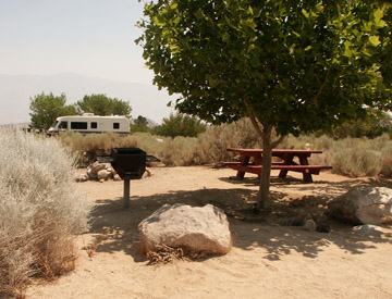
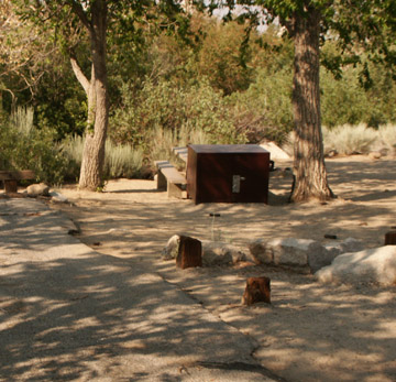
Toilets: Vault Water: Yes Picnic tables and fire grills
Nearest town: Lone Pine
Nearby facilities: Lone Pine
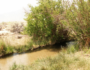
Nearby fishing: Diaz Lake, Lone Pine Creek (See Highway 395 Fishing Category)
Reservations: Reservations are accepted ($9. fee). For reservable campsites, call (877) 444-6777 or http://www.ReserveUSA.com or http://www.recreation.gov/. 1-877-444-6777.
Additional information: Pets must be kept on a leash.
Directions: From Highway 395 in Lone Pine, turn right (west) on Whitney Portal Road and drive one mile to the Tuttle Creek Road. The campground is just a small distance from this intersection.
________________________________________________________________________
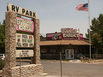
Boulder Creek RV Campground (800) 648-8965 / (760) 876-4243
_
 _______________________________________________________________________
Campground Name: Diaz Lake Campground Area: Lone Pine
Administered by: Inyo National Forest / Ranger District
Elevation: 3,650
Season Length: Opens late April through late October and subject to weather conditions
Contact: Inyo National Forest. http://www.fs.fed.us/r5/inyo/ 760-873-2400; Inyo County Parks Department (760) 878-0272
Number of sites: 200
Fee: $10-14 per night
RV sites: Yes RV’s up to: No restrictions Hook-ups: Garbage: containers
Toilets: flush Water: Yes Picnic tables and fire grills
Nearest town: Lone Pine
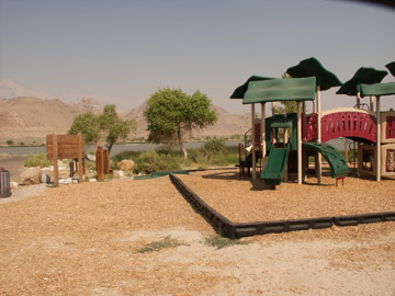
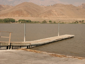
Nearby facilities: Boat ramp (water skiing), playground; golf course nearby
Nearby fishing: 85 acre Diaz Lake (See Highway 395 Fishing Category)
Reservations: Reservations are accepted. For reservable campsites, contact the National Recreation Reservation Center at http://www.recreation.gov or call them at 1-877-444-6777.
Additional information: Pets must be kept on a leash. Inyo National Forest Listings: Please note that the dates and prices below are subject to change and reflect 2007 data. If listed, the campground opening dates are approximate due to weather conditions. For reservable campsites, contact the National Recreation Reservation Center at http://www.recreation.gov or call them at 1-877-444-6777.
Directions: Highway 395 three miles south of Lone Pine
Diaz Lake Fishing: Warm water species include largemouth bass, bluegill and crappie, along with some channel catfish. Trout are planted in the spring and winter when cooler water temperatures prevail and the stocked fish can survive. Covering 80 acres the lake is mostly used for boating and water recreation and not a viable fishery due to summer heating and evaporation. However, with cooler temperatures and better oxygen levels, fishing can be fair to good.
Lake name:
Road condition: Paved
Region: Mt. Whitney Ranger District Area/description: Three miles south of Lone Pine.
Closest town or supplies: Lone Pine
Contacts: Inyo
County Parks Department; Mt. Whitney Ranger District (760) 876-6200; Lone Pine
Chamber of Commerce: toll-free at (877) 253-8981 or locally at (760) 876-4444;
Lone Pine Sporting Goods (760) 876-5365;
Facilities: Boat launch; rest rooms, picnic site, swimming area and playground
Nearest campground:
Boating: Personal watercraft allowed
Fishing season: Early opener-see regulations Best times: Spring and late fall
Favorite lures or bait: Conventional gear for bass; lures and bait for trout
Stocking information:
12,000 rainbows
Additional
information: If you are a bass fisherman and a trout fisherman, this is a
great spot for a spring outing. Lone Pine also hosts an Early Opener Derby. If you enjoy bass fishing ask locally for
directions to “High Banks” on the Owens River as well as
Nearby fishing: Lone Pine Creek
Directions: Three miles south of Lone Pine on Highway 395.
___________________________________________________________________
Campground Name: Tuttle Creek Campground (primitive) Area: Lone Pine
Note: The county also has a campground named Tuttle Creek in the same vicinity.
Administered by: Bureau of Land Management / Whitney Ranger District /
Elevation: 5,120
Season Length: Opens late April through late October and subject to weather conditions
Contact: Inyo National Forest. http://www.fs.fed.us/r5/inyo/ 760-873-2400
Number of sites: 85
Fee: $5
RV sites: Yes RV’s up to: 30 feet Garbage: Pack-it-out!
Toilets: Vault Water: Non-potable only Picnic tables and fire grills
Nearest town: Lone Pine
Nearby facilities: Lone Pine
Nearby fishing: Although the creek is very small, Tuttle Creek is stocked with 6,000 Rainbow trout a year. (See Highway 395 Fishing Category)
Reservations: Reservations are not accepted
Additional information: Some facilities have wheel-chair accessibility; pets must be kept on a leash; an extra fee is charged for each additional vehicle. Inyo National Forest Listings: Please note that the dates and prices below are subject to change and reflect 2008 data. If listed, the campground opening dates are approximate due to weather conditions. For reservable campsites, contact the National Recreation Reservation Center at http://www.recreation.gov or call them at 1-877-444-6777.
Directions: From Highway 395 in Lone Pine, turn right (west) on Whitney Portal Road. Continue 3.5 miles to the Horseshoe Meadow Road and turn left. The campground is 1.5 miles on a good dirt road.
Tuttle Creek Fishing: Tuttle Creek is another small drainage creek that is both narrow and shallow. However, generous weekly stocking in and around the campground provide close fishing for campers who could not find a camp site at Whitney Portal or Lone Pine Creek.
_________________________________________________________________________________________
Campground Name: Lone Pine Creek (Below the Whitney Portal Campground) Area: Lone Pine
Administered by: Inyo National Forest / Mt. Whitney Ranger District
Elevation: 6,000
Season Length: Opens late April through late October and subject to weather conditions
Contact: Inyo National Forest. http://www.fs.fed.us/r5/inyo/ 760-873-2400
Number of sites: 43
Fee: $16.
RV sites: Yes RV’s up to: 35 feet
Toilets: Pit Water: Yes Picnic tables and fire grills
Nearest town: Lone Pine
Nearby facilities: Small campground store
Nearby fishing: Lone Pine Creek (See Highway 395 Fishing Category)
Reservations: Reservations are accepted ($9. fee). For reservable campsites, call (877) 444-6777 or http://www.ReserveUSA.com or http://www.recreation.gov/. 1-877-444-6777.
Additional information: Some facilities have wheel-chair accessibility; pets must be kept on a leash.
Directions: From Highway 395 in Lone Pine, turn right (west) on Whitney Portal Road. Continue 13 miles to the campground.
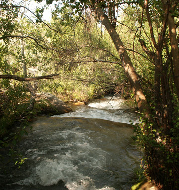
Lone Pine Creek Fishing: Although fishing for stocked fish in a campground is not something that interests me, when I saw the size and the numbers of fish swimming in the pocket water I was shocked. You pay for these campground fish so you might as well catch your dinner! Fish ranged from 8 to 12-inches. I was impressed, and I began to think of how good they would taste. This is a great spot to take children fishing. Leave the pools where the fish are looking right at you, and look for broken water where they are more likely to take your bait. I watched a mother showing her young children how to snag. Fortunately, she was not all that successful.
____________________________________________________________________________________________
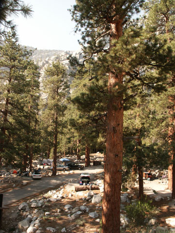
Campground Name: Whitney Portal Campground Area: Lone Pine
Administered by: Inyo National Forest / Mt. Whitney Ranger District
Season Length: Opens late April through late October and subject to weather conditions
Contact: Inyo National Forest. http://www.fs.fed.us/r5/inyo/ (760) 937-6070
Number of sites: 44
Fee: $17 + $5. for extra vehicle. Golden Age Access is half price. (2008)
RV sites: Yes RV’s up to: 30 feet Garbage: containers
Toilets: Vault Water: Yes Picnic tables and fire grills
Nearest town: Lone Pine
Nearby facilities: small campground store
Nearby fishing: Yes (See Highway 395 Fishing Category)
Reservations: Reservations are accepted ($9. fee). For reservable campsites, call (877) 444-6777 or http://www.ReserveUSA.com or http://www.recreation.gov/. 1-877-444-6777.
Additional information: Whitney Portal Campground is used for climbers planning on climbing Mt. Whitney, the highest mountain in the lower 48 states. It is also the trailhead for the John Muir Wilderness Trail. Some facilities have wheel-chair accessibility; pets must be kept on a leash; the campground is seven miles from Whitney Trailhead. The campground is located in the eastern Sierra, six miles west of the town of Lone Pine, California. Firewood is for sale at the campground. Popular activities include hiking and fishing. Restrooms are provided. Some first come, first serve sites may be available.
Forest Listings: Please note that the dates and prices below are subject to change and reflect 2007 data. If listed, the campground opening dates are approximate due to weather conditions. For reservable campsites, contact the National Recreation Reservation Center at http://www.recreation.gov or call them at 1-877-444-6777.
Directions: From Highway 395 in Lone Pine, turn right (west) on Whitney Portal Road. Continue 13 miles to the campground.
________________________________________________________________________
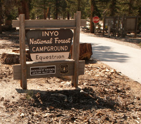
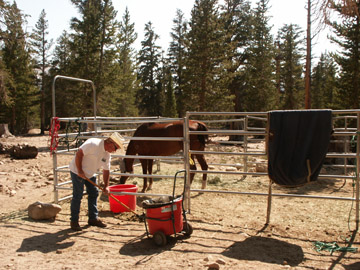
Campground Name: Horseshoe Meadow Walk-In and Equestrian Campground Area: Lone Pine
Administered by: Whitney Ranger District / Inyo National Forest
Elevation: 5,120
Season Length: Opens late April through late October and subject to weather conditions
Contact: Inyo National Forest. http://www.fs.fed.us/r5/inyo/ 760-873-2400
Number of sites: 18 walk-in camp sites for hikers entering the John Muir Wilderness and the Golden Trout Wilderness; 10 equestrian sites at the trail head provide corrals and hitching posts
Fee: $6 for walk-in campsites; $12 for equestrian camp sites.
RV sites: Yes RV’s up to: 30 feet Garbage: Pack-it-out!
Toilets: Vault Water: Yes Picnic tables and fire grills
Nearest town: Lone Pine
Nearby facilities: Pack Station
Nearby fishing: Although the creek is very small, Tuttle Creek is stocked with 6,000 Rainbow trout a year. (See Highway 395 Fishing Category)
Reservations: Reservations are not accepted for equestrian camp sites; trailhead reservations for wilderness stays are required.
Additional information: Inyo National Forest Listings: Please note that the dates and prices below are subject to change and reflect 2007 data. If listed, the campground opening dates are approximate due to weather conditions.
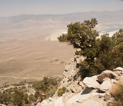
Directions: From Highway 395 in Lone Pine, turn west on Whitney Portal Road and drive 3.5 miles and turn left on Horseshoe Meadows Road. Drive 19 miles to the trail head. (Warning: This is an extremely steep climb. I over-heated my engine pulling a large camper in 102-degree heat. Yes, at the top it was 20-degrees cooler, but I had to pull over and idle my engine for about 20 minutes.)
Non-potable water is available for stock, but bring a bucket. Equestrian campers are expected to clean up all horse manure, so bring a bucket and rake and pack it out.
Road condition: Paved to Cottonwood Lakes Trailhead
Day hike: A physically challenging 4 mile hike. It is the last mile that is most challenging.
Region: Mt.
Whitney Ranger District Area/description:
Closest town or supplies: Lone Pine
Contacts:
Nearest campground: Tuttle
Creek Campground; Whitney Portal is located in the eastern Sierra, 13 miles
west of Lone Pine, CA. This campground is adjacent to
Fishing season: General Restrictions: Artificial lures with barbless hooks
Tips: Bring a good map, plenty of water or a water filter and watch for trail signs as the trail forks after Golden Trout Camp. The trail will follow Cottonwood Creek.
Favorite lures or bait: Use small lures such as Kastmasters, Daredevils and Panther-Martins. Bring smaller lures, but have a variety of color combinations to entice both shallow and deep cruising trout. (See Category: Fishing Tips – Best Lures and Bait)
Favorite fly patterns: Fly & Bubble technique with small nymphs such as Hare’s Ear, Zug Bug, Bead-Head Prince Nymph, Pheasant Tail or a Tellico Shrimp. (See Category: Fishing Tips – Best Fly Patterns and Techniques)
Stocking information: Wild trout populations
Additional information: This is a popular and scenic Golden trout lake.
Nearby fishing: Cottonwood Creek
Directions: From
Highway 395 in Lone Pine, turn left on
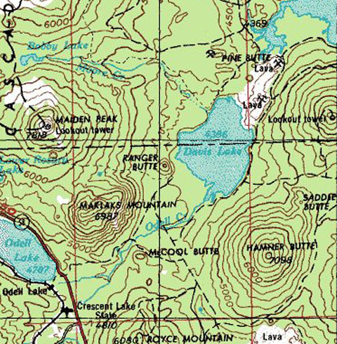
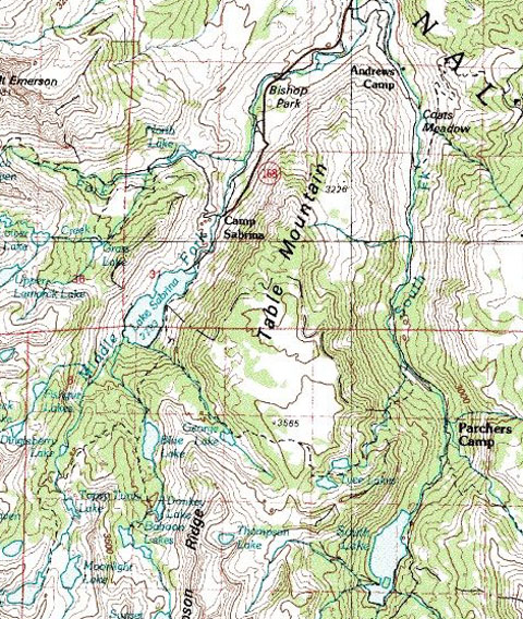
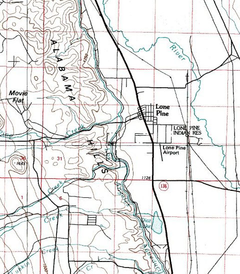
Maps courtesy of mytopo.com.