 Map courtesy of mytopo.com
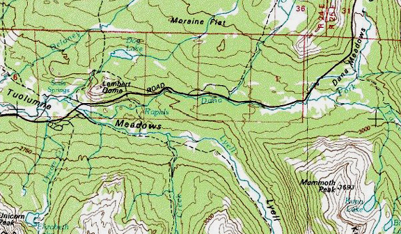
Tuolumne River / Tuolumne
Meadows / Dana Fork and Lyell Fork
Road condition: Paved
Region: Tioga Pass
/ Highway 120 Drainage: Dana Fork, Lyell Fork
Description: Tuolumne
Meadows is the largest sub-alpine meadow in the Sierra Mountains. In spite of the number of people up and down
the road, Tuolumne Meadows is still lovely with its lush green meadows,
pristine waters, abundant wildflowers and towering granite mountains. Formed by
two forks near the highway crossing, the river flows west towards Hetch Hetchy
Reservoir, San Francisco’s
chief water supply. Dana Fork parallels
Highway 120 from Dana Meadows at the base of Tioga Pass. A shallow creek, Dana Fork, nonetheless,
provides good fishing for smaller brook trout.
Keep in mind, however, that Tuolumne Meadows is one of the most heavily
visited places after Yosemite
Falls, and anglers harass
and harry little brook trout in this shallow, clear creek. Fly fishers will have more success hiking up
the Lyell Fork of the Tuolumne
River. Affording more water and less pressure, the
Lyell Fork brookies are less spooked and slightly larger. Most of the Brook trout will average 6 to 9
inches, but there are some resident Brown trout that will bulk up to the 10 to
14-inch range. Good pocket water may be found further up the trail, as the
creek heads into the canyon. The trail
is rarely more than a half-mile from Lyell Fork water. It is common in the summer months to see lots
of back-packers using the John Muir Trail that follows closely to Lyell Fork,
but the further that you walk the trail the fewer anglers you will encounter.
The river itself is wide and shallow with little cover. The trout are generally small, and fly
fishers have the most success keeping a low profile and casting gently
upstream.
Species: Brook
trout, brown trout
Closest town or
supplies:
Contacts: Lee
Vining Chamber of Commerce (info@leevining.com; Visiting Mono Lake
www.monolake.org/visiting/; Mono
Lake Visitor
Center (http://www.monolake.org/monomap/vc.htm
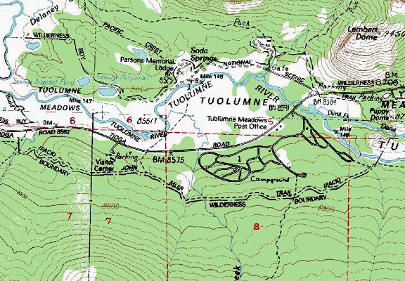
Nearest campground: Tuolumne Meadows Campground
Map courtesy of mytopo.com.
Fishing season: Opens the last Saturday in April and closes November 15.
Fishing Tips: Attractor patterns properly presented will entice hungry Brook trout.
Favorite lures or
bait: Use the smallest of because the creeks are shallow and difficult to
cast and retrieve. Make your casts
downstream. (See Category: Fishing Tips
– Best Lures and Bait)
Favorite fly
patterns: Use attractor dry fly patterns for the streams and fly &
Bubble technique with small nymphs such as Hare’s Ear, Zug Bug, Bead-Head
Prince Nymph, Pheasant Tail or a Tellico Shrimp for the lakes. (See Category: Fishing Tips – Best Fly
Patterns and Techniques)
Stocking information:
Fish stocking programs were discontinued in 1991. A continuing debate on
whether or not fishing should be allowed in national parks has been gaining
support for a number of years.
Nearby fishing: Ellery Lake,
Gaylor Lakes,
Granite Lakes,
Tioga Lake,
Saddlebag Creek, Saddlebag
Lake
Additional
information: Both Tuolumne Meadows Resort and Tioga Pass Resort offer food
and supplies.
Directions: Highway
120 ____ miles from Tioga
Pass Visitor
Center.
Twenty Lakes Basin (See Saddlebag
Lake)

Leave a comment