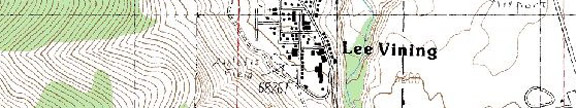
Highway 395, 16.3 miles north of June Lake and 25.2 miles south of Bridgeport
Photo Gallery
Services and Accommodations
Restaurants and Eateries:
Public Internet Use Facilities:
Museums and Point of Interest: Old School House Museum (760) 647-6461; Mono County Museum (760) 932-5281;
Events and Festivities: April 26: Opening
Day for the General Trout Season); November 15: General Trout Season
Closes
Summer Recreation: Birdwatching, Camping, Hiking, Fishing, Kayaking on Mono Lake, Photography
Winter Recreation: Downhill skiing in June Lake and Mammoth; cross country skiing
Sporting Goods: Bell's Sporting Goods (760) 647-6406
Nearby Fishing: Home: Lee Vining: Fishing (See also Highway 120 Fishing) Fishing Tips
Nearby Camping: Home: Lee Vining: Camping (See also Highway 120 Camping)
Lee Vining Chamber of Commerce: http://www.leevining.com/ (760)
647-6629
Visitor Links: Mono Basin Scenic Area Visitor Center, Highway 395 a half mile north of Lee Vining, (760) 873-2408, www.fs.fed.us/r5/inyo/vc/mono
Community Parks:
Tours and Side-Trips: Bodie Ghost Town; Mono Craters; Mono Lake Tufa State Reserve;Yosemite National Park,
RV Related:
Recreational Contacts: Mono Lake Boat Tour (760) 937-1934
Government Contacts:
Bureau of Land Management (Bishop Office) 787 Main Street, Suite P, Bishop, CA 93514
Department of Fish and Game: (www.dfg.ca.gov/fishing) Season dates, licenses, restrictions, fish stocking
Inyo National Forest: books, maps and wilderness passes and permits: Mt. Whitney Ranger Station (760) 873-2500; White Mountain Ranger Station (760) 873-2500; Mammoth Ranger Station (760) 924-5500 www.fs.fed.us/r5/inyo
Lee Vining Expansion
Notes in Alphabetical Order
Bodie Ghost Town
Souvenirs and Collecting
Everything in Bodie is part of the historic scene and is fully protected. NOTHING may be collected or removed from the park. Metal detectors are not allowed.
Closed Areas
For public protection, certain unstable sections of the park are posted as prohibited areas, and are closed to entry by park visitors.
Camping
There is no camping at Bodie. You must camp at least three miles from Bodie on BLM land. Fire restrictions are often in effect.
Winter Visits
Bodie is open all year. However, because of the high elevation (8375 feet), it is accessible only by over-snow equipment during the winter months. Many four wheel drive vehicles get stuck each year in powdery snow that is deeper than it first appears. Spring thaws bring mud, and wheeled vehicles are not advised. TOWING FACILITIES ARE NOT AVAILABLE. Snowmobiles must stay on designated roads within the park. Winter weather is often unpredictable. Sub-zero temperatures, strong winds and white-out conditions are not uncommon.
Directions
The
park is northeast of Yosemite, 13 miles east of Highway 395 on
(public domain-- http://www.parks.ca.gov/?page_id=509)
During the Bodie mining boom, W.J. Lundy established a
sawmill along the creek and supplied lumber to the Bodie mines. Shortly thereafter a prospecting family
discovered gold in the area and prospectors staked out their claims. The May Lundy was a successful mine that
operated for many years.
Mono Craters
One of the youngest of these volcanoes in the chain of
volcanoes stretching from Mammoth to
The
reserve was established to preserve the spectacular "tufa towers,"
calcium-carbonate spires and knobs formed by interaction of freshwater springs
and alkaline lake water.
Interpretive Programs
These programs are a cooperative effort of the State Reserve, U.S. Forest Service and the Mono Lake Committee. Rangers lead free tufa walks at the South Tufa area -- tours are at 1:00 pm on Saturdays and Sundays May through October. Tours are offered 3 times daily from late June through Labor Day (10am, 1pm, and 6pm); and daily at 1pm late May through September. Bird walks are offered at the Mono Lake County Park/State Reserve boardwalk at 8:00 a.m. Fridays and Sundays mid-May through Labor Day….
The
Outdoor Activities
Hiking, swimming, boating, and cross-country skiing are just a few of the many activities you can enjoy at this unusual lake. Photographers come from all over the world to capture the interplay of light, desert, and water. The natural history of the lake is described and explained in a one-mile self-guided nature trail at South Tufa.
This
spectacular tufa area is the best place to visit if you have time for only one
stop. A boardwalk trail below the
A
swim in
Camping
The
State Reserve is surrounded by the Mono Basin National Forest Scenic Area,
operated by the Forest Service. There are no campgrounds in the State Reserve
or the Scenic Area. Dispersed camping is permitted in most of the Scenic Area
outside the exposed lake bed lands. Campfire permits are required. Established
campgrounds are located in
Boating
All
types of boating are permitted on
(public domain--
http://www.parks.ca.gov/?page_id=514)
Companion Web Sites:
Glacier to Yellowstone (A complete guide to camping and fishing in Montana from Glacier to Yellowstone)
Fishing Tips 101 (Offering a "Mastering the Basics" series for freshwater fishing)
Bass and Trout Fishing Digest (Dave's hodge-podge of fishing adventures in Northern California and Oregon)

Leave a comment