Big Pine, California

| No Comments | No TrackBacks
BigPineMap.jpg


Highway 395, 26 miles north of Independence and 15 miles south of Bishop

Photo Gallery

Services and Accommodations

Restaurants and Eateries:

Public Internet Use Facilities:

Museums and Point of Interest:

Events and Festivities: April 26: Opening Day for the General Trout Season; November 15: General Trout Season Closes

Summer Recreation: Biking, Birding, Camping, Fishing, Golfing, Hang Gliding, Hiking, Horseback Riding, Mountaineering, Photography, Rock Climbing

Winter Recreation:

Sporting Goods Stores:

Fly Shops:

Nearby Fishing: Home: Big Pine: Fishing   Fishing Tips (Big Pine Creek, Owens River)

Nearby Camping: Home: Big Pine: Camping (Tinnemaha Campground)

Big Pine Chamber of Commerce:   Big Pine Chamber of Commerce and Visitor Center, P.O. Box 23, Big Pine, California 93513
(760) 938-2114  or  (866) 938-2114

Community Parks:

Tours and Side-Trips:  Ancient Bristlecone Pine Forest; Big Pine Canyon; Keoughs Hots Springs

Weather  

RV Related:

Recreational Contacts: Glacier Pack Train (760) 938-2538. The pack station is located 11 miles west of Big Pine on a paved road.  Pack trips include spot, dunnage and base camp, along with day rides.  Fishing and pack trips reach Big Pine Lakes, Palisades Glaciers, Sawmill Pass, Baker Lakes and day rides to upper lakes.

Government Contacts:

            Department of Fish and Game: (www.dfg.ca.gov/fishing) Season dates, licenses, restrictions, fish stocking

            Inyo National Forest: books, maps and wilderness passes and permits: Mt. Whitney Ranger Station (760) 873-2500; White Mountain Ranger Station (760) 873-2500; Mammoth Ranger Station (760) 924-5500  www.fs.fed.us/r5/inyo/about

Big Pine Expansion Notes in Alphabetical Order

The Ancient Bristlecone Pine Forest

Across the broad Owens Valley lays a parallel mountain range that stretches east of Lone Pine northwards into Nevada.  The White and Inyo Mountains, bereft of rainfall as storms stall over the high Sierra, rise to impressive heights in a seemingly barren landscape.  The third highest mountain in California and the largest mountain in this range is White Mountain Peak at 14,246 feet.  Home to bighorn sheep, wild horses, deer and mountain lion, along with many species of birds, the White Mountains are home to the oldest living species in the world – the ancient Bristlecone Pine trees.  In this cold and desolate region, visitors, may visit and photograph “Methuselah”, a 4,774 year-old, or they may visit “Patriarch”, the largest of the ancient Bristlecone Pines, who is a youngster at 1,500 years.

Unassuming in height, the Bristlecone Pine grows on barren, windswept slopes with little vegetation, which protects them from to wildfire danger.  Stout and gnarly, their twisted limbs entwine as they stand as proud survivors and testimony to the rigors of nature and time not in decades or centuries but in millennium.  Slow to grow, their dense wood core wards off insects and disease.  Dr. Edmund Schulman, who discovered the trees in the 1950’s, has studied the ring growth in living and dead trees and provided a 9,000 year record of weather patterns for the region.

The Ancient Bristlecone Pine Forest is 36 miles from Big Pine.  The last thirteen miles are unpaved and rough in places.  A picnic site is located at approximately 16 miles.  The only campground is Grandview Campground, a few miles north from the Cedar Flat Information Center.  The next stopping point is the Sierra Overlook at 9,000 feet elevation.  From this vista, the sweeping Sierra Mountains can be identified from a trail side marker to help identify Mt. Whitney in the southern region and Mt. Dana in Yosemite to the north. Below the broad plain of Owens Valley stretches from Lone Pine to Bishop, and looking to the east, one can see the mountain peaks surrounding Death Valley.  Up the road is Schulman Grove Visitor Center.  Picnic tables and rest rooms are available, as well as Methuselah Walk, a trail to Old Methuselah.  Patriarch Grove lies ahead at an elevation of 11,000.  This final destination is reached on a narrow dirt road not recommended for large RV’.  From the parking area, it is a short walk to see the “Patriarch”, the largest of the Bristlecone Pine trees.

To visit Ancient Bristlecone Pine Forest, turn east on Highway 168 from Highway 395 in Big Pine.  After thirteen miles, turn left onto Road 01, a signed road to the forest.
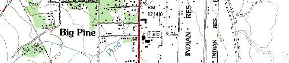
Big Pine

Named for the large stands of pine trees in the area, Big Pine was a logging and lumber operation that served the mining districts from Cerro Gordo all the way up to Bodie and Aurora, Nevada and eastward over Westgard Pass to White Mountain City.  The lumber was freighted by  teams of oxen on large wagons with iron-rimmed, spoke wheels.  Big Pine offers highway junction 168 to the Ancient Bristlecone Forest, as well as a northern route to Death Valley.  Jutting above the escarpment is Palisade Glacier and the head waters of Big Pine Creek, along with a number of good campgrounds with shaded camp sites.  Big Pine Creeks offers good fishing.  The creek forks higher up the slope.  “The north fork trail offer access to the Big Pine Lakes and the Palisade Glacier, the largest glacier in the Sierra and the southernmost glacier in the Western Hemisphere.  The Palisade Crest, rising above 14,000 feet contains some of the finest alpine climbing in California.  The Big Pine Lakes zigzags through a slope of sage, manzanita, and Jeffrey pines before it reaches Second Falls and follows the creek to its headwaters.  Hikers will pass a stone cabin built by movie actor Lon Chaney (the original “Quasimodo”)while walking through a forest of Lodge pole  Pine.” (www.bigpine.com)

Keough’s Hot Springs.

With a claim to be the Eastern Sierra’s largest natural hot springs pool, Keough’s Hot Springs has a long history for soaking tired bodies in geothermal spring water.  During the 1920’s and 30’s, Keough’s Hot Springs was a health and leisure resort.  Valley residents then and now hold barbecues and picnics.  I have fond memories of swimming here as a youngster in the late 1940’s.  At that time it had a little train that circled the premises.  I know that I will be returning soon.  The hot spring pool is located seven miles south of Bishop, just off Highway 395.  For information call (760) 872-4670.

To provide a correction or offer a suggestion, email David Archer.

Companion Web Sites:

Glacier to Yellowstone (A complete guide to camping and fishing in Montana from Glacier to Yellowstone)

Fishing Tips 101 (Offering a "Mastering the Basics" series for freshwater fishing)

Bass and Trout Fishing Digest (Dave's hodge-podge of fishing adventures in Northern California and Oregon)


No TrackBacks

TrackBack URL: http://www.guidetohighway395.com/cgi-bin/mt/mt-t.cgi/124

Leave a comment

Categories

Pages

OpenID accepted here Learn more about OpenID
Powered by Movable Type 5.04

About this Entry

This page contains a single entry by David Archer published on January 26, 2008 6:31 PM.

Independence, California was the previous entry in this blog.

Bishop, California is the next entry in this blog.

Find recent content on the main index or look in the archives to find all content.