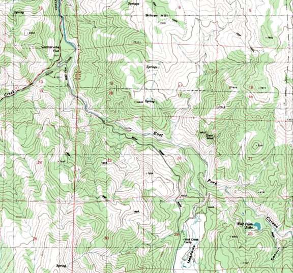
East Fork of the
Carson River and
Road condition: Paved
to gravel
Region: Alpine County / Markleeville Drainage: Carson-Iceberg Wilderness
Description: Coursing
out of the Carson-Iceberg Wilderness, the East Fork plunges down through a
steep canyon to enter Wolf Creek Meadows.
This is the furthermost section of the river accessed by vehicle. Good
fishing can be experienced all along
Species: Stocked
rainbows along the access road from Highway 4 to Wolf Meadows, which is
approximately six miles from the Highway 4 turn-off.
Closest town or supplies: Markleeville
Contacts: Alpine
Fly Fishing, 14841 Highway 89,
Nearest campground: Primitive camping spots are available in the area, or you may camp at Silver Creek Campground on Highway 4.
Fishing season: General season
Tips: Bring mosquito repellant as well as mosquito head netting tucked in your vest if the fishing is good but the vector attacks are in full force.
Favorite lures or
bait:
Favorite fly
patterns:
Stocking information: 20,000+ trout in the 10-12-inch range
Nearby fishing: Silver Creek (small, heavy willow thickets)
Additional
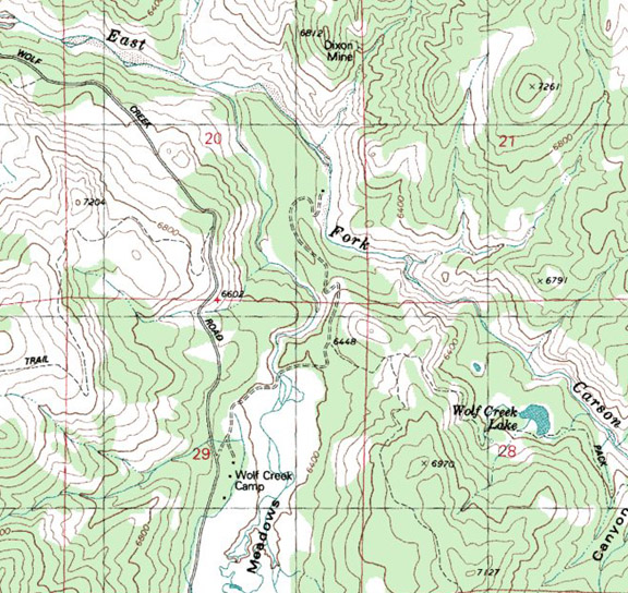
information: At Wolf Meadows the dirt road forks. The left fork is a 4x4 ranch road that leads
to Dixon Mine. This rough road only goes
about a mile and dead-ends on a bluff over-looking the East Fork. Follow the
right fork through the meadow section to a primitive campground. Anglers willing to hike up
Directions: From Highway 395, turn left at the junction
with Highway 89 and proceed over
Maps courtesy of mytopo.com

Leave a comment