Tom's Place, California

| No Comments | No TrackBacks
TomsMapName.jpg


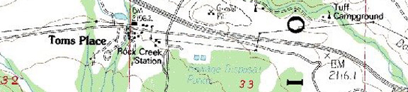
Highway 395, 20.5 miles north of Bishop and 17.6 miles south of Mammoth Lakes and gateway to Rock Creek and Little Lakes Valley.  Tom's Place is right off Highway 395 across from Crowley Lake.  Tom's Place Resort offers cabins, a general store and a cafe and bar.  (See the separate categories for Rock Creek fishing and camping.)

RkCkLake-Above.jpgMosquitoFlatTrailhead.jpg

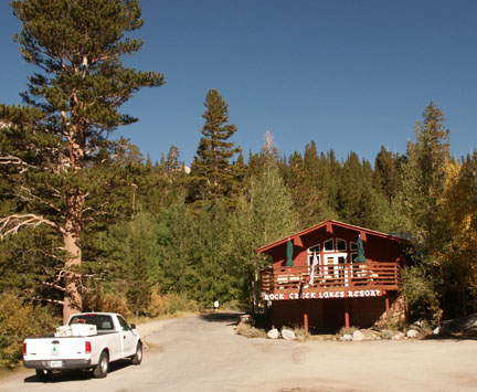
Restaurants and Eateries: Tom's Place Resort; Rock Creek Resort


Events and Festivities: April 26: Opening Day for the General Trout Season); November 15: General Trout Season Closes

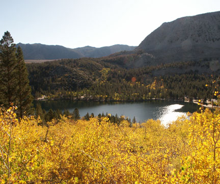
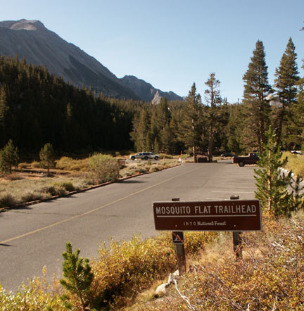
Summer Recreation: Biking, Birding, Camping, Fishing, Hiking, Horseback Riding, Mountaineering, Photography, Rock Climbing

Nearby Fishing: Rock Creek and the Bishop area.

Home: Bishop: Fishing   Fishing Tips

Nearby Camping: Home: Bishop: Camping

Bishop Chamber of Commerce
690 N. Main St., Bishop, California  93514; 760-873-8405; 888-395-3952 Toll free
Visitor center hours: 10AM to 5PM M-F  10AM to 4PM Weekends

Tours and Side-Trips:

Weather  


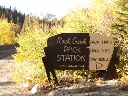
Recreational Contacts: Rock Creek Pack Station (760) 872-8331


RockCK-PackSign.jpg

Government Contacts:

            Bureau of Land Management (Bishop Office) 787 Main Street, Suite P, Bishop, CA 93514

            Department of Fish and Game: Season dates, licenses, restrictions, fish stocking

            Inyo National Forest: books, maps and wilderness passes and permits: Mt. Whitney Ranger Station (760) 873-2500; White Mountain Ranger Station (760) 873-2500; Mammoth Ranger Station (760) 924-5500  www.fs.fed.us/r5/inyo


Rock Creek Canyon and the Little Lakes Valley

Rock Creek Canyon has bragging rights.  At the Mosquito Flat Trailhead, it is the highest paved road in California, towering above the valley floor at 10,250 feet elevation.  But it is also considered one of the most beautiful entrances to the John Muir Wilderness simply because the gain in elevation eliminates those arduous climbs that most trailheads into the Sierra Mountains demand.  Day hikers can make a round-trip hike of a little over five miles to Little Lakes Valley, a popular destination for photographers and anglers.  The trail offers a very gradual accent, and in places it could be described as almost level.  Standing guard over the Little Lakes Valley are three sentinels: Mt. Dade, Mt. Abbot and Mt. Mills, each towering over 13,000 feet.  Summer’s splendid profusion of wildflowers and verdant green meadows and the autumnal hues of gold from Quaking Aspen and willow have inspired hikers, photographers and artists for many generations.

RkCkResort.jpg


To provide a correction or offer a suggestion, email David Archer.

Companion Web Sites:

Glacier to Yellowstone (A complete guide to camping and fishing in Montana from Glacier to Yellowstone)

Fishing Tips 101 (Offering a "Mastering the Basics" series for freshwater fishing)


No TrackBacks

TrackBack URL: http://www.guidetohighway395.com/cgi-bin/mt/mt-t.cgi/126

Leave a comment

Categories

Pages

OpenID accepted here Learn more about OpenID
Powered by Movable Type 5.04

About this Entry

This page contains a single entry by David Archer published on January 26, 2008 6:39 PM.

Bishop, California was the previous entry in this blog.

Mammoth Lakes, California is the next entry in this blog.

Find recent content on the main index or look in the archives to find all content.